Property Record
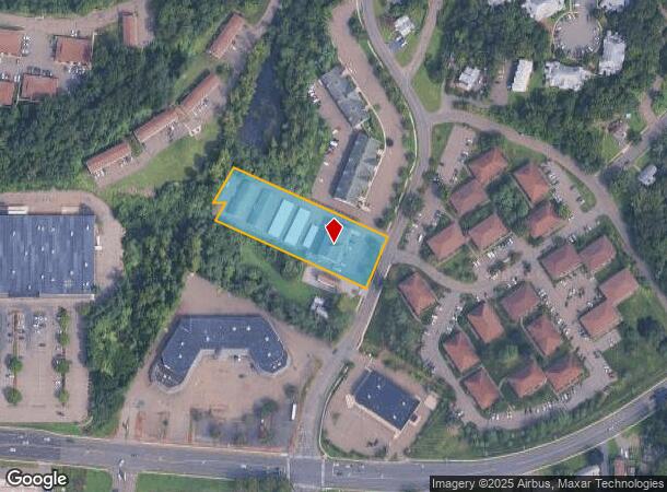
42 Thompson St, East Haven, CT 06513
NEARBY LISTINGS FOR SALE OR LEASE
-
-
View all East Haven listings for lease on LoopNet.com
Property Detail
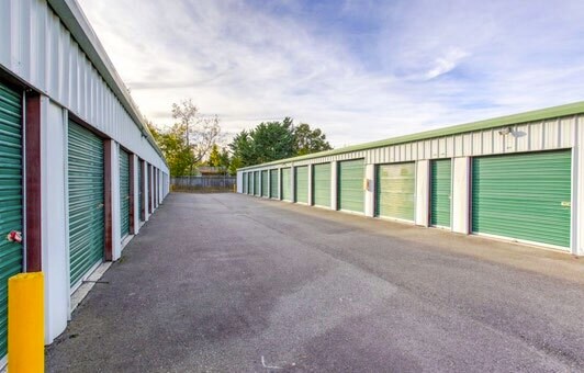
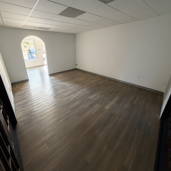
42 Thompson St
EHAV-000460-005927-000002
New Haven
Officebuilding
Connecticut
X
2
09009C0453K
1.55 AC
2025
East Haven
2025
Westchester/So Connecticut
180500
New Haven, CT
9,600 SF
DEMOGRAPHICS near 42 Thompson St
1 Mile
3 Mile
5 Mile
2024 Total Population
10,006
58,745
200,782
2029 Population
10,048
57,970
199,757
Pop Growth 2024-2029
+ 0.42%
(1.32%)
(0.51%)
Average Age
43
40
39
2024 Total Households
3,997
22,924
81,959
HH Growth 2024-2029
+ 0.40%
(1.22%)
(0.40%)
Median Household Inc
$82,087
$60,730
$65,602
Avg Household Size
2.50
2.50
2.30
2024 Avg HH Vehicles
2.00
2.00
1.00
Median Home Value
$242,442
$253,345
$275,199
Median Year Built
1974
1964
1960
Nearby Places
Map Layers
Map Styles
 Street
 Aerial
- Restaurants
- Banks
- Shops
- Fitness
- Groceries
PUBLIC TRANSPORTATION
COMMUTER RAIL
New Haven-State Street Station (New Haven Line - Metro-North Commuter Railroad Company (Metro-North))
DRIVE
WALK
Distance
New Haven-State Street Station (New Haven Line - Metro-North Commuter Railroad Company (Metro-North))
10 min
4.8 mi
DRIVE
WALK
Distance
11 min
5.4 mi
AIRPORT
Tweed/New Haven
DRIVE
WALK
Distance
Tweed/New Haven
12 min
5.0 mi
Freight Ports
Port of New Haven
DRIVE
WALK
Distance
Port of New Haven
11 min
4.5 mi
SALE & LEASE HISTORY
LISTING DATE
SALE/LEASE

Sep 03, 2025
For Lease
Mar 27, 2023
For Sale
Mar 27, 2023
For Sale
Mar 27, 2023
For Sale
Nearby Properties
Address
Land Use
TOTAL SIZE
Lot Size
Zoning
Address
Land Use
TOTAL SIZE
Lot Size
Zoning
258,313 SF
23.50 AC
PDU 34
Address
Land Use
TOTAL SIZE
Lot Size
Zoning
50.70 AC
R40
Address
Land Use
TOTAL SIZE
Lot Size
Zoning
78,878 SF
3.12 AC
RM2
Address
Land Use
TOTAL SIZE
Lot Size
Zoning
54 AC
R-3
Address
Land Use
TOTAL SIZE
Lot Size
Zoning
68,706 SF
3.34 AC
BA1
Address
Land Use
TOTAL SIZE
Lot Size
Zoning
7,345 SF
3.09 AC
IL/RM2
Address
Land Use
TOTAL SIZE
Lot Size
Zoning
296,444 SF
23.30 AC
T145
Address
Land Use
TOTAL SIZE
Lot Size
Zoning
72,007 SF
1.79 AC
RS2
Address
Land Use
TOTAL SIZE
Lot Size
Zoning
66.68 AC
IG80
Address
Land Use
TOTAL SIZE
Lot Size
Zoning
163,505 SF
3.96 AC
BA1
Address
Land Use
TOTAL SIZE
Lot Size
Zoning
85,679 SF
14.23 AC
RM1
Address
Land Use
TOTAL SIZE
Lot Size
Zoning
126,430 SF
10.63 AC
RM1
Address
Land Use
TOTAL SIZE
Lot Size
Zoning
31.34 AC
IL30
Address
Land Use
TOTAL SIZE
Lot Size
Zoning
17.71 AC
IL80
Address
Land Use
TOTAL SIZE
Lot Size
Zoning
97,057 SF
2.78 AC
RM2
Address
Land Use
TOTAL SIZE
Lot Size
Zoning
85,000 SF
14 AC
R4
Address
Land Use
TOTAL SIZE
Lot Size
Zoning
23.40 AC
IG80
Address
Land Use
TOTAL SIZE
Lot Size
Zoning
27.36 AC
IL80
Address
Land Use
TOTAL SIZE
Lot Size
Zoning
132,592 SF
4.61 AC
PDD 23
Address
Land Use
TOTAL SIZE
Lot Size
Zoning
5,946 SF
0.09 AC
RM1
Address
Land Use
TOTAL SIZE
Lot Size
Zoning
213,892 SF
8 AC
IL30
Address
Land Use
TOTAL SIZE
Lot Size
Zoning
306,943 SF
1.92 AC
PDD 23
Address
Land Use
TOTAL SIZE
Lot Size
Zoning
5,820 SF
RM2
Address
Land Use
TOTAL SIZE
Lot Size
Zoning
15.57 AC
IL80
Address
Land Use
TOTAL SIZE
Lot Size
Zoning
249,513 SF
6.57 AC
PDD 23
Address
Land Use
TOTAL SIZE
Lot Size
Zoning
35 AC
RA-1
Address
Land Use
TOTAL SIZE
Lot Size
Zoning
276,776 SF
4.98 AC
PDD 23
Address
Land Use
TOTAL SIZE
Lot Size
Zoning
2,299 SF
14.94 AC
RA-1
Address
Land Use
TOTAL SIZE
Lot Size
Zoning
19.26 AC
R-2
Address
Land Use
TOTAL SIZE
Lot Size
Zoning
125,680 SF
10.70 AC
IL80
The World's #1 Commercial Real Estate Marketplace
Connect with us
© 2026 CoStar Group
The information above has been obtained from sources believed reliable. While we do not doubt its accuracy we have not verified it and make no guarantee, warranty or representation about it. It is your responsibility to independently confirm its accuracy and completeness. Any projections, opinions, assumptions, or estimates used are for example only and do not represent the current or future performance of the property. The value of this transaction to you depends on tax and other factors which should be evaluated by your tax, financial, and legal advisors. You and your advisors should conduct a careful, independent investigation of the property to determine to your satisfaction the suitability of the property for your needs.