Property Record
420 Beatrice Ct, Brentwood, CA 94513


NEARBY LISTINGS FOR SALE OR LEASE
Property Detail
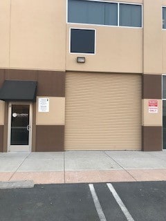
420 Beatrice Ct
Oakland-Fremont-Berkeley, CA
8842 Sunset Industrial Complex 2
018-200-029-9
T8842 L18
Industrialpark
Contra Costa
X
California
06013C0354G
18
2025
1.02 AC
2025
Antioch/Pittsburg
303106
East Bay/Oakland
19,195 SF
DEMOGRAPHICS near 420 Beatrice Ct
1 mile
3 mile
5 mile
2024 Total Population
7,823
77,938
147,248
2029 Population
7,836
77,715
147,446
Pop Growth 2024-2029
+ 0.17%
(0.29%)
+ 0.13%
Average Age
37
37
39
2024 Total Households
2,363
23,405
45,837
HH Growth 2024-2029
+ 0.04%
(0.35%)
+ 0.14%
Median Household Inc
$105,353
$127,140
$122,999
Avg Household Size
3.30
3.30
3.20
2024 Avg HH Vehicles
3.00
3.00
2.00
Median Home Value
$764,756
$735,084
$713,619
Median Year Built
2005
2001
2000
Nearby Places
Map Layers
Map Styles
 Street
 Aerial
Transit
 Traffic
 Biking
Places
Listings with unknown addresses are not visible on the map
- Restaurants
- Banks
- Shops
- Fitness
- Groceries
PUBLIC TRANSPORTATION
AIRPORT
Stockton Metro
Drive
Walk
Distance
Stockton Metro
53 min
32.8 mi
Freight Ports
Port of Stockton
Drive
Walk
Distance
Port of Stockton
48 min
30.5 mi
SALE & LEASE HISTORY
LISTING DATE
SALE/LEASE

May 01, 2018
For Lease
Jul 02, 2025
For Lease
Jan 23, 2018
For Lease
Aug 28, 2017
For Lease
Nearby Properties
Address
Land Use
TOTAL SIZE
Lot Size
Zoning
Address
Land Use
TOTAL SIZE
Lot Size
Zoning
39,038 SF
14.43 AC
Address
Land Use
TOTAL SIZE
Lot Size
Zoning
55.08 AC
Address
Land Use
TOTAL SIZE
Lot Size
Zoning
14,968 SF
7.07 AC
Address
Land Use
TOTAL SIZE
Lot Size
Zoning
67,691 SF
28.26 AC
Address
Land Use
TOTAL SIZE
Lot Size
Zoning
308.96 AC
Address
Land Use
TOTAL SIZE
Lot Size
Zoning
67,133 SF
8.65 AC
Address
Land Use
TOTAL SIZE
Lot Size
Zoning
117,486 SF
7.26 AC
Address
Land Use
TOTAL SIZE
Lot Size
Zoning
15,000 SF
17.17 AC
Address
Land Use
TOTAL SIZE
Lot Size
Zoning
59,066 SF
3.89 AC
Address
Land Use
TOTAL SIZE
Lot Size
Zoning
115,013 SF
6.54 AC
Address
Land Use
TOTAL SIZE
Lot Size
Zoning
113,902 SF
9.71 AC
Address
Land Use
TOTAL SIZE
Lot Size
Zoning
12,410 SF
5.38 AC
Address
Land Use
TOTAL SIZE
Lot Size
Zoning
62,441 SF
5.65 AC
Address
Land Use
TOTAL SIZE
Lot Size
Zoning
13,468 SF
8.77 AC
Address
Land Use
TOTAL SIZE
Lot Size
Zoning
65,898 SF
8.72 AC
Address
Land Use
TOTAL SIZE
Lot Size
Zoning
23,822 SF
7.16 AC
Address
Land Use
TOTAL SIZE
Lot Size
Zoning
40,995 SF
10.59 AC
Address
Land Use
TOTAL SIZE
Lot Size
Zoning
96,956 SF
10.49 AC
Address
Land Use
TOTAL SIZE
Lot Size
Zoning
32,198 SF
1.08 AC
Address
Land Use
TOTAL SIZE
Lot Size
Zoning
150,783 SF
5.79 AC
Address
Land Use
TOTAL SIZE
Lot Size
Zoning
47,642 SF
3.10 AC
Address
Land Use
TOTAL SIZE
Lot Size
Zoning
62,861 SF
27.55 AC
Address
Land Use
TOTAL SIZE
Lot Size
Zoning
36,915 SF
6.90 AC
Address
Land Use
TOTAL SIZE
Lot Size
Zoning
58,039 SF
9.92 AC
Address
Land Use
TOTAL SIZE
Lot Size
Zoning
18,700 SF
19.01 AC
Address
Land Use
TOTAL SIZE
Lot Size
Zoning
7,818 SF
9.03 AC
Address
Land Use
TOTAL SIZE
Lot Size
Zoning
71,680 SF
4.82 AC
Address
Land Use
TOTAL SIZE
Lot Size
Zoning
7,550 SF
3.47 AC
Address
Land Use
TOTAL SIZE
Lot Size
Zoning
103,852 SF
9.37 AC
Address
Land Use
TOTAL SIZE
Lot Size
Zoning
6,620 SF
2.90 AC
The World's #1 Commercial Real Estate Marketplace
Connect with us
© 2026 CoStar Group
The information above has been obtained from sources believed reliable. While we do not doubt its accuracy we have not verified it and make no guarantee, warranty or representation about it. It is your responsibility to independently confirm its accuracy and completeness. Any projections, opinions, assumptions, or estimates used are for example only and do not represent the current or future performance of the property. The value of this transaction to you depends on tax and other factors which should be evaluated by your tax, financial, and legal advisors. You and your advisors should conduct a careful, independent investigation of the property to determine to your satisfaction the suitability of the property for your needs.