Property Record
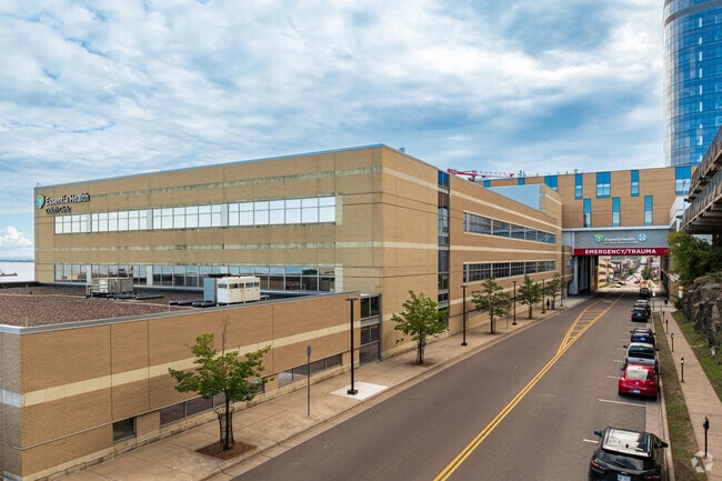
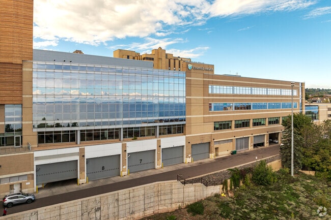
420 E 1St St, Duluth, MN 55805

Property Detail
420 E 1St St
Duluth, MN-WI
ELY 5 FT OF LOT 7 AND LOTS 8 THRU 16 BLK 25INC W1/2 OF VAC 5TH AVE E ADJ AND LOTS 1 THRU7 BLK 24 INC E1/2 OF VAC 5TH AVE E ADJ SERIAL #
010383002940
Saint Louis
Hospitalpublic
Minnesota
B and X Area of moderate flood hazard, usually the area between the limits of the 100-year and 500-year floods.
1-16
2024
0.24 AC
2024
Downtown CBD
001700
Duluth
203,540 SF
NEARBY LISTINGS FOR SALE OR LEASE
DEMOGRAPHICS near 420 E 1St St
1 mile
3 mile
5 mile
2025 Total Population
12,249
44,524
75,564
2030 Population
12,161
44,012
74,551
Pop Growth 2025-2030
(0.72%)
(1.15%)
(1.34%)
Average Age
37
37
39
2025 Total Households
6,065
18,744
31,947
HH Growth 2025-2030
(0.73%)
(1.42%)
(1.52%)
Median Household Inc
$37,109
$53,222
$61,768
Avg Household Size
1.80
2.00
2.10
2025 Avg HH Vehicles
1.00
2.00
2.00
Median Home Value
$196,277
$284,765
$270,128
Median Year Built
1947
1951
1952
Nearby Places
Map Layers
Map Styles
 Street
 Aerial
Transit
 Traffic
 Biking
Places
Listings with unknown addresses are not visible on the map
- Restaurants
- Banks
- Shops
- Fitness
- Groceries
PUBLIC TRANSPORTATION
AIRPORT
Duluth International
Drive
Walk
Distance
Duluth International
21 min
8.7 mi
Freight Ports
Port Milwaukee
Drive
Walk
Distance
Port Milwaukee
453 min
399.3 mi
Nearby Properties
Address
Land Use
TOTAL SIZE
Lot Size
Zoning
Address
Land Use
TOTAL SIZE
Lot Size
Zoning
210,288 SF
146 AC
Address
Land Use
TOTAL SIZE
Lot Size
Zoning
539,170 SF
0.49 AC
Address
Land Use
TOTAL SIZE
Lot Size
Zoning
338,800 SF
0.17 AC
Address
Land Use
TOTAL SIZE
Lot Size
Zoning
547,975 SF
18.72 AC
Address
Land Use
TOTAL SIZE
Lot Size
Zoning
372,356 SF
1.35 AC
Address
Land Use
TOTAL SIZE
Lot Size
Zoning
143,370 SF
8.69 AC
Address
Land Use
TOTAL SIZE
Lot Size
Zoning
134,100 SF
0.17 AC
Address
Land Use
TOTAL SIZE
Lot Size
Zoning
195,455 SF
54.06 AC
Address
Land Use
TOTAL SIZE
Lot Size
Zoning
148,777 SF
1.19 AC
Address
Land Use
TOTAL SIZE
Lot Size
Zoning
248,716 SF
1.02 AC
Address
Land Use
TOTAL SIZE
Lot Size
Zoning
143,132 SF
41.55 AC
Address
Land Use
TOTAL SIZE
Lot Size
Zoning
40,835 SF
0.33 AC
Address
Land Use
TOTAL SIZE
Lot Size
Zoning
6,500 SF
3.31 AC
R3
Address
Land Use
TOTAL SIZE
Lot Size
Zoning
132,316 SF
2.13 AC
Address
Land Use
TOTAL SIZE
Lot Size
Zoning
32,824 SF
117.72 AC
Address
Land Use
TOTAL SIZE
Lot Size
Zoning
97,552 SF
1.29 AC
Address
Land Use
TOTAL SIZE
Lot Size
Zoning
232,586 SF
0.16 AC
Address
Land Use
TOTAL SIZE
Lot Size
Zoning
178,184 SF
20 AC
Address
Land Use
TOTAL SIZE
Lot Size
Zoning
205,584 SF
0.81 AC
Address
Land Use
TOTAL SIZE
Lot Size
Zoning
178,104 SF
0.95 AC
Address
Land Use
TOTAL SIZE
Lot Size
Zoning
126,349 SF
8.35 AC
Address
Land Use
TOTAL SIZE
Lot Size
Zoning
82,119 SF
5.21 AC
Address
Land Use
TOTAL SIZE
Lot Size
Zoning
91,053 SF
0.60 AC
Address
Land Use
TOTAL SIZE
Lot Size
Zoning
113,615 SF
0.32 AC
R4
Address
Land Use
TOTAL SIZE
Lot Size
Zoning
107,796 SF
9.19 AC
Address
Land Use
TOTAL SIZE
Lot Size
Zoning
175,168 SF
0.16 AC
Address
Land Use
TOTAL SIZE
Lot Size
Zoning
77,816 SF
4.43 AC
Address
Land Use
TOTAL SIZE
Lot Size
Zoning
144,760 SF
0.56 AC
C4
Address
Land Use
TOTAL SIZE
Lot Size
Zoning
68,296 SF
0.38 AC
The World's #1 Commercial Real Estate Marketplace
Connect with us
© 2026 CoStar Group
The information above has been obtained from sources believed reliable. While we do not doubt its accuracy we have not verified it and make no guarantee, warranty or representation about it. It is your responsibility to independently confirm its accuracy and completeness. Any projections, opinions, assumptions, or estimates used are for example only and do not represent the current or future performance of the property. The value of this transaction to you depends on tax and other factors which should be evaluated by your tax, financial, and legal advisors. You and your advisors should conduct a careful, independent investigation of the property to determine to your satisfaction the suitability of the property for your needs.