Property Record
420 N Range Line Rd, Joplin, MO 64801
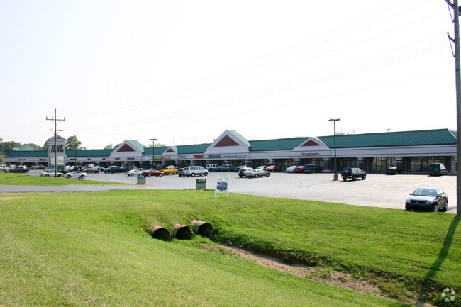

Property Detail
420 N Range Line Rd
Joplin, MO-KS
JOP MISC BEG 639.8 S & 110 W NE COR SEC S ALG HWY 71 682.62 TO HOGDON RD SW ALG HOGDON RD TO PT 583 W OF E SEC LN N 12 DEG E 84.95 N 7 DEG E 153.04 N 2 DEG E 177.3 N
19-1.0-01-10-001-002.005
Jasper
Apartment
Missouri
C and X Area of minimal flood hazard, usually depicted on FIRMs as above the 500-year flood level.
2
2024
5.73 AC
2025
Missouri South Area
010100
Other Market Areas
33,490 SF
NEARBY LISTINGS FOR SALE OR LEASE
DEMOGRAPHICS near 420 N Range Line Rd
1 mile
3 mile
5 mile
2025 Total Population
5,360
43,185
80,455
2030 Population
5,487
44,461
83,063
Pop Growth 2025-2030
+ 2.37%
+ 2.95%
+ 3.24%
Average Age
38
38
39
2025 Total Households
2,255
18,196
33,258
HH Growth 2025-2030
+ 2.62%
+ 3.11%
+ 3.39%
Median Household Inc
$48,905
$46,512
$52,444
Avg Household Size
2.00
2.20
2.30
2025 Avg HH Vehicles
2.00
2.00
2.00
Median Home Value
$158,649
$169,413
$172,530
Median Year Built
1979
1985
1985
Nearby Places
Map Layers
Map Styles
 Street
 Aerial
Transit
 Traffic
 Biking
Places
Listings with unknown addresses are not visible on the map
- Restaurants
- Banks
- Shops
- Fitness
- Groceries
SALE & LEASE HISTORY
LISTING DATE
SALE/LEASE

Dec 16, 2022
For Lease
Nearby Properties
Address
Land Use
TOTAL SIZE
Lot Size
Zoning
Address
Land Use
TOTAL SIZE
Lot Size
Zoning
605,856 SF
40.96 AC
Address
Land Use
TOTAL SIZE
Lot Size
Zoning
380,504 SF
20.32 AC
Address
Land Use
TOTAL SIZE
Lot Size
Zoning
236,532 SF
205.82 AC
Address
Land Use
TOTAL SIZE
Lot Size
Zoning
28,488 SF
2.34 AC
Address
Land Use
TOTAL SIZE
Lot Size
Zoning
531,297 SF
24.88 AC
Address
Land Use
TOTAL SIZE
Lot Size
Zoning
37,492 SF
11.54 AC
Address
Land Use
TOTAL SIZE
Lot Size
Zoning
220,377 SF
10.45 AC
Address
Land Use
TOTAL SIZE
Lot Size
Zoning
20,619 SF
4.56 AC
Address
Land Use
TOTAL SIZE
Lot Size
Zoning
62,916 SF
0.28 AC
Address
Land Use
TOTAL SIZE
Lot Size
Zoning
194,326 SF
24.61 AC
Address
Land Use
TOTAL SIZE
Lot Size
Zoning
66,470 SF
7.71 AC
Address
Land Use
TOTAL SIZE
Lot Size
Zoning
76,512 SF
5.60 AC
Address
Land Use
TOTAL SIZE
Lot Size
Zoning
18,902 SF
4.02 AC
Address
Land Use
TOTAL SIZE
Lot Size
Zoning
85,574 SF
16.39 AC
Address
Land Use
TOTAL SIZE
Lot Size
Zoning
Address
Land Use
TOTAL SIZE
Lot Size
Zoning
11,550 SF
1.38 AC
Address
Land Use
TOTAL SIZE
Lot Size
Zoning
151,868 SF
16.74 AC
Address
Land Use
TOTAL SIZE
Lot Size
Zoning
142,801 SF
11.85 AC
Address
Land Use
TOTAL SIZE
Lot Size
Zoning
88,710 SF
8.75 AC
Address
Land Use
TOTAL SIZE
Lot Size
Zoning
124,230 SF
15.25 AC
Address
Land Use
TOTAL SIZE
Lot Size
Zoning
36,405 SF
4.04 AC
Address
Land Use
TOTAL SIZE
Lot Size
Zoning
41,287 SF
5.32 AC
Address
Land Use
TOTAL SIZE
Lot Size
Zoning
73,052 SF
0.62 AC
Address
Land Use
TOTAL SIZE
Lot Size
Zoning
12,211 SF
2.57 AC
Address
Land Use
TOTAL SIZE
Lot Size
Zoning
18,610 SF
1.66 AC
Address
Land Use
TOTAL SIZE
Lot Size
Zoning
48,378 SF
6.94 AC
Address
Land Use
TOTAL SIZE
Lot Size
Zoning
113,028 SF
7.99 AC
Address
Land Use
TOTAL SIZE
Lot Size
Zoning
5.80 AC
Address
Land Use
TOTAL SIZE
Lot Size
Zoning
104,501 SF
8.54 AC
The World's #1 Commercial Real Estate Marketplace
Connect with us
© 2026 CoStar Group
The information above has been obtained from sources believed reliable. While we do not doubt its accuracy we have not verified it and make no guarantee, warranty or representation about it. It is your responsibility to independently confirm its accuracy and completeness. Any projections, opinions, assumptions, or estimates used are for example only and do not represent the current or future performance of the property. The value of this transaction to you depends on tax and other factors which should be evaluated by your tax, financial, and legal advisors. You and your advisors should conduct a careful, independent investigation of the property to determine to your satisfaction the suitability of the property for your needs.