Property Record
420 28Th Ave E, Tuscaloosa, AL 35401


NEARBY LISTINGS FOR SALE OR LEASE
Property Detail
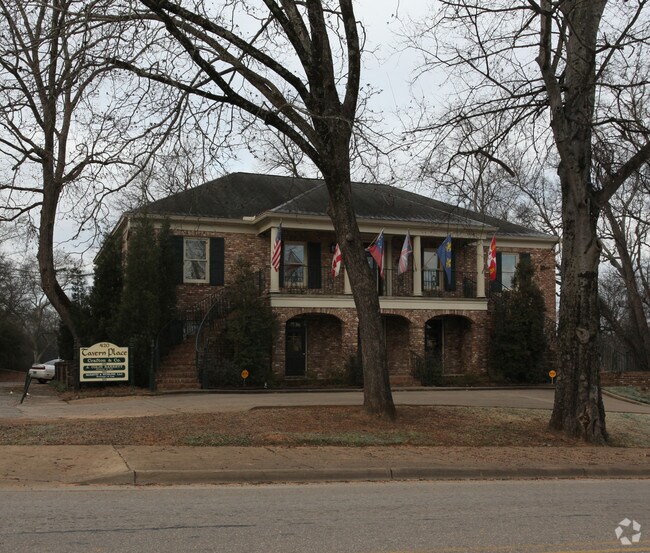
420 28Th Ave E
31-05-22-2-015-005.000
BEG AT INTERSECTION OF NORTH ROW OF UNIV BLVD WITH WEST ROW OF 28TH AVE; TH RUN NORTH WITH ROW 82; TH W-60; TH S-82 TO N ROW OF UNIV BLVD; EAST WITH ROW TO POB LYING IN S-22 TSP-21 RNG 10 RNG 10
Officebuilding
Tuscaloosa
X
Alabama
01125C0504F
0.11 AC
2025
Tuscaloosa
2024
Birmingham
011600
Tuscaloosa, AL
4,560 SF
DEMOGRAPHICS near 420 28Th Ave E
1 Mile
3 Mile
5 Mile
2024 Total Population
8,205
78,350
128,451
2029 Population
9,544
87,937
144,831
Pop Growth 2024-2029
+ 16.32%
+ 12.24%
+ 12.75%
Average Age
36
33
34
2024 Total Households
3,468
27,817
49,187
HH Growth 2024-2029
+ 15.77%
+ 15.36%
+ 14.38%
Median Household Inc
$30,491
$34,129
$42,519
Avg Household Size
1.90
2.10
2.10
2024 Avg HH Vehicles
1.00
2.00
2.00
Median Home Value
$176,177
$203,120
$196,967
Median Year Built
1973
1985
1989
Nearby Places
Map Layers
Map Styles
 Street
 Aerial
- Restaurants
- Banks
- Shops
- Fitness
- Groceries
SALE & LEASE HISTORY
LISTING DATE
SALE/LEASE

Jul 31, 2019
For Lease
Nearby Properties
Address
Land Use
TOTAL SIZE
Lot Size
Zoning
Address
Land Use
TOTAL SIZE
Lot Size
Zoning
22,791 SF
13 AC
Address
Land Use
TOTAL SIZE
Lot Size
Zoning
148,656 SF
2.79 AC
BC
Address
Land Use
TOTAL SIZE
Lot Size
Zoning
22,925 SF
13.45 AC
R4
Address
Land Use
TOTAL SIZE
Lot Size
Zoning
252,793 SF
2.73 AC
BN
Address
Land Use
TOTAL SIZE
Lot Size
Zoning
24,165 SF
28 AC
BN
Address
Land Use
TOTAL SIZE
Lot Size
Zoning
40,160 SF
10.79 AC
RMF1
Address
Land Use
TOTAL SIZE
Lot Size
Zoning
25,920 SF
16 AC
RMF1
Address
Land Use
TOTAL SIZE
Lot Size
Zoning
6,579 SF
15.07 AC
RMF1
Address
Land Use
TOTAL SIZE
Lot Size
Zoning
160,989 SF
1.53 AC
RMF2
Address
Land Use
TOTAL SIZE
Lot Size
Zoning
1.33 AC
BC
Address
Land Use
TOTAL SIZE
Lot Size
Zoning
176,360 SF
1.13 AC
RMF2
Address
Land Use
TOTAL SIZE
Lot Size
Zoning
15,888 SF
112 AC
I
Address
Land Use
TOTAL SIZE
Lot Size
Zoning
200,388 SF
1.22 AC
Address
Land Use
TOTAL SIZE
Lot Size
Zoning
24,360 SF
142 AC
Address
Land Use
TOTAL SIZE
Lot Size
Zoning
110,337 SF
0.91 AC
RMF2
Address
Land Use
TOTAL SIZE
Lot Size
Zoning
105,728 SF
4.75 AC
BGO
Address
Land Use
TOTAL SIZE
Lot Size
Zoning
121,384 SF
21 AC
O-I
Address
Land Use
TOTAL SIZE
Lot Size
Zoning
173,452 SF
2.30 AC
ML
Address
Land Use
TOTAL SIZE
Lot Size
Zoning
144,660 SF
1 AC
RMF2
Address
Land Use
TOTAL SIZE
Lot Size
Zoning
110,000 SF
5.80 AC
RD
Address
Land Use
TOTAL SIZE
Lot Size
Zoning
26,576 SF
2.53 AC
RD
Address
Land Use
TOTAL SIZE
Lot Size
Zoning
15.30 AC
Address
Land Use
TOTAL SIZE
Lot Size
Zoning
115,911 SF
4.48 AC
I
Address
Land Use
TOTAL SIZE
Lot Size
Zoning
12 AC
R1
Address
Land Use
TOTAL SIZE
Lot Size
Zoning
45,716 SF
8.80 AC
R4
Address
Land Use
TOTAL SIZE
Lot Size
Zoning
12,048 SF
21 AC
RM2
Address
Land Use
TOTAL SIZE
Lot Size
Zoning
34 AC
R-3
Address
Land Use
TOTAL SIZE
Lot Size
Zoning
301,560 SF
15 AC
ML
Address
Land Use
TOTAL SIZE
Lot Size
Zoning
16,000 SF
12 AC
RMF1
Address
Land Use
TOTAL SIZE
Lot Size
Zoning
25,422 SF
8.90 AC
RMF1
The World's #1 Commercial Real Estate Marketplace
Connect with us
© 2025 CoStar Group
The information above has been obtained from sources believed reliable. While we do not doubt its accuracy we have not verified it and make no guarantee, warranty or representation about it. It is your responsibility to independently confirm its accuracy and completeness. Any projections, opinions, assumptions, or estimates used are for example only and do not represent the current or future performance of the property. The value of this transaction to you depends on tax and other factors which should be evaluated by your tax, financial, and legal advisors. You and your advisors should conduct a careful, independent investigation of the property to determine to your satisfaction the suitability of the property for your needs.