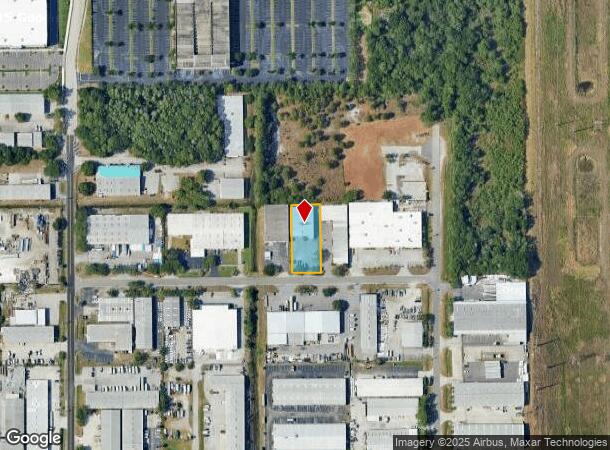
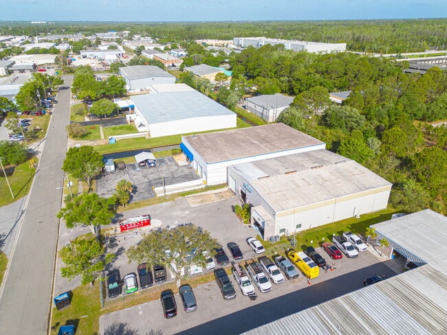
Property Record
420 Roberts Rd, Oldsmar, FL 34677

NEARBY LISTINGS FOR SALE OR LEASE
Property Detail
420 Roberts Rd
Tampa-St. Petersburg-Clearwater, FL
Burbank Center
13-28-16-12808-000-0080
BURBANK CENTER LOT 8
Lightindustrial
Pinellas
AE
Florida
12057C0167J
8
2024
0.54 AC
2025
North Pinellas
027327
Tampa/St Petersburg
8,160 SF
DEMOGRAPHICS near 420 Roberts Rd
1 Mile
3 Mile
5 Mile
2024 Total Population
1,691
42,015
153,474
2029 Population
1,676
43,593
159,361
Pop Growth 2024-2029
(0.89%)
+ 3.76%
+ 3.84%
Average Age
41
41
43
2024 Total Households
625
16,891
63,906
HH Growth 2024-2029
(1.28%)
+ 3.71%
+ 3.65%
Median Household Inc
$73,471
$93,583
$80,871
Avg Household Size
2.60
2.40
2.30
2024 Avg HH Vehicles
2.00
2.00
2.00
Median Home Value
$350,359
$366,041
$348,254
Median Year Built
1988
1993
1988
Nearby Places
Map Layers
Map Styles
 Street
 Aerial
- Restaurants
- Banks
- Shops
- Fitness
- Groceries
PUBLIC TRANSPORTATION
AIRPORT
Tampa International
DRIVE
WALK
Distance
Tampa International
24 min
11.8 mi
St Pete-Clearwater International
DRIVE
WALK
Distance
St Pete-Clearwater International
34 min
16.8 mi
SALE & LEASE HISTORY
LISTING DATE
SALE/LEASE

Apr 15, 2025
For Sale
Apr 11, 2017
For Lease
Nearby Properties
Address
Land Use
TOTAL SIZE
Lot Size
Zoning
Address
Land Use
TOTAL SIZE
Lot Size
Zoning
536,079 SF
23.90 AC
PD
Address
Land Use
TOTAL SIZE
Lot Size
Zoning
399,137 SF
44.98 AC
PD
Address
Land Use
TOTAL SIZE
Lot Size
Zoning
374,906 SF
54.10 AC
PD
Address
Land Use
TOTAL SIZE
Lot Size
Zoning
459,627 SF
23.28 AC
PD
Address
Land Use
TOTAL SIZE
Lot Size
Zoning
449,097 SF
75.52 AC
PD
Address
Land Use
TOTAL SIZE
Lot Size
Zoning
323,386 SF
30.50 AC
PD
Address
Land Use
TOTAL SIZE
Lot Size
Zoning
358,185 SF
41.27 AC
PD
Address
Land Use
TOTAL SIZE
Lot Size
Zoning
473,742 SF
20.84 AC
Address
Land Use
TOTAL SIZE
Lot Size
Zoning
417,535 SF
42.47 AC
Address
Land Use
TOTAL SIZE
Lot Size
Zoning
305,687 SF
31.48 AC
PD
Address
Land Use
TOTAL SIZE
Lot Size
Zoning
427,299 SF
80.27 AC
PD
Address
Land Use
TOTAL SIZE
Lot Size
Zoning
311,117 SF
16.96 AC
Address
Land Use
TOTAL SIZE
Lot Size
Zoning
241,867 SF
19.54 AC
Address
Land Use
TOTAL SIZE
Lot Size
Zoning
234,591 SF
39.39 AC
PD
Address
Land Use
TOTAL SIZE
Lot Size
Zoning
123,836 SF
15.17 AC
PD
Address
Land Use
TOTAL SIZE
Lot Size
Zoning
188,940 SF
24.78 AC
PD
Address
Land Use
TOTAL SIZE
Lot Size
Zoning
220,103 SF
28.40 AC
Address
Land Use
TOTAL SIZE
Lot Size
Zoning
575,565 SF
335.60 AC
PD
Address
Land Use
TOTAL SIZE
Lot Size
Zoning
130,000 SF
11.27 AC
Address
Land Use
TOTAL SIZE
Lot Size
Zoning
102,074 SF
18.39 AC
Address
Land Use
TOTAL SIZE
Lot Size
Zoning
122,912 SF
19.61 AC
Address
Land Use
TOTAL SIZE
Lot Size
Zoning
249,928 SF
79.57 AC
M1
Address
Land Use
TOTAL SIZE
Lot Size
Zoning
137,424 SF
9.93 AC
Address
Land Use
TOTAL SIZE
Lot Size
Zoning
283,201 SF
27 AC
Address
Land Use
TOTAL SIZE
Lot Size
Zoning
100,896 SF
6.60 AC
PD
Address
Land Use
TOTAL SIZE
Lot Size
Zoning
77,858 SF
8.43 AC
PD
Address
Land Use
TOTAL SIZE
Lot Size
Zoning
158,269 SF
16.44 AC
PD
Address
Land Use
TOTAL SIZE
Lot Size
Zoning
104,301 SF
3.35 AC
PD
Address
Land Use
TOTAL SIZE
Lot Size
Zoning
103,184 SF
12.47 AC
Address
Land Use
TOTAL SIZE
Lot Size
Zoning
214,078 SF
19.43 AC
The World's #1 Commercial Real Estate Marketplace
Connect with us
© 2025 CoStar Group
The information above has been obtained from sources believed reliable. While we do not doubt its accuracy we have not verified it and make no guarantee, warranty or representation about it. It is your responsibility to independently confirm its accuracy and completeness. Any projections, opinions, assumptions, or estimates used are for example only and do not represent the current or future performance of the property. The value of this transaction to you depends on tax and other factors which should be evaluated by your tax, financial, and legal advisors. You and your advisors should conduct a careful, independent investigation of the property to determine to your satisfaction the suitability of the property for your needs.