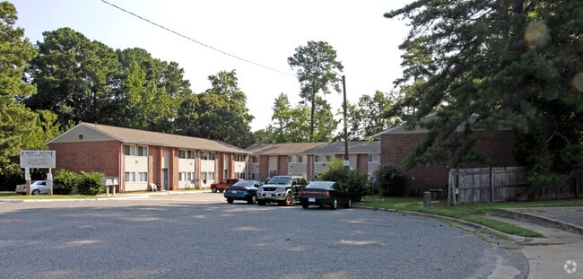
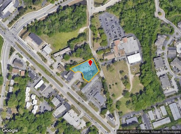
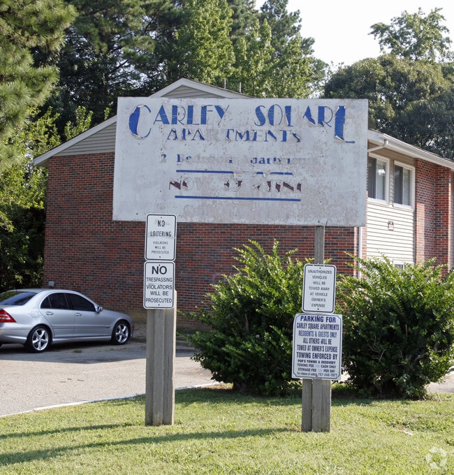
Property Record
420 Shawn Cir, Newport News, VA 23602
NEARBY LISTINGS FOR SALE OR LEASE
-
-
View all Newport News listings for sale on LoopNet.com
Property Detail
420 Shawn Cir
Virginia Beach-Norfolk-Newport News, VA-NC
Laprades Sub Rev
129.00-05-13
2 130.18XVAR
Apartmenthouse5plusunits
Newport News
X
Virginia
5101030107D
2
2025
0.73 AC
2025
Jenkins
032006
Hampton Roads
DEMOGRAPHICS near 420 Shawn Cir
1 Mile
3 Mile
5 Mile
2024 Total Population
14,278
75,789
148,748
2029 Population
14,037
74,712
147,826
Pop Growth 2024-2029
(1.69%)
(1.42%)
(0.62%)
Average Age
36
38
38
2024 Total Households
6,152
31,298
59,319
HH Growth 2024-2029
(1.74%)
(1.48%)
(0.74%)
Median Household Inc
$58,776
$68,836
$69,371
Avg Household Size
2.30
2.40
2.40
2024 Avg HH Vehicles
2.00
2.00
2.00
Median Home Value
$222,337
$248,745
$262,100
Median Year Built
1978
1983
1984
Nearby Places
Map Layers
Map Styles
 Street
 Aerial
- Restaurants
- Banks
- Shops
- Fitness
- Groceries
PUBLIC TRANSPORTATION
COMMUTER RAIL
Newport News (Northeast Regional - Amtrak)
DRIVE
WALK
Distance
Newport News (Northeast Regional - Amtrak)
17 min
8.1 mi
Newport News (Northeast Regional - Amtrak)
DRIVE
WALK
Distance
Newport News (Northeast Regional - Amtrak)
14 min
9.2 mi
AIRPORT
Newport News/Williamsburg International
DRIVE
WALK
Distance
Newport News/Williamsburg International
5 min
2.1 mi
Norfolk International
DRIVE
WALK
Distance
Norfolk International
42 min
28.2 mi
Freight Ports
Virginia Port Authority - Newport News
DRIVE
WALK
Distance
Virginia Port Authority - Newport News
23 min
12.3 mi
Nearby Properties
Address
Land Use
TOTAL SIZE
Lot Size
Zoning
Address
Land Use
TOTAL SIZE
Lot Size
Zoning
565,343 SF
46.70 AC
C1
Address
Land Use
TOTAL SIZE
Lot Size
Zoning
75,168 SF
824.63 AC
M1
Address
Land Use
TOTAL SIZE
Lot Size
Zoning
210,585 SF
32.06 AC
R9
Address
Land Use
TOTAL SIZE
Lot Size
Zoning
100 SF
7.27 AC
R9
Address
Land Use
TOTAL SIZE
Lot Size
Zoning
139,155 SF
15.01 AC
O2
Address
Land Use
TOTAL SIZE
Lot Size
Zoning
3,278 SF
7.44 AC
R9
Address
Land Use
TOTAL SIZE
Lot Size
Zoning
28.29 AC
R7
Address
Land Use
TOTAL SIZE
Lot Size
Zoning
71,551 SF
110 AC
O3
Address
Land Use
TOTAL SIZE
Lot Size
Zoning
290,280 SF
41.97 AC
C1
Address
Land Use
TOTAL SIZE
Lot Size
Zoning
100 SF
7.68 AC
R9
Address
Land Use
TOTAL SIZE
Lot Size
Zoning
617 SF
73.49 AC
M1
Address
Land Use
TOTAL SIZE
Lot Size
Zoning
19.86 AC
R8
Address
Land Use
TOTAL SIZE
Lot Size
Zoning
100 SF
10.46 AC
R8
Address
Land Use
TOTAL SIZE
Lot Size
Zoning
197,355 SF
10.89 AC
R8
Address
Land Use
TOTAL SIZE
Lot Size
Zoning
13.10 AC
R5
Address
Land Use
TOTAL SIZE
Lot Size
Zoning
5.04 AC
R9
Address
Land Use
TOTAL SIZE
Lot Size
Zoning
20.73 AC
R7
Address
Land Use
TOTAL SIZE
Lot Size
Zoning
97,180 SF
53.17 AC
C1
Address
Land Use
TOTAL SIZE
Lot Size
Zoning
18.76 AC
R7
Address
Land Use
TOTAL SIZE
Lot Size
Zoning
100 SF
16.23 AC
R7
Address
Land Use
TOTAL SIZE
Lot Size
Zoning
365,956 SF
27.40 AC
M1
Address
Land Use
TOTAL SIZE
Lot Size
Zoning
13.31 AC
R7
Address
Land Use
TOTAL SIZE
Lot Size
Zoning
276,537 SF
27 AC
C1
Address
Land Use
TOTAL SIZE
Lot Size
Zoning
8.19 AC
R7
Address
Land Use
TOTAL SIZE
Lot Size
Zoning
95,053 SF
52.81 AC
R3
Address
Land Use
TOTAL SIZE
Lot Size
Zoning
232,799 SF
48.03 AC
P1
Address
Land Use
TOTAL SIZE
Lot Size
Zoning
16.48 AC
R7
Address
Land Use
TOTAL SIZE
Lot Size
Zoning
7.09 AC
R7
Address
Land Use
TOTAL SIZE
Lot Size
Zoning
100 SF
13.60 AC
R7
Address
Land Use
TOTAL SIZE
Lot Size
Zoning
12.08 AC
R7
The World's #1 Commercial Real Estate Marketplace
Connect with us
© 2025 CoStar Group
The information above has been obtained from sources believed reliable. While we do not doubt its accuracy we have not verified it and make no guarantee, warranty or representation about it. It is your responsibility to independently confirm its accuracy and completeness. Any projections, opinions, assumptions, or estimates used are for example only and do not represent the current or future performance of the property. The value of this transaction to you depends on tax and other factors which should be evaluated by your tax, financial, and legal advisors. You and your advisors should conduct a careful, independent investigation of the property to determine to your satisfaction the suitability of the property for your needs.