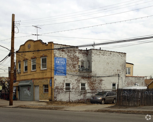
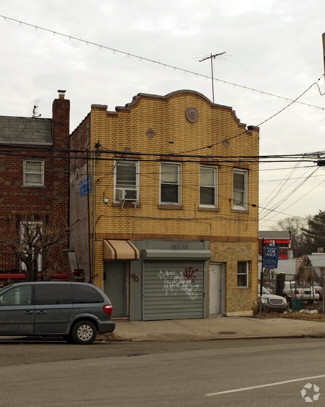
Property Record
420 Soundview Ave, Bronx, NY 10473
NEARBY LISTINGS FOR SALE OR LEASE
Property Detail
420 Soundview Ave
03499-0016
Map 63 Lots Herman Manaker
Commercialofficeresidentialmixeduse
Bronx
X
New York
3604970103F
16
2024
0.06 AC
2025
Clason Point
000400
Westchester/So Connecticut
4,900 SF
New York-Jersey City-White Plains, NY-NJ
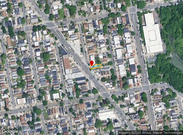
DEMOGRAPHICS near 420 Soundview Ave
1 Mile
3 Mile
5 Mile
2024 Total Population
51,625
533,668
2,206,878
2029 Population
46,334
488,888
2,046,660
Pop Growth 2024-2029
(10.25%)
(8.39%)
(7.26%)
Average Age
39
38
39
2024 Total Households
18,373
184,418
796,095
HH Growth 2024-2029
(10.74%)
(9.16%)
(7.74%)
Median Household Inc
$41,716
$42,597
$47,801
Avg Household Size
2.70
2.70
2.60
2024 Avg HH Vehicles
1.00
1.00
.00
Median Home Value
$555,801
$631,608
$609,556
Median Year Built
1961
1957
1952
Nearby Places
Map Layers
Map Styles
 Street
 Aerial
- Restaurants
- Banks
- Shops
- Fitness
- Groceries
PUBLIC TRANSPORTATION
COMMUTER RAIL
Tremont Station (Harlem Line - Metro-North Commuter Railroad Company (Metro-North))
DRIVE
WALK
Distance
Tremont Station (Harlem Line - Metro-North Commuter Railroad Company (Metro-North))
7 min
3.6 mi
Fordham Station (Harlem Line - Metro-North Commuter Railroad Company (Metro-North), New Haven Line - Metro-North Commuter Railroad Company (Metro-North))
DRIVE
WALK
Distance
Fordham Station (Harlem Line - Metro-North Commuter Railroad Company (Metro-North), New Haven Line - Metro-North Commuter Railroad Company (Metro-North))
10 min
4.9 mi
AIRPORT
LaGuardia
DRIVE
WALK
Distance
LaGuardia
19 min
9.4 mi
John F Kennedy International
DRIVE
WALK
Distance
John F Kennedy International
26 min
17.0 mi
Newark Liberty International
DRIVE
WALK
Distance
Newark Liberty International
32 min
25.6 mi
Freight Ports
NY - Red Hook Container Terminal
DRIVE
WALK
Distance
NY - Red Hook Container Terminal
32 min
17.6 mi
Nearby Properties
Address
Land Use
TOTAL SIZE
Lot Size
Zoning
Address
Land Use
TOTAL SIZE
Lot Size
Zoning
5,519,372 SF
409.21 AC
C8-2
Address
Land Use
TOTAL SIZE
Lot Size
Zoning
1,427,393 SF
39.94 AC
R4
Address
Land Use
TOTAL SIZE
Lot Size
Zoning
1,012,000 SF
7.79 AC
R6
Address
Land Use
TOTAL SIZE
Lot Size
Zoning
485,484 SF
39.63 AC
R5
Address
Land Use
TOTAL SIZE
Lot Size
Zoning
667,405 SF
5.51 AC
R6
Address
Land Use
TOTAL SIZE
Lot Size
Zoning
390,750 SF
265 AC
PARK
Address
Land Use
TOTAL SIZE
Lot Size
Zoning
851,821 SF
7.95 AC
R4
Address
Land Use
TOTAL SIZE
Lot Size
Zoning
426,172 SF
14.30 AC
M3-1
Address
Land Use
TOTAL SIZE
Lot Size
Zoning
491,007 SF
11.85 AC
M3-1
Address
Land Use
TOTAL SIZE
Lot Size
Zoning
14,681 SF
97 AC
PARK
Address
Land Use
TOTAL SIZE
Lot Size
Zoning
127,000 SF
16.53 AC
M3-1
Address
Land Use
TOTAL SIZE
Lot Size
Zoning
489,326 SF
19.18 AC
C8-1
Address
Land Use
TOTAL SIZE
Lot Size
Zoning
361,354 SF
C4-2
Address
Land Use
TOTAL SIZE
Lot Size
Zoning
1,172,005 SF
128.83 AC
M1-1
Address
Land Use
TOTAL SIZE
Lot Size
Zoning
510 SF
68.73 AC
PARK
Address
Land Use
TOTAL SIZE
Lot Size
Zoning
601,260 SF
3.27 AC
R4
Address
Land Use
TOTAL SIZE
Lot Size
Zoning
450,879 SF
9.10 AC
M1-1
Address
Land Use
TOTAL SIZE
Lot Size
Zoning
450,000 SF
5.59 AC
R6
Address
Land Use
TOTAL SIZE
Lot Size
Zoning
726,051 SF
33.66 AC
R5
Address
Land Use
TOTAL SIZE
Lot Size
Zoning
274,840 SF
2.80 AC
M1-1
Address
Land Use
TOTAL SIZE
Lot Size
Zoning
312,844 SF
0.44 AC
M14R7X
Address
Land Use
TOTAL SIZE
Lot Size
Zoning
674,889 SF
51.55 AC
M3-1
Address
Land Use
TOTAL SIZE
Lot Size
Zoning
140,000 SF
2.34 AC
M1-4
Address
Land Use
TOTAL SIZE
Lot Size
Zoning
16,300 SF
148.32 AC
PARK
Address
Land Use
TOTAL SIZE
Lot Size
Zoning
464,700 SF
5.07 AC
R4
Address
Land Use
TOTAL SIZE
Lot Size
Zoning
454,631 SF
24.61 AC
M1-1
Address
Land Use
TOTAL SIZE
Lot Size
Zoning
1,214,370 SF
13.09 AC
R6
Address
Land Use
TOTAL SIZE
Lot Size
Zoning
15.83 AC
M2-1
Address
Land Use
TOTAL SIZE
Lot Size
Zoning
262,716 SF
2.80 AC
M1-1
Address
Land Use
TOTAL SIZE
Lot Size
Zoning
1,172,800 SF
19.66 AC
R4
The World's #1 Commercial Real Estate Marketplace
Connect with us
© 2026 CoStar Group
The information above has been obtained from sources believed reliable. While we do not doubt its accuracy we have not verified it and make no guarantee, warranty or representation about it. It is your responsibility to independently confirm its accuracy and completeness. Any projections, opinions, assumptions, or estimates used are for example only and do not represent the current or future performance of the property. The value of this transaction to you depends on tax and other factors which should be evaluated by your tax, financial, and legal advisors. You and your advisors should conduct a careful, independent investigation of the property to determine to your satisfaction the suitability of the property for your needs.