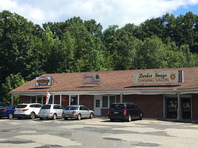
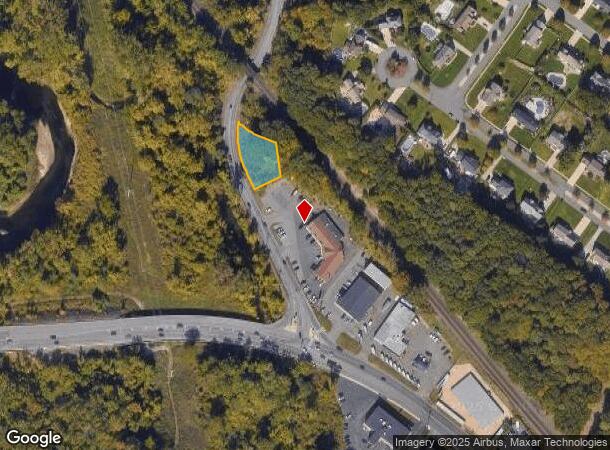
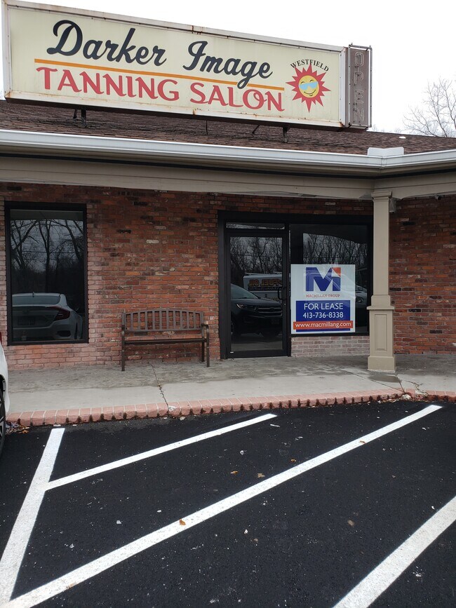
Property Record
420 Union St, Westfield, MA 01085
NEARBY LISTINGS FOR SALE OR LEASE
Property Detail
420 Union St
WFLD-000112-000000-000007
Hampden
Departmentstore
Massachusetts
AE
7
25013C0377E
1.39 AC
2025
Hampden County
2025
Hartford
812500
Springfield, MA
9,804 SF
DEMOGRAPHICS near 420 Union St
1 Mile
3 Mile
5 Mile
2024 Total Population
2,089
35,022
83,405
2029 Population
2,049
34,391
82,070
Pop Growth 2024-2029
(1.91%)
(1.80%)
(1.60%)
Average Age
43
42
42
2024 Total Households
767
14,265
33,762
HH Growth 2024-2029
(1.96%)
(1.83%)
(1.68%)
Median Household Inc
$118,534
$78,321
$74,147
Avg Household Size
2.60
2.40
2.30
2024 Avg HH Vehicles
3.00
2.00
2.00
Median Home Value
$378,723
$277,208
$280,676
Median Year Built
1974
1961
1964
Nearby Places
Map Layers
Map Styles
 Street
 Aerial
- Restaurants
- Banks
- Shops
- Fitness
- Groceries
PUBLIC TRANSPORTATION
COMMUTER RAIL
Springfield (Amtrak Hartford Line - Amtrak, Hartford Line - Amtrak, Lake Shore Limited - Amtrak, Northeast Regional - Amtrak, Valley Flyer - Amtrak, Vermonter - Amtrak)
DRIVE
WALK
Distance
Springfield (Amtrak Hartford Line - Amtrak, Hartford Line - Amtrak, Lake Shore Limited - Amtrak, Northeast Regional - Amtrak, Valley Flyer - Amtrak, Vermonter - Amtrak)
14 min
7.1 mi
AIRPORT
Bradley International
DRIVE
WALK
Distance
Bradley International
37 min
17.0 mi
Freight Ports
Port of New Haven
DRIVE
WALK
Distance
Port of New Haven
96 min
71.3 mi
SALE & LEASE HISTORY
LISTING DATE
SALE/LEASE

Sep 25, 2016
For Lease
Jun 04, 2020
For Lease
Jul 16, 2024
For Lease
Dec 29, 2021
For Lease
Nearby Properties
Address
Land Use
TOTAL SIZE
Lot Size
Zoning
Address
Land Use
TOTAL SIZE
Lot Size
Zoning
Address
Land Use
TOTAL SIZE
Lot Size
Zoning
16.48 AC
Address
Land Use
TOTAL SIZE
Lot Size
Zoning
9.25 AC
Address
Land Use
TOTAL SIZE
Lot Size
Zoning
180,130 SF
90.75 AC
Address
Land Use
TOTAL SIZE
Lot Size
Zoning
1,992 SF
185 AC
Address
Land Use
TOTAL SIZE
Lot Size
Zoning
811.20 AC
RA2
Address
Land Use
TOTAL SIZE
Lot Size
Zoning
25.35 AC
Address
Land Use
TOTAL SIZE
Lot Size
Zoning
2.60 AC
Address
Land Use
TOTAL SIZE
Lot Size
Zoning
113,406 SF
23.30 AC
Address
Land Use
TOTAL SIZE
Lot Size
Zoning
215,179 SF
9.83 AC
Address
Land Use
TOTAL SIZE
Lot Size
Zoning
14.78 AC
Address
Land Use
TOTAL SIZE
Lot Size
Zoning
64,414 SF
6.62 AC
Address
Land Use
TOTAL SIZE
Lot Size
Zoning
28.81 AC
Address
Land Use
TOTAL SIZE
Lot Size
Zoning
17,428 SF
15.80 AC
Address
Land Use
TOTAL SIZE
Lot Size
Zoning
Address
Land Use
TOTAL SIZE
Lot Size
Zoning
9.99 AC
Address
Land Use
TOTAL SIZE
Lot Size
Zoning
50,911 SF
3.31 AC
Address
Land Use
TOTAL SIZE
Lot Size
Zoning
43,050 SF
11.60 AC
Address
Land Use
TOTAL SIZE
Lot Size
Zoning
5,396 SF
329.20 AC
Address
Land Use
TOTAL SIZE
Lot Size
Zoning
42.70 AC
Address
Land Use
TOTAL SIZE
Lot Size
Zoning
275,103 SF
23.28 AC
Address
Land Use
TOTAL SIZE
Lot Size
Zoning
9.80 AC
Address
Land Use
TOTAL SIZE
Lot Size
Zoning
6.80 AC
Address
Land Use
TOTAL SIZE
Lot Size
Zoning
100,908 SF
1.84 AC
Address
Land Use
TOTAL SIZE
Lot Size
Zoning
53,734 SF
8 AC
Address
Land Use
TOTAL SIZE
Lot Size
Zoning
97,311 SF
5.11 AC
Address
Land Use
TOTAL SIZE
Lot Size
Zoning
Address
Land Use
TOTAL SIZE
Lot Size
Zoning
53,734 SF
15 AC
Address
Land Use
TOTAL SIZE
Lot Size
Zoning
Address
Land Use
TOTAL SIZE
Lot Size
Zoning
4.44 AC
The World's #1 Commercial Real Estate Marketplace
Connect with us
© 2026 CoStar Group
The information above has been obtained from sources believed reliable. While we do not doubt its accuracy we have not verified it and make no guarantee, warranty or representation about it. It is your responsibility to independently confirm its accuracy and completeness. Any projections, opinions, assumptions, or estimates used are for example only and do not represent the current or future performance of the property. The value of this transaction to you depends on tax and other factors which should be evaluated by your tax, financial, and legal advisors. You and your advisors should conduct a careful, independent investigation of the property to determine to your satisfaction the suitability of the property for your needs.