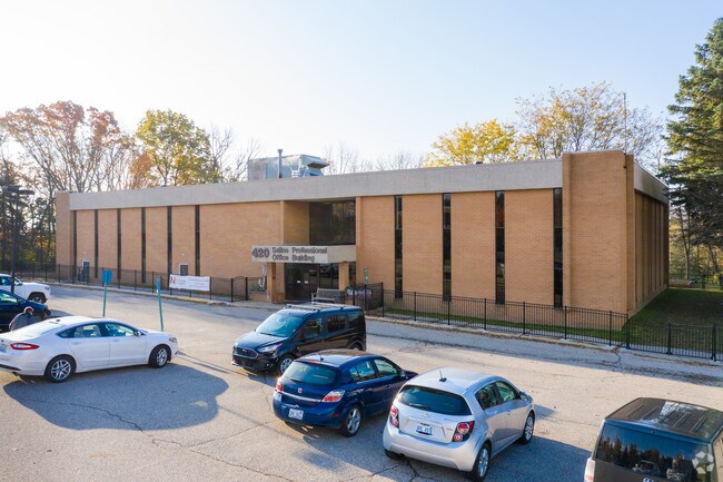
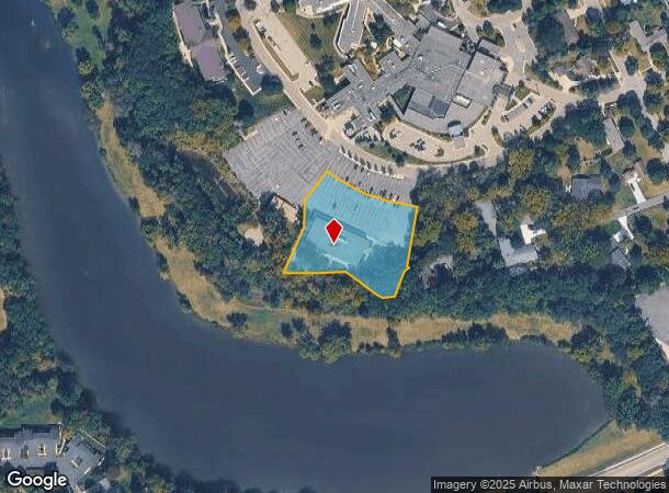
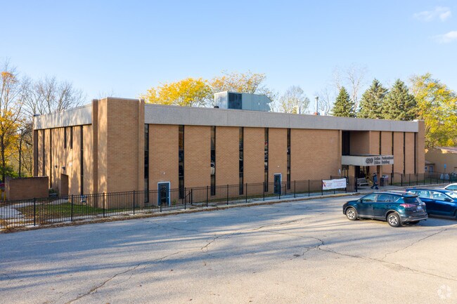
Property Record
420 W Russell St, Saline, MI 48176
NEARBY LISTINGS FOR SALE OR LEASE
Property Detail
420 W Russell St
18-01-200-026
BNDRY ADJST PER SURVEY 05/17/2016 SC 1-7A-2 PCL B COM AT NW COR SALINE HEIGHTS SUBDIVISION
Commercialnec
Washtenaw
X
Michigan
26161C0391E
1.62 AC
2025
Washtenaw W of 23
2025
Detroit
423400
Ann Arbor, MI
21,960 SF
DEMOGRAPHICS near 420 W Russell St
1 Mile
3 Mile
5 Mile
2024 Total Population
7,114
16,594
30,140
2029 Population
7,033
16,382
29,844
Pop Growth 2024-2029
(1.14%)
(1.28%)
(0.98%)
Average Age
43
43
42
2024 Total Households
3,124
6,578
11,413
HH Growth 2024-2029
(1.18%)
(1.35%)
(1.08%)
Median Household Inc
$83,406
$101,133
$117,296
Avg Household Size
2.20
2.50
2.60
2024 Avg HH Vehicles
2.00
2.00
2.00
Median Home Value
$293,418
$373,216
$425,598
Median Year Built
1974
1980
1990
Nearby Places
Map Layers
Map Styles
 Street
 Aerial
- Restaurants
- Banks
- Shops
- Fitness
- Groceries
PUBLIC TRANSPORTATION
AIRPORT
Detroit Metro Wayne County
DRIVE
WALK
Distance
Detroit Metro Wayne County
38 min
27.7 mi
Freight Ports
Port of Toledo
DRIVE
WALK
Distance
Port of Toledo
74 min
52.2 mi
SALE & LEASE HISTORY
LISTING DATE
SALE/LEASE

Dec 04, 2018
For Lease
Aug 11, 2017
For Sale
Nearby Properties
Address
Land Use
TOTAL SIZE
Lot Size
Zoning
Address
Land Use
TOTAL SIZE
Lot Size
Zoning
283,484 SF
22.64 AC
R-3
Address
Land Use
TOTAL SIZE
Lot Size
Zoning
1,562,480 SF
189.08 AC
I-4
Address
Land Use
TOTAL SIZE
Lot Size
Zoning
99,663 SF
6.89 AC
R-1A
Address
Land Use
TOTAL SIZE
Lot Size
Zoning
99,000 SF
12.22 AC
I-2
Address
Land Use
TOTAL SIZE
Lot Size
Zoning
140,284 SF
6.83 AC
I-2
Address
Land Use
TOTAL SIZE
Lot Size
Zoning
65,899 SF
6.37 AC
R-3
Address
Land Use
TOTAL SIZE
Lot Size
Zoning
179,324 SF
14.91 AC
I-2
Address
Land Use
TOTAL SIZE
Lot Size
Zoning
105,418 SF
9.47 AC
I-2
Address
Land Use
TOTAL SIZE
Lot Size
Zoning
86,859 SF
12.33 AC
SPA-1
Address
Land Use
TOTAL SIZE
Lot Size
Zoning
53,876 SF
SPA-1
Address
Land Use
TOTAL SIZE
Lot Size
Zoning
135,417 SF
8.19 AC
I-2
Address
Land Use
TOTAL SIZE
Lot Size
Zoning
8.80 AC
I-2
Address
Land Use
TOTAL SIZE
Lot Size
Zoning
33,000 SF
I-2
Address
Land Use
TOTAL SIZE
Lot Size
Zoning
49,311 SF
4.90 AC
SPA-1
Address
Land Use
TOTAL SIZE
Lot Size
Zoning
53,244 SF
8.10 AC
SPA-1
Address
Land Use
TOTAL SIZE
Lot Size
Zoning
76,690 SF
8.82 AC
I-2
Address
Land Use
TOTAL SIZE
Lot Size
Zoning
27,258 SF
I-4
Address
Land Use
TOTAL SIZE
Lot Size
Zoning
6,888 SF
65.56 AC
DH
Address
Land Use
TOTAL SIZE
Lot Size
Zoning
43,500 SF
I-2
Address
Land Use
TOTAL SIZE
Lot Size
Zoning
111,816 SF
13.98 AC
I-2
Address
Land Use
TOTAL SIZE
Lot Size
Zoning
69,916 SF
5 AC
I-2
Address
Land Use
TOTAL SIZE
Lot Size
Zoning
88,526 SF
10.35 AC
I-2
Address
Land Use
TOTAL SIZE
Lot Size
Zoning
111,530 SF
11.69 AC
I-2
Address
Land Use
TOTAL SIZE
Lot Size
Zoning
10,780 SF
1.45 AC
Address
Land Use
TOTAL SIZE
Lot Size
Zoning
74,294 SF
4.59 AC
R-3
Address
Land Use
TOTAL SIZE
Lot Size
Zoning
31,690 SF
9.62 AC
BI
Address
Land Use
TOTAL SIZE
Lot Size
Zoning
32,160 SF
3.50 AC
I-2
Address
Land Use
TOTAL SIZE
Lot Size
Zoning
24,140 SF
10.46 AC
BI
Address
Land Use
TOTAL SIZE
Lot Size
Zoning
24,551 SF
6.15 AC
C-3
Address
Land Use
TOTAL SIZE
Lot Size
Zoning
85,160 SF
9.42 AC
I-2
The World's #1 Commercial Real Estate Marketplace
Connect with us
© 2026 CoStar Group
The information above has been obtained from sources believed reliable. While we do not doubt its accuracy we have not verified it and make no guarantee, warranty or representation about it. It is your responsibility to independently confirm its accuracy and completeness. Any projections, opinions, assumptions, or estimates used are for example only and do not represent the current or future performance of the property. The value of this transaction to you depends on tax and other factors which should be evaluated by your tax, financial, and legal advisors. You and your advisors should conduct a careful, independent investigation of the property to determine to your satisfaction the suitability of the property for your needs.