Property Record
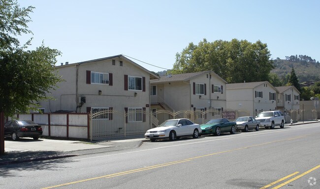
4200 Appian Way, El Sobrante, CA 94803


NEARBY LISTINGS FOR SALE OR LEASE
Property Detail
4200 Appian Way
Oakland-Hayward-Berkeley, CA
Santa Rita Acres 1
425-170-024-3
PORTION LOT70
Apartment
Contra Costa
A
California
06013C0233G
70
2024
0.96 AC
2025
Outer Richmond/Martinez
360200
East Bay/Oakland
8,420 SF
DEMOGRAPHICS near 4200 Appian Way
1 Mile
3 Mile
5 Mile
2024 Total Population
14,890
143,788
259,545
2029 Population
14,775
142,243
256,944
Pop Growth 2024-2029
(0.77%)
(1.07%)
(1.00%)
Average Age
41
40
40
2024 Total Households
5,236
47,716
87,550
HH Growth 2024-2029
(0.84%)
(1.13%)
(1.06%)
Median Household Inc
$98,794
$91,002
$93,120
Avg Household Size
2.70
2.90
2.90
2024 Avg HH Vehicles
2.00
2.00
2.00
Median Home Value
$704,874
$705,704
$736,927
Median Year Built
1965
1964
1966
Nearby Places
Map Layers
Map Styles
 Street
 Aerial
- Restaurants
- Banks
- Shops
- Fitness
- Groceries
PUBLIC TRANSPORTATION
COMMUTER RAIL
Richmond (Capitol Corridor - Capitol Corridor Joint Powers Authority)
DRIVE
WALK
Distance
Richmond (Capitol Corridor - Capitol Corridor Joint Powers Authority)
10 min
5.4 mi
Berkeley (Capitol Corridor - Amtrak)
DRIVE
WALK
Distance
Berkeley (Capitol Corridor - Amtrak)
14 min
9.5 mi
AIRPORT
Metro Oakland International
DRIVE
WALK
Distance
Metro Oakland International
33 min
23.9 mi
San Francisco International
DRIVE
WALK
Distance
San Francisco International
46 min
31.5 mi
Freight Ports
Port of Richmond
DRIVE
WALK
Distance
Port of Richmond
19 min
10.0 mi
Nearby Properties
Address
Land Use
TOTAL SIZE
Lot Size
Zoning
Address
Land Use
TOTAL SIZE
Lot Size
Zoning
892,224 SF
46.87 AC
Address
Land Use
TOTAL SIZE
Lot Size
Zoning
252,714 SF
14.68 AC
C
Address
Land Use
TOTAL SIZE
Lot Size
Zoning
459,003 SF
21.30 AC
Address
Land Use
TOTAL SIZE
Lot Size
Zoning
179,961 SF
1.05 AC
Address
Land Use
TOTAL SIZE
Lot Size
Zoning
247,924 SF
14.36 AC
Address
Land Use
TOTAL SIZE
Lot Size
Zoning
245,680 SF
18.89 AC
Address
Land Use
TOTAL SIZE
Lot Size
Zoning
18,600 SF
9.55 AC
Address
Land Use
TOTAL SIZE
Lot Size
Zoning
190,471 SF
11.32 AC
Address
Land Use
TOTAL SIZE
Lot Size
Zoning
171,052 SF
12.06 AC
M3
Address
Land Use
TOTAL SIZE
Lot Size
Zoning
135,904 SF
7.12 AC
Address
Land Use
TOTAL SIZE
Lot Size
Zoning
191,800 SF
1.09 AC
Address
Land Use
TOTAL SIZE
Lot Size
Zoning
14,722 SF
5.69 AC
Address
Land Use
TOTAL SIZE
Lot Size
Zoning
124,257 SF
2.72 AC
Address
Land Use
TOTAL SIZE
Lot Size
Zoning
41,400 SF
6.32 AC
Address
Land Use
TOTAL SIZE
Lot Size
Zoning
69,949 SF
0.65 AC
C2 CD
Address
Land Use
TOTAL SIZE
Lot Size
Zoning
177,724 SF
63.32 AC
M-2
Address
Land Use
TOTAL SIZE
Lot Size
Zoning
118,658 SF
8.57 AC
Address
Land Use
TOTAL SIZE
Lot Size
Zoning
178,277 SF
58.72 AC
Address
Land Use
TOTAL SIZE
Lot Size
Zoning
61,875 SF
3.62 AC
Address
Land Use
TOTAL SIZE
Lot Size
Zoning
110,765 SF
2.67 AC
Address
Land Use
TOTAL SIZE
Lot Size
Zoning
60,196 SF
13.44 AC
Address
Land Use
TOTAL SIZE
Lot Size
Zoning
136,648 SF
13.27 AC
Address
Land Use
TOTAL SIZE
Lot Size
Zoning
85,225 SF
8.34 AC
Address
Land Use
TOTAL SIZE
Lot Size
Zoning
61,403 SF
8.38 AC
Address
Land Use
TOTAL SIZE
Lot Size
Zoning
97,116 SF
7.26 AC
Address
Land Use
TOTAL SIZE
Lot Size
Zoning
99,468 SF
10.44 AC
Address
Land Use
TOTAL SIZE
Lot Size
Zoning
72,927 SF
3.47 AC
Address
Land Use
TOTAL SIZE
Lot Size
Zoning
6,440 SF
8.14 AC
Address
Land Use
TOTAL SIZE
Lot Size
Zoning
17,660 SF
1.99 AC
Address
Land Use
TOTAL SIZE
Lot Size
Zoning
53,000 SF
3.74 AC
The World's #1 Commercial Real Estate Marketplace
Connect with us
© 2025 CoStar Group
The information above has been obtained from sources believed reliable. While we do not doubt its accuracy we have not verified it and make no guarantee, warranty or representation about it. It is your responsibility to independently confirm its accuracy and completeness. Any projections, opinions, assumptions, or estimates used are for example only and do not represent the current or future performance of the property. The value of this transaction to you depends on tax and other factors which should be evaluated by your tax, financial, and legal advisors. You and your advisors should conduct a careful, independent investigation of the property to determine to your satisfaction the suitability of the property for your needs.