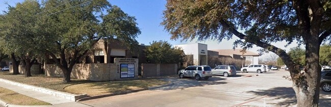
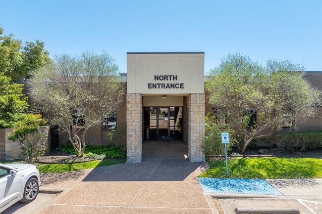
Property Record
4200 Bryant Irvin Rd, Benbrook, TX 76109

Property Detail
4200 Bryant Irvin Rd
Dallas-Fort Worth-Arlington, TX
COUNTRY DAY MEADOWS ADDITION BLOCK 3 LOT 1A
04974662
TARRANT
Commercialnec
Texas
B and X Area of moderate flood hazard, usually the area between the limits of the 100-year and 500-year floods.
1a
2023
1.75 AC
2025
West Southwest Ft Worth
105405
Dallas/Ft Worth
20,378 SF
NEARBY LISTINGS FOR SALE OR LEASE
DEMOGRAPHICS near 4200 Bryant Irvin Rd
1 mile
3 mile
5 mile
2025 Total Population
11,543
103,258
278,186
2030 Population
12,273
108,807
293,835
Pop Growth 2025-2030
+ 6.32%
+ 5.37%
+ 5.63%
Average Age
39
39
38
2025 Total Households
6,485
45,496
113,072
HH Growth 2025-2030
+ 6.45%
+ 5.67%
+ 5.90%
Median Household Inc
$71,959
$72,226
$70,442
Avg Household Size
1.70
2.20
2.40
2025 Avg HH Vehicles
1.00
2.00
2.00
Median Home Value
$690,331
$373,410
$335,694
Median Year Built
1993
1981
1979
Nearby Places
Map Layers
Map Styles
 Street
 Aerial
Layers
 Traffic
 Biking
Places
Listings with unknown addresses are not visible on the map
- Restaurants
- Banks
- Shops
- Fitness
- Groceries
PUBLIC TRANSPORTATION
COMMUTER RAIL
Drive
Walk
Distance
14 min
7.6 mi
Drive
Walk
Distance
14 min
7.6 mi
AIRPORT
Dallas-Fort Worth International
Drive
Walk
Distance
Dallas-Fort Worth International
44 min
32.1 mi
Dallas Love Field
Drive
Walk
Distance
Dallas Love Field
55 min
40.7 mi
SALE & LEASE HISTORY
LISTING DATE
SALE/LEASE

Oct 16, 2023
For Sale
Jun 23, 2022
For Lease
Feb 20, 2024
For Lease
Nearby Properties
Address
Land Use
TOTAL SIZE
Lot Size
Zoning
Address
Land Use
TOTAL SIZE
Lot Size
Zoning
505,069 SF
6.49 AC
Address
Land Use
TOTAL SIZE
Lot Size
Zoning
438,943 SF
3.77 AC
Address
Land Use
TOTAL SIZE
Lot Size
Zoning
477,907 SF
11.83 AC
Address
Land Use
TOTAL SIZE
Lot Size
Zoning
346,920 SF
9.88 AC
Address
Land Use
TOTAL SIZE
Lot Size
Zoning
482,938 SF
22.22 AC
Address
Land Use
TOTAL SIZE
Lot Size
Zoning
323,685 SF
19.61 AC
Address
Land Use
TOTAL SIZE
Lot Size
Zoning
353,842 SF
101.26 AC
Address
Land Use
TOTAL SIZE
Lot Size
Zoning
401,767 SF
20.68 AC
Address
Land Use
TOTAL SIZE
Lot Size
Zoning
348,025 SF
26.33 AC
Address
Land Use
TOTAL SIZE
Lot Size
Zoning
382,376 SF
21.61 AC
Address
Land Use
TOTAL SIZE
Lot Size
Zoning
492,130 SF
6.55 AC
Address
Land Use
TOTAL SIZE
Lot Size
Zoning
373,138 SF
15 AC
Address
Land Use
TOTAL SIZE
Lot Size
Zoning
446,116 SF
12.50 AC
Address
Land Use
TOTAL SIZE
Lot Size
Zoning
344,054 SF
21.30 AC
Address
Land Use
TOTAL SIZE
Lot Size
Zoning
355,125 SF
21.29 AC
Address
Land Use
TOTAL SIZE
Lot Size
Zoning
388,957 SF
20 AC
Address
Land Use
TOTAL SIZE
Lot Size
Zoning
350,654 SF
21.29 AC
Address
Land Use
TOTAL SIZE
Lot Size
Zoning
296,664 SF
14.71 AC
Address
Land Use
TOTAL SIZE
Lot Size
Zoning
347,423 SF
7.32 AC
Address
Land Use
TOTAL SIZE
Lot Size
Zoning
294,193 SF
59.09 AC
Address
Land Use
TOTAL SIZE
Lot Size
Zoning
100,000 SF
1.60 AC
Address
Land Use
TOTAL SIZE
Lot Size
Zoning
310,935 SF
14.74 AC
Address
Land Use
TOTAL SIZE
Lot Size
Zoning
312,709 SF
16.26 AC
Address
Land Use
TOTAL SIZE
Lot Size
Zoning
292,450 SF
8.17 AC
Address
Land Use
TOTAL SIZE
Lot Size
Zoning
297,813 SF
13.81 AC
Address
Land Use
TOTAL SIZE
Lot Size
Zoning
267,098 SF
14.06 AC
Address
Land Use
TOTAL SIZE
Lot Size
Zoning
166,474 SF
12.60 AC
Address
Land Use
TOTAL SIZE
Lot Size
Zoning
362,698 SF
4.59 AC
Address
Land Use
TOTAL SIZE
Lot Size
Zoning
209,329 SF
90.74 AC
Address
Land Use
TOTAL SIZE
Lot Size
Zoning
300,006 SF
15 AC
The World's #1 Commercial Real Estate Marketplace
Connect with us
© 2026 CoStar Group
The information above has been obtained from sources believed reliable. While we do not doubt its accuracy we have not verified it and make no guarantee, warranty or representation about it. It is your responsibility to independently confirm its accuracy and completeness. Any projections, opinions, assumptions, or estimates used are for example only and do not represent the current or future performance of the property. The value of this transaction to you depends on tax and other factors which should be evaluated by your tax, financial, and legal advisors. You and your advisors should conduct a careful, independent investigation of the property to determine to your satisfaction the suitability of the property for your needs.