Property Record
4200 E Kiehl Ave, Sherwood, AR 72120


NEARBY LISTINGS FOR SALE OR LEASE
Property Detail
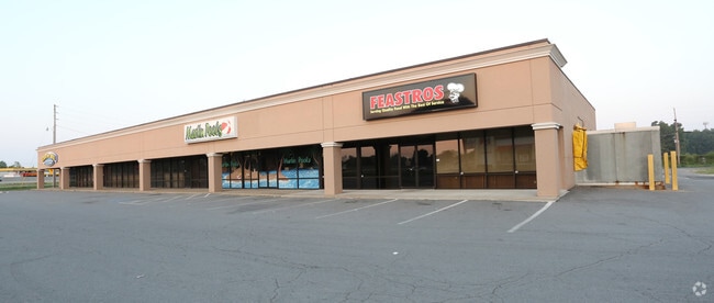
4200 E Kiehl Ave
Little Rock-North Little Rock-Conway, AR
Indianhead Center Addn
23S-003-15-001-00
LT 1 LESS & EXC COM NW COR NE SE S00*W30 E320.58 S17*E604.87 TO PT ON NLY R/W LN WARDEN RD & POB S62*W189.14 N315.54 E135 S08*E230 TO POB
Regionalshoppingcenterormallwithanchorstore
Pulaski
X
Arkansas
05119C0358G
1
2025
6.25 AC
2025
Outlying Pulaski County
003704
Little Rock/N Little Rock
23,100 SF
DEMOGRAPHICS near 4200 E Kiehl Ave
1 Mile
3 Mile
5 Mile
2024 Total Population
5,428
32,960
76,986
2029 Population
5,420
32,813
76,747
Pop Growth 2024-2029
(0.15%)
(0.45%)
(0.31%)
Average Age
38
40
40
2024 Total Households
2,332
13,791
32,366
HH Growth 2024-2029
(0.17%)
(0.52%)
(0.30%)
Median Household Inc
$50,635
$66,078
$58,441
Avg Household Size
2.30
2.30
2.30
2024 Avg HH Vehicles
2.00
2.00
2.00
Median Home Value
$182,003
$178,662
$174,572
Median Year Built
1985
1985
1980
Nearby Places
Map Layers
Map Styles
 Street
 Aerial
- Restaurants
- Banks
- Shops
- Fitness
- Groceries
PUBLIC TRANSPORTATION
COMMUTER RAIL
Little Rock Union Station (Texas Eagle - Amtrak)
DRIVE
WALK
Distance
Little Rock Union Station (Texas Eagle - Amtrak)
13 min
9.4 mi
AIRPORT
Bill and Hillary Clinton Ntl/Adams Field
DRIVE
WALK
Distance
Bill and Hillary Clinton Ntl/Adams Field
18 min
13.0 mi
Freight Ports
Port of Shreveport
DRIVE
WALK
Distance
Port of Shreveport
260 min
241.9 mi
Nearby Properties
Address
Land Use
TOTAL SIZE
Lot Size
Zoning
Address
Land Use
TOTAL SIZE
Lot Size
Zoning
82,978 SF
12.54 AC
Address
Land Use
TOTAL SIZE
Lot Size
Zoning
72,806 SF
10.95 AC
Address
Land Use
TOTAL SIZE
Lot Size
Zoning
17,352 SF
42.55 AC
Address
Land Use
TOTAL SIZE
Lot Size
Zoning
38,202 SF
14.23 AC
Address
Land Use
TOTAL SIZE
Lot Size
Zoning
36,934 SF
15.06 AC
Address
Land Use
TOTAL SIZE
Lot Size
Zoning
75,462 SF
5.33 AC
Address
Land Use
TOTAL SIZE
Lot Size
Zoning
72,157 SF
9.45 AC
Address
Land Use
TOTAL SIZE
Lot Size
Zoning
31,644 SF
Address
Land Use
TOTAL SIZE
Lot Size
Zoning
56,643 SF
9.46 AC
Address
Land Use
TOTAL SIZE
Lot Size
Zoning
62,316 SF
6.23 AC
Address
Land Use
TOTAL SIZE
Lot Size
Zoning
28,947 SF
8.29 AC
Address
Land Use
TOTAL SIZE
Lot Size
Zoning
60,539 SF
2.95 AC
Address
Land Use
TOTAL SIZE
Lot Size
Zoning
45,500 SF
12.07 AC
Address
Land Use
TOTAL SIZE
Lot Size
Zoning
100,163 SF
15.51 AC
Address
Land Use
TOTAL SIZE
Lot Size
Zoning
111,425 SF
1.69 AC
Address
Land Use
TOTAL SIZE
Lot Size
Zoning
145,604 SF
12.62 AC
Address
Land Use
TOTAL SIZE
Lot Size
Zoning
32,788 SF
3.99 AC
Address
Land Use
TOTAL SIZE
Lot Size
Zoning
33,597 SF
Address
Land Use
TOTAL SIZE
Lot Size
Zoning
141,664 SF
12.21 AC
Address
Land Use
TOTAL SIZE
Lot Size
Zoning
44,092 SF
7.97 AC
Address
Land Use
TOTAL SIZE
Lot Size
Zoning
54,401 SF
1.68 AC
Address
Land Use
TOTAL SIZE
Lot Size
Zoning
40,065 SF
8.26 AC
Address
Land Use
TOTAL SIZE
Lot Size
Zoning
26,334 SF
4.51 AC
Address
Land Use
TOTAL SIZE
Lot Size
Zoning
75,064 SF
5.78 AC
Address
Land Use
TOTAL SIZE
Lot Size
Zoning
35,645 SF
7.97 AC
Address
Land Use
TOTAL SIZE
Lot Size
Zoning
9,222 SF
6.58 AC
Address
Land Use
TOTAL SIZE
Lot Size
Zoning
17,622 SF
7.88 AC
Address
Land Use
TOTAL SIZE
Lot Size
Zoning
15,165 SF
4.70 AC
Address
Land Use
TOTAL SIZE
Lot Size
Zoning
89,724 SF
7.60 AC
Address
Land Use
TOTAL SIZE
Lot Size
Zoning
19,514 SF
54.85 AC
The World's #1 Commercial Real Estate Marketplace
Connect with us
© 2026 CoStar Group
The information above has been obtained from sources believed reliable. While we do not doubt its accuracy we have not verified it and make no guarantee, warranty or representation about it. It is your responsibility to independently confirm its accuracy and completeness. Any projections, opinions, assumptions, or estimates used are for example only and do not represent the current or future performance of the property. The value of this transaction to you depends on tax and other factors which should be evaluated by your tax, financial, and legal advisors. You and your advisors should conduct a careful, independent investigation of the property to determine to your satisfaction the suitability of the property for your needs.