Property Record
4200 E Mcdowell Rd, Mesa, AZ 85215

Property Detail
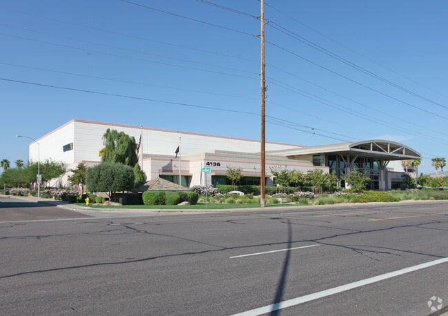
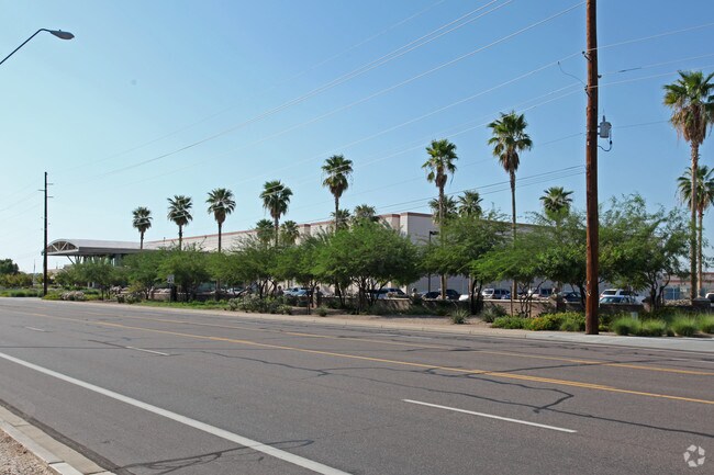
4200 E Mcdowell Rd
141-25-103A
COMMONS INDUSTRIAL PARK AT FALCON VIEW UNIT 3 MCR 477-38
Warehouse
MARICOPA
I-1
Arizona
C and X Area of minimal flood hazard, usually depicted on FIRMs as above the 500-year flood level.
1
2025
6.58 AC
2025
Falcon Fld/Apache Jct
420206
Phoenix
96,839 SF
Phoenix-Mesa-Chandler, AZ
NEARBY LISTINGS FOR SALE OR LEASE
DEMOGRAPHICS near 4200 E Mcdowell Rd
1 mile
3 mile
5 mile
2024 Total Population
1,442
54,926
187,500
2029 Population
1,501
57,082
195,318
Pop Growth 2024-2029
+ 4.09%
+ 3.93%
+ 4.17%
Average Age
42
42
44
2024 Total Households
428
20,341
74,893
HH Growth 2024-2029
+ 3.97%
+ 4.31%
+ 4.64%
Median Household Inc
$185,647
$107,635
$81,317
Avg Household Size
3.20
2.60
2.40
2024 Avg HH Vehicles
3.00
2.00
2.00
Median Home Value
$957,649
$504,757
$416,499
Median Year Built
1994
1990
1986
Nearby Places
Map Layers
Map Styles
 Street
 Aerial
Transit
 Traffic
 Biking
Places
Listings with unknown addresses are not visible on the map
- Restaurants
- Banks
- Shops
- Fitness
- Groceries
PUBLIC TRANSPORTATION
AIRPORT
Phoenix-Mesa Gateway
Drive
Walk
Distance
Phoenix-Mesa Gateway
27 min
15.5 mi
Phoenix Sky Harbor International
Drive
Walk
Distance
Phoenix Sky Harbor International
25 min
16.5 mi
Freight Ports
Port of San Diego
Drive
Walk
Distance
Port of San Diego
421 min
375.8 mi
Nearby Properties
Address
Land Use
TOTAL SIZE
Lot Size
Zoning
Address
Land Use
TOTAL SIZE
Lot Size
Zoning
181.80 AC
Address
Land Use
TOTAL SIZE
Lot Size
Zoning
125,356 SF
21.63 AC
R-9
Address
Land Use
TOTAL SIZE
Lot Size
Zoning
1,691,248 SF
528.80 AC
I-1
Address
Land Use
TOTAL SIZE
Lot Size
Zoning
29.74 AC
Address
Land Use
TOTAL SIZE
Lot Size
Zoning
22.19 AC
Address
Land Use
TOTAL SIZE
Lot Size
Zoning
1,217,466 SF
102.41 AC
I-1
Address
Land Use
TOTAL SIZE
Lot Size
Zoning
11,722 SF
182.53 AC
PS
Address
Land Use
TOTAL SIZE
Lot Size
Zoning
400,798 SF
55.94 AC
PF
Address
Land Use
TOTAL SIZE
Lot Size
Zoning
22.71 AC
Address
Land Use
TOTAL SIZE
Lot Size
Zoning
20.08 AC
Address
Land Use
TOTAL SIZE
Lot Size
Zoning
161,388 SF
32.52 AC
R-35
Address
Land Use
TOTAL SIZE
Lot Size
Zoning
279,338 SF
39.90 AC
PF
Address
Land Use
TOTAL SIZE
Lot Size
Zoning
66,350 SF
22.32 AC
I-1
Address
Land Use
TOTAL SIZE
Lot Size
Zoning
158,514 SF
21.39 AC
Address
Land Use
TOTAL SIZE
Lot Size
Zoning
8.82 AC
Address
Land Use
TOTAL SIZE
Lot Size
Zoning
359,204 SF
40.94 AC
LI
Address
Land Use
TOTAL SIZE
Lot Size
Zoning
7.90 AC
Address
Land Use
TOTAL SIZE
Lot Size
Zoning
4.79 AC
Address
Land Use
TOTAL SIZE
Lot Size
Zoning
7.26 AC
Address
Land Use
TOTAL SIZE
Lot Size
Zoning
225,233 SF
21.66 AC
C-G
Address
Land Use
TOTAL SIZE
Lot Size
Zoning
125,534 SF
19.59 AC
I-2
Address
Land Use
TOTAL SIZE
Lot Size
Zoning
81,000 SF
15.70 AC
AG
Address
Land Use
TOTAL SIZE
Lot Size
Zoning
146,107 SF
10.12 AC
LI
Address
Land Use
TOTAL SIZE
Lot Size
Zoning
157,048 SF
10.75 AC
Address
Land Use
TOTAL SIZE
Lot Size
Zoning
6.56 AC
Address
Land Use
TOTAL SIZE
Lot Size
Zoning
113,207 SF
6.87 AC
C-G
Address
Land Use
TOTAL SIZE
Lot Size
Zoning
157,592 SF
6.31 AC
C-G
Address
Land Use
TOTAL SIZE
Lot Size
Zoning
209,538 SF
13.47 AC
M-M
Address
Land Use
TOTAL SIZE
Lot Size
Zoning
168,861 SF
66.90 AC
R-90
Address
Land Use
TOTAL SIZE
Lot Size
Zoning
304.07 AC
GI
The World's #1 Commercial Real Estate Marketplace
Connect with us
© 2026 CoStar Group
The information above has been obtained from sources believed reliable. While we do not doubt its accuracy we have not verified it and make no guarantee, warranty or representation about it. It is your responsibility to independently confirm its accuracy and completeness. Any projections, opinions, assumptions, or estimates used are for example only and do not represent the current or future performance of the property. The value of this transaction to you depends on tax and other factors which should be evaluated by your tax, financial, and legal advisors. You and your advisors should conduct a careful, independent investigation of the property to determine to your satisfaction the suitability of the property for your needs.