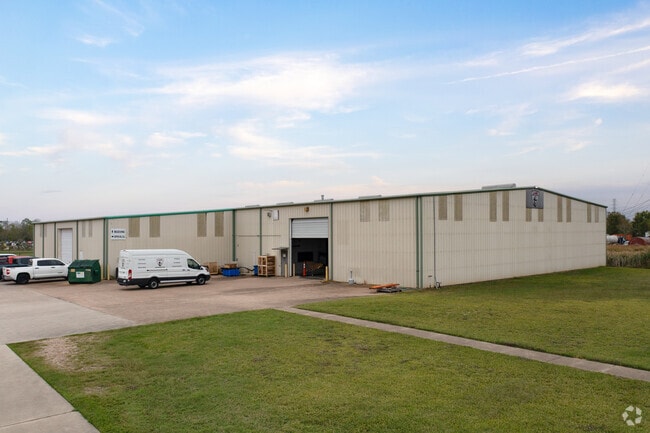
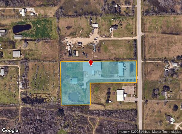
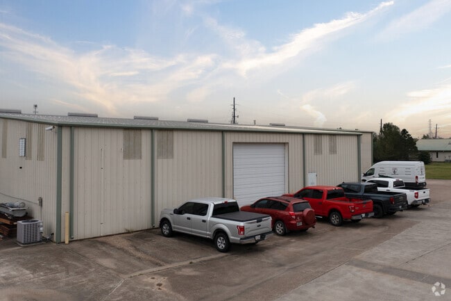
Property Record
4200 Manvel Rd, Pearland, TX 77584
NEARBY LISTINGS FOR SALE OR LEASE
Property Detail
4200 Manvel Rd
0290-0020-105
H T & B R R
Commercialnec
A0290 H T & B R R TRACT 56 ACRES 6.67
X
Brazoria
48039C0040K
Texas
2024
6.67 AC
2025
South Hwy 35
660704
Houston
34,250 SF
Houston-The Woodlands-Sugar Land, TX
DEMOGRAPHICS near 4200 Manvel Rd
1 Mile
3 Mile
5 Mile
2024 Total Population
1,342
40,940
118,576
2029 Population
1,485
45,290
131,607
Pop Growth 2024-2029
+ 10.66%
+ 10.63%
+ 10.99%
Average Age
37
36
37
2024 Total Households
431
13,290
40,092
HH Growth 2024-2029
+ 10.67%
+ 10.83%
+ 11.08%
Median Household Inc
$86,111
$112,634
$102,956
Avg Household Size
3.10
3.00
2.90
2024 Avg HH Vehicles
2.00
2.00
2.00
Median Home Value
$348,561
$303,703
$306,517
Median Year Built
2003
2000
2001
Nearby Places
Map Layers
Map Styles
 Street
 Aerial
- Restaurants
- Banks
- Shops
- Fitness
- Groceries
PUBLIC TRANSPORTATION
AIRPORT
William P Hobby
DRIVE
WALK
Distance
William P Hobby
23 min
11.4 mi
Freight Ports
Port of Houston
DRIVE
WALK
Distance
Port of Houston
34 min
19.6 mi
SALE & LEASE HISTORY
LISTING DATE
SALE/LEASE

Mar 15, 2022
For Sale
Nearby Properties
Address
Land Use
TOTAL SIZE
Lot Size
Zoning
Address
Land Use
TOTAL SIZE
Lot Size
Zoning
64.56 AC
0016
Address
Land Use
TOTAL SIZE
Lot Size
Zoning
379,071 SF
20.02 AC
Address
Land Use
TOTAL SIZE
Lot Size
Zoning
7.42 AC
Address
Land Use
TOTAL SIZE
Lot Size
Zoning
334,628 SF
13.87 AC
Address
Land Use
TOTAL SIZE
Lot Size
Zoning
252,472 SF
13.28 AC
Address
Land Use
TOTAL SIZE
Lot Size
Zoning
79.45 AC
1000
Address
Land Use
TOTAL SIZE
Lot Size
Zoning
221,401 SF
11 AC
Address
Land Use
TOTAL SIZE
Lot Size
Zoning
344,782 SF
14.14 AC
Address
Land Use
TOTAL SIZE
Lot Size
Zoning
81,170 SF
50 AC
Address
Land Use
TOTAL SIZE
Lot Size
Zoning
70,964 SF
6.51 AC
Address
Land Use
TOTAL SIZE
Lot Size
Zoning
106,341 SF
12.12 AC
0550
Address
Land Use
TOTAL SIZE
Lot Size
Zoning
19.61 AC
Address
Land Use
TOTAL SIZE
Lot Size
Zoning
122,473 SF
2.30 AC
Address
Land Use
TOTAL SIZE
Lot Size
Zoning
66,399 SF
6.10 AC
Address
Land Use
TOTAL SIZE
Lot Size
Zoning
64,290 SF
3.14 AC
Address
Land Use
TOTAL SIZE
Lot Size
Zoning
46,732 SF
8.64 AC
0752
Address
Land Use
TOTAL SIZE
Lot Size
Zoning
28,143 SF
13.08 AC
Address
Land Use
TOTAL SIZE
Lot Size
Zoning
3,159 SF
64.95 AC
0227
Address
Land Use
TOTAL SIZE
Lot Size
Zoning
120,583 SF
9.07 AC
0050
Address
Land Use
TOTAL SIZE
Lot Size
Zoning
46,328 SF
2.76 AC
Address
Land Use
TOTAL SIZE
Lot Size
Zoning
47,820 SF
2.83 AC
Address
Land Use
TOTAL SIZE
Lot Size
Zoning
67,130 SF
17.70 AC
0151
Address
Land Use
TOTAL SIZE
Lot Size
Zoning
9.72 AC
Address
Land Use
TOTAL SIZE
Lot Size
Zoning
84,254 SF
5.45 AC
Address
Land Use
TOTAL SIZE
Lot Size
Zoning
27,935 SF
4.01 AC
0051
Address
Land Use
TOTAL SIZE
Lot Size
Zoning
105,330 SF
4.55 AC
Address
Land Use
TOTAL SIZE
Lot Size
Zoning
41,656 SF
5.44 AC
Address
Land Use
TOTAL SIZE
Lot Size
Zoning
32,596 SF
22.44 AC
1010
Address
Land Use
TOTAL SIZE
Lot Size
Zoning
4,290 SF
38.48 AC
Address
Land Use
TOTAL SIZE
Lot Size
Zoning
25,862 SF
1.35 AC
The World's #1 Commercial Real Estate Marketplace
Connect with us
© 2025 CoStar Group
The information above has been obtained from sources believed reliable. While we do not doubt its accuracy we have not verified it and make no guarantee, warranty or representation about it. It is your responsibility to independently confirm its accuracy and completeness. Any projections, opinions, assumptions, or estimates used are for example only and do not represent the current or future performance of the property. The value of this transaction to you depends on tax and other factors which should be evaluated by your tax, financial, and legal advisors. You and your advisors should conduct a careful, independent investigation of the property to determine to your satisfaction the suitability of the property for your needs.