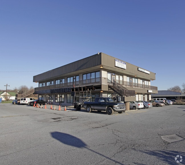
Property Record
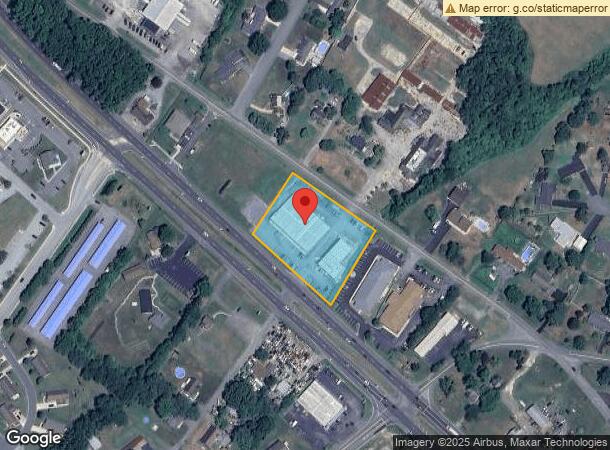
4200 N Dupont Hwy, Dover, DE 19901
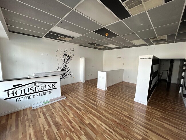
Current Lease Availabilities
NEARBY LISTINGS FOR SALE OR LEASE
Property Detail
4200 N Dupont Hwy
4-00-04703-01-3803-000
PAR 3 - E SD RT 13 1.7437 A 4200 N DUPONT HWY
Commercialnec
Kent
X
Delaware
10001C0154H
1.70 AC
2024
Kent County
2025
Philadelphia
040501
Dover, DE
15,000 SF
DEMOGRAPHICS near 4200 N Dupont Hwy
1 Mile
3 Mile
5 Mile
2024 Total Population
3,424
23,006
66,538
2029 Population
3,711
24,867
71,945
Pop Growth 2024-2029
+ 8.38%
+ 8.09%
+ 8.13%
Average Age
44
40
40
2024 Total Households
1,329
8,074
25,203
HH Growth 2024-2029
+ 8.65%
+ 8.50%
+ 8.36%
Median Household Inc
$64,125
$65,090
$62,241
Avg Household Size
2.50
2.50
2.50
2024 Avg HH Vehicles
2.00
2.00
2.00
Median Home Value
$254,266
$259,548
$258,737
Median Year Built
1998
1995
1994
Nearby Places
- Restaurants
- Banks
- Shops
- Fitness
- Groceries
Nearby Properties
Address
Land Use
TOTAL SIZE
Lot Size
Zoning
Address
Land Use
TOTAL SIZE
Lot Size
Zoning
231,470 SF
213.60 AC
IO
Address
Land Use
TOTAL SIZE
Lot Size
Zoning
247,145 SF
43.71 AC
CPO
Address
Land Use
TOTAL SIZE
Lot Size
Zoning
1,120 SF
181.50 AC
RC
Address
Land Use
TOTAL SIZE
Lot Size
Zoning
81,711 SF
93.70 AC
IO
Address
Land Use
TOTAL SIZE
Lot Size
Zoning
105,846 SF
15.79 AC
SC2
Address
Land Use
TOTAL SIZE
Lot Size
Zoning
379,358 SF
67.30 AC
SC3
Address
Land Use
TOTAL SIZE
Lot Size
Zoning
55,456 SF
43.90 AC
IO
Address
Land Use
TOTAL SIZE
Lot Size
Zoning
44,560 SF
8.10 AC
IO
Address
Land Use
TOTAL SIZE
Lot Size
Zoning
210,400 SF
30 AC
IPM
Address
Land Use
TOTAL SIZE
Lot Size
Zoning
97,248 SF
9 AC
RG2
Address
Land Use
TOTAL SIZE
Lot Size
Zoning
69,228 SF
16.90 AC
RG5
Address
Land Use
TOTAL SIZE
Lot Size
Zoning
98,669 SF
12.40 AC
C4
Address
Land Use
TOTAL SIZE
Lot Size
Zoning
1,292 SF
65.25 AC
RMH
Address
Land Use
TOTAL SIZE
Lot Size
Zoning
56.90 AC
IO
Address
Land Use
TOTAL SIZE
Lot Size
Zoning
14,214 SF
319.30 AC
MULTI
Address
Land Use
TOTAL SIZE
Lot Size
Zoning
199,272 SF
8.50 AC
RG1
Address
Land Use
TOTAL SIZE
Lot Size
Zoning
94,576 SF
10.74 AC
SC2
Address
Land Use
TOTAL SIZE
Lot Size
Zoning
137,247 SF
17 AC
C4
Address
Land Use
TOTAL SIZE
Lot Size
Zoning
132,449 SF
6 AC
RC
Address
Land Use
TOTAL SIZE
Lot Size
Zoning
112,320 SF
15.60 AC
RG2
Address
Land Use
TOTAL SIZE
Lot Size
Zoning
184,072 SF
22 AC
BG
Address
Land Use
TOTAL SIZE
Lot Size
Zoning
42,940 SF
7.85 AC
RM2
Address
Land Use
TOTAL SIZE
Lot Size
Zoning
136,933 SF
20.40 AC
C4
Address
Land Use
TOTAL SIZE
Lot Size
Zoning
47,245 SF
4.92 AC
C4
Address
Land Use
TOTAL SIZE
Lot Size
Zoning
76.70 AC
NA
Address
Land Use
TOTAL SIZE
Lot Size
Zoning
73,810 SF
17.90 AC
MULTI
Address
Land Use
TOTAL SIZE
Lot Size
Zoning
11,104 SF
7.56 AC
RG3
Address
Land Use
TOTAL SIZE
Lot Size
Zoning
274,907 SF
14.61 AC
IPM
Address
Land Use
TOTAL SIZE
Lot Size
Zoning
87,042 SF
17.30 AC
M
Address
Land Use
TOTAL SIZE
Lot Size
Zoning
63,145 SF
5.90 AC
C4
The World's #1 Commercial Real Estate Marketplace
Connect with us
© 2025 CoStar Group
The information above has been obtained from sources believed reliable. While we do not doubt its accuracy we have not verified it and make no guarantee, warranty or representation about it. It is your responsibility to independently confirm its accuracy and completeness. Any projections, opinions, assumptions, or estimates used are for example only and do not represent the current or future performance of the property. The value of this transaction to you depends on tax and other factors which should be evaluated by your tax, financial, and legal advisors. You and your advisors should conduct a careful, independent investigation of the property to determine to your satisfaction the suitability of the property for your needs.