Property Record
4200 N Highway 19 41, Hampton, GA 30228
NEARBY LISTINGS FOR SALE OR LEASE
Property Detail
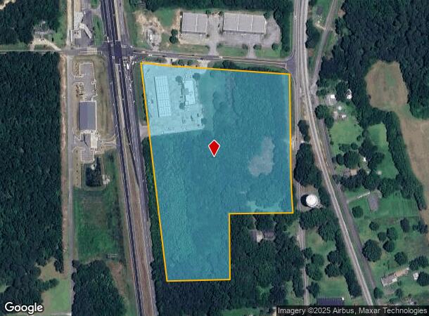
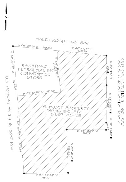
4200 N Highway 19 41
241-03-002-C
TR B 11.392 AC PB 24/279
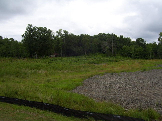
Conveniencestore
Spalding
X
Georgia
13255C0060E
108
2024
11.39 AC
2024
Spalding County
160402
Atlanta
5,518 SF
Atlanta-Sandy Springs-Roswell, GA
DEMOGRAPHICS near 4200 N Highway 19 41
1 Mile
3 Mile
5 Mile
2024 Total Population
1,722
11,083
34,968
2029 Population
1,836
11,950
37,621
Pop Growth 2024-2029
+ 6.62%
+ 7.82%
+ 7.59%
Average Age
37
38
40
2024 Total Households
594
3,775
12,639
HH Growth 2024-2029
+ 6.40%
+ 7.68%
+ 7.45%
Median Household Inc
$58,395
$61,559
$64,635
Avg Household Size
2.90
2.90
2.70
2024 Avg HH Vehicles
2.00
2.00
2.00
Median Home Value
$166,901
$184,026
$192,013
Median Year Built
1992
1994
1997
Nearby Places
Map Layers
Map Styles
 Street
 Aerial
- Restaurants
- Banks
- Shops
- Fitness
- Groceries
PUBLIC TRANSPORTATION
AIRPORT
Hartsfield - Jackson Atlanta International
DRIVE
WALK
Distance
Hartsfield - Jackson Atlanta International
38 min
23.9 mi
SALE & LEASE HISTORY
LISTING DATE
SALE/LEASE

Sep 24, 2016
For Sale
Nearby Properties
Address
Land Use
TOTAL SIZE
Lot Size
Zoning
Address
Land Use
TOTAL SIZE
Lot Size
Zoning
1,424,654 SF
172.86 AC
Address
Land Use
TOTAL SIZE
Lot Size
Zoning
640,693 SF
691.83 AC
PD
Address
Land Use
TOTAL SIZE
Lot Size
Zoning
11,520 SF
8.77 AC
C-1B
Address
Land Use
TOTAL SIZE
Lot Size
Zoning
11,312 SF
560 AC
RA
Address
Land Use
TOTAL SIZE
Lot Size
Zoning
20 AC
AR-1
Address
Land Use
TOTAL SIZE
Lot Size
Zoning
41,568 SF
29.31 AC
M2
Address
Land Use
TOTAL SIZE
Lot Size
Zoning
1,404 SF
62.12 AC
RMH
Address
Land Use
TOTAL SIZE
Lot Size
Zoning
21,542 SF
7.53 AC
C-1B
Address
Land Use
TOTAL SIZE
Lot Size
Zoning
2,160 SF
6.90 AC
C-1B
Address
Land Use
TOTAL SIZE
Lot Size
Zoning
594 SF
4.08 AC
C-1B
Address
Land Use
TOTAL SIZE
Lot Size
Zoning
39,681 SF
6.19 AC
C2
Address
Land Use
TOTAL SIZE
Lot Size
Zoning
341.53 AC
RA
Address
Land Use
TOTAL SIZE
Lot Size
Zoning
19,500 SF
3.09 AC
C
Address
Land Use
TOTAL SIZE
Lot Size
Zoning
9,020 SF
3.30 AC
C1
Address
Land Use
TOTAL SIZE
Lot Size
Zoning
6,880 SF
7.89 AC
M2
Address
Land Use
TOTAL SIZE
Lot Size
Zoning
40,411 SF
47.18 AC
C1
Address
Land Use
TOTAL SIZE
Lot Size
Zoning
16,800 SF
2.01 AC
C-1B
Address
Land Use
TOTAL SIZE
Lot Size
Zoning
30.24 AC
M1
Address
Land Use
TOTAL SIZE
Lot Size
Zoning
40,536 SF
6 AC
Address
Land Use
TOTAL SIZE
Lot Size
Zoning
10,200 SF
8.35 AC
Address
Land Use
TOTAL SIZE
Lot Size
Zoning
308.50 AC
Address
Land Use
TOTAL SIZE
Lot Size
Zoning
23,233 SF
5 AC
Address
Land Use
TOTAL SIZE
Lot Size
Zoning
16,080 SF
2.91 AC
C2
Address
Land Use
TOTAL SIZE
Lot Size
Zoning
19,026 SF
4.75 AC
RA
Address
Land Use
TOTAL SIZE
Lot Size
Zoning
73,390 SF
6.35 AC
M2
The World's #1 Commercial Real Estate Marketplace
Connect with us
© 2025 CoStar Group
The information above has been obtained from sources believed reliable. While we do not doubt its accuracy we have not verified it and make no guarantee, warranty or representation about it. It is your responsibility to independently confirm its accuracy and completeness. Any projections, opinions, assumptions, or estimates used are for example only and do not represent the current or future performance of the property. The value of this transaction to you depends on tax and other factors which should be evaluated by your tax, financial, and legal advisors. You and your advisors should conduct a careful, independent investigation of the property to determine to your satisfaction the suitability of the property for your needs.