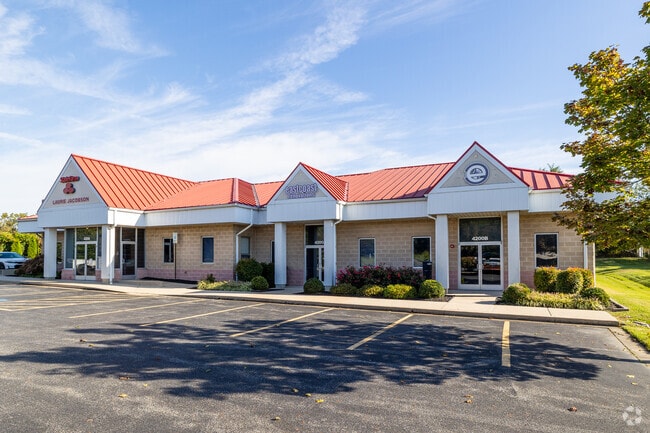
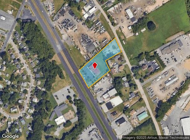
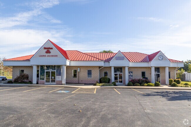
Property Record
4129 N Point Rd, Dundalk, MD 21222
Current Lease Availabilities
NEARBY LISTINGS FOR SALE OR LEASE
Property Detail
4129 N Point Rd
15-1516600390
1.70 AC NES
Officebuilding
Baltimore
X
Maryland
2400100440H
112
2024
1.70 AC
2025
Baltimore County East
420200
Baltimore
6,302 SF
Baltimore-Columbia-Towson, MD
DEMOGRAPHICS near 4129 N Point Rd
1 Mile
3 Mile
5 Mile
2024 Total Population
6,295
71,698
143,461
2029 Population
6,218
70,895
141,173
Pop Growth 2024-2029
(1.22%)
(1.12%)
(1.59%)
Average Age
40
39
40
2024 Total Households
2,275
27,413
54,692
HH Growth 2024-2029
(1.41%)
(1.21%)
(1.66%)
Median Household Inc
$67,135
$58,316
$60,289
Avg Household Size
2.70
2.60
2.60
2024 Avg HH Vehicles
2.00
2.00
2.00
Median Home Value
$227,532
$198,594
$201,615
Median Year Built
1956
1956
1956
Nearby Places
Map Layers
Map Styles
 Street
 Aerial
- Restaurants
- Banks
- Shops
- Fitness
- Groceries
PUBLIC TRANSPORTATION
COMMUTER RAIL
Penn Station (Penn Line - Maryland Area Regional Commuter Trains (The MARC))
DRIVE
WALK
Distance
Penn Station (Penn Line - Maryland Area Regional Commuter Trains (The MARC))
22 min
9.9 mi
AIRPORT
Baltimore/Washington International Thurgood Marshall
DRIVE
WALK
Distance
Baltimore/Washington International Thurgood Marshall
31 min
19.2 mi
Freight Ports
Port of Baltimore
DRIVE
WALK
Distance
Port of Baltimore
21 min
12.4 mi
Nearby Properties
Address
Land Use
TOTAL SIZE
Lot Size
Zoning
Address
Land Use
TOTAL SIZE
Lot Size
Zoning
979,200 SF
49.24 AC
Address
Land Use
TOTAL SIZE
Lot Size
Zoning
859,500 SF
64.32 AC
MH-IM
Address
Land Use
TOTAL SIZE
Lot Size
Zoning
1,282,700 SF
66.23 AC
Address
Land Use
TOTAL SIZE
Lot Size
Zoning
347,000 SF
42.73 AC
DR
Address
Land Use
TOTAL SIZE
Lot Size
Zoning
519,489 SF
45.05 AC
Address
Land Use
TOTAL SIZE
Lot Size
Zoning
603,980 SF
30.68 AC
Address
Land Use
TOTAL SIZE
Lot Size
Zoning
291,062 SF
47.39 AC
Address
Land Use
TOTAL SIZE
Lot Size
Zoning
Address
Land Use
TOTAL SIZE
Lot Size
Zoning
735,681 SF
44.98 AC
Address
Land Use
TOTAL SIZE
Lot Size
Zoning
449,920 SF
26.42 AC
Address
Land Use
TOTAL SIZE
Lot Size
Zoning
278,006 SF
49.85 AC
DR
Address
Land Use
TOTAL SIZE
Lot Size
Zoning
401,280 SF
25.38 AC
Address
Land Use
TOTAL SIZE
Lot Size
Zoning
33.65 AC
DR16
Address
Land Use
TOTAL SIZE
Lot Size
Zoning
399,600 SF
21.59 AC
Address
Land Use
TOTAL SIZE
Lot Size
Zoning
135,548 SF
13 AC
DR5.5
Address
Land Use
TOTAL SIZE
Lot Size
Zoning
213,997 SF
45.22 AC
DR
Address
Land Use
TOTAL SIZE
Lot Size
Zoning
13.72 AC
DR16
Address
Land Use
TOTAL SIZE
Lot Size
Zoning
104,410 SF
3.85 AC
DR
Address
Land Use
TOTAL SIZE
Lot Size
Zoning
12.11 AC
DR16
Address
Land Use
TOTAL SIZE
Lot Size
Zoning
24,300 SF
1.62 AC
MHIM
Address
Land Use
TOTAL SIZE
Lot Size
Zoning
197,823 SF
34.32 AC
DR5.5
Address
Land Use
TOTAL SIZE
Lot Size
Zoning
23.40 AC
DR16
Address
Land Use
TOTAL SIZE
Lot Size
Zoning
3,099 SF
16.10 AC
BM
Address
Land Use
TOTAL SIZE
Lot Size
Zoning
189,347 SF
28.24 AC
DR10
Address
Land Use
TOTAL SIZE
Lot Size
Zoning
24.95 AC
DR16
Address
Land Use
TOTAL SIZE
Lot Size
Zoning
126,096 SF
14.68 AC
DR105
Address
Land Use
TOTAL SIZE
Lot Size
Zoning
10.27 AC
DR16
Address
Land Use
TOTAL SIZE
Lot Size
Zoning
10.48 AC
DR16
Address
Land Use
TOTAL SIZE
Lot Size
Zoning
463,050 SF
24.27 AC
ML
Address
Land Use
TOTAL SIZE
Lot Size
Zoning
12.25 AC
DR16
The World's #1 Commercial Real Estate Marketplace
Connect with us
© 2025 CoStar Group
The information above has been obtained from sources believed reliable. While we do not doubt its accuracy we have not verified it and make no guarantee, warranty or representation about it. It is your responsibility to independently confirm its accuracy and completeness. Any projections, opinions, assumptions, or estimates used are for example only and do not represent the current or future performance of the property. The value of this transaction to you depends on tax and other factors which should be evaluated by your tax, financial, and legal advisors. You and your advisors should conduct a careful, independent investigation of the property to determine to your satisfaction the suitability of the property for your needs.