Property Record
4200 Salem Rd, Covington, GA 30016
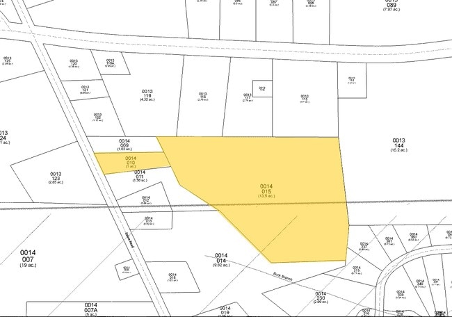

Property Detail
4200 Salem Rd
0014000000015000
26.171 AC SALEM RD
Storebuilding
Newton
R1
Georgia
B and X Area of moderate flood hazard, usually the area between the limits of the 100-year and 500-year floods.
26.17 AC
2025
Newton County
2025
Atlanta
100503
Atlanta-Sandy Springs-Roswell, GA
151,955 SF
NEARBY LISTINGS FOR SALE OR LEASE
DEMOGRAPHICS near 4200 Salem Rd
1 mile
3 mile
5 mile
2025 Total Population
5,091
47,982
95,415
2030 Population
5,564
51,663
102,093
Pop Growth 2025-2030
+ 9.29%
+ 7.67%
+ 7.00%
Average Age
37
38
38
2025 Total Households
1,688
16,445
33,323
HH Growth 2025-2030
+ 9.48%
+ 7.78%
+ 7.13%
Median Household Inc
$73,788
$73,760
$80,074
Avg Household Size
2.90
2.90
2.80
2025 Avg HH Vehicles
2.00
2.00
2.00
Median Home Value
$242,329
$269,378
$272,080
Median Year Built
2002
1998
1996
Nearby Places
Map Layers
Map Styles
 Street
 Aerial
Layers
 Traffic
 Biking
Places
Listings with unknown addresses are not visible on the map
- Restaurants
- Banks
- Shops
- Fitness
- Groceries
PUBLIC TRANSPORTATION
AIRPORT
Hartsfield - Jackson Atlanta International
Drive
Walk
Distance
Hartsfield - Jackson Atlanta International
50 min
35.3 mi
Nearby Properties
Address
Land Use
TOTAL SIZE
Lot Size
Zoning
Address
Land Use
TOTAL SIZE
Lot Size
Zoning
1,158,095 SF
161.26 AC
Address
Land Use
TOTAL SIZE
Lot Size
Zoning
1,158,095 SF
0.01 AC
Address
Land Use
TOTAL SIZE
Lot Size
Zoning
306,886 SF
118.50 AC
R2
Address
Land Use
TOTAL SIZE
Lot Size
Zoning
1,648 SF
25.08 AC
C1
Address
Land Use
TOTAL SIZE
Lot Size
Zoning
175,605 SF
39.99 AC
AR
Address
Land Use
TOTAL SIZE
Lot Size
Zoning
17,056 SF
16.78 AC
C1
Address
Land Use
TOTAL SIZE
Lot Size
Zoning
131,111 SF
22.17 AC
R3
Address
Land Use
TOTAL SIZE
Lot Size
Zoning
5,160 SF
45.17 AC
C1
Address
Land Use
TOTAL SIZE
Lot Size
Zoning
8,156 SF
14.49 AC
C1
Address
Land Use
TOTAL SIZE
Lot Size
Zoning
8,832 SF
8.26 AC
C1
Address
Land Use
TOTAL SIZE
Lot Size
Zoning
8,632 SF
8.11 AC
C1
Address
Land Use
TOTAL SIZE
Lot Size
Zoning
82,716 SF
21.04 AC
R2
Address
Land Use
TOTAL SIZE
Lot Size
Zoning
125,971 SF
23.84 AC
C1
Address
Land Use
TOTAL SIZE
Lot Size
Zoning
130,000 SF
33.48 AC
R1
Address
Land Use
TOTAL SIZE
Lot Size
Zoning
65,360 SF
75.51 AC
E6
Address
Land Use
TOTAL SIZE
Lot Size
Zoning
65,520 SF
35 AC
E6
Address
Land Use
TOTAL SIZE
Lot Size
Zoning
65,008 SF
23.81 AC
R2
Address
Land Use
TOTAL SIZE
Lot Size
Zoning
64,799 SF
19.10 AC
E6
Address
Land Use
TOTAL SIZE
Lot Size
Zoning
11,294 SF
7.63 AC
C1
Address
Land Use
TOTAL SIZE
Lot Size
Zoning
66,660 SF
12.80 AC
C1
Address
Land Use
TOTAL SIZE
Lot Size
Zoning
181,858 SF
6.92 AC
I1
Address
Land Use
TOTAL SIZE
Lot Size
Zoning
38,250 SF
26.56 AC
AR
Address
Land Use
TOTAL SIZE
Lot Size
Zoning
36,615 SF
9.78 AC
E2
Address
Land Use
TOTAL SIZE
Lot Size
Zoning
7,440 SF
48.60 AC
C1
Address
Land Use
TOTAL SIZE
Lot Size
Zoning
58,892 SF
17.52 AC
E6
Address
Land Use
TOTAL SIZE
Lot Size
Zoning
6,466 SF
2.30 AC
MXD
Address
Land Use
TOTAL SIZE
Lot Size
Zoning
30,000 SF
11.06 AC
E2
Address
Land Use
TOTAL SIZE
Lot Size
Zoning
1,790 SF
79.74 AC
E2
Address
Land Use
TOTAL SIZE
Lot Size
Zoning
53,994 SF
6.83 AC
C1
The World's #1 Commercial Real Estate Marketplace
Connect with us
© 2026 CoStar Group
The information above has been obtained from sources believed reliable. While we do not doubt its accuracy we have not verified it and make no guarantee, warranty or representation about it. It is your responsibility to independently confirm its accuracy and completeness. Any projections, opinions, assumptions, or estimates used are for example only and do not represent the current or future performance of the property. The value of this transaction to you depends on tax and other factors which should be evaluated by your tax, financial, and legal advisors. You and your advisors should conduct a careful, independent investigation of the property to determine to your satisfaction the suitability of the property for your needs.