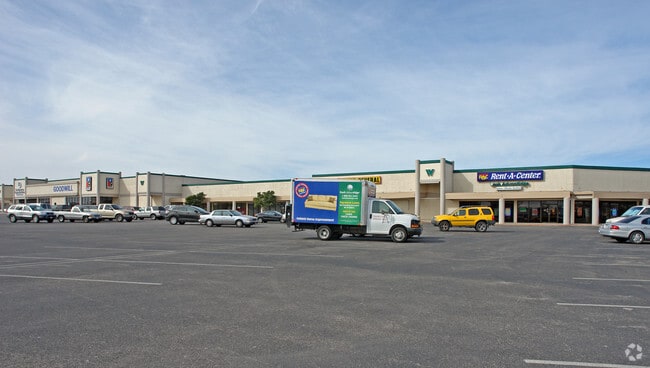
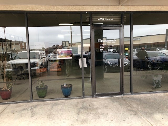
Property Record
4200 W Illinois Ave, Midland, TX 79703

Property Detail
4200 W Illinois Ave
Midland, TX
ACRES: 3.629 BLK: 15A LOT: 003 LESS E 2.14 AC ADDN: OXFORD HEIGHTS SEC 7 (AKA LT3A SECT 8)
R000035-914
Midland
Officebuilding
Texas
LR2
3
2025
3.63 AC
2025
Midland & Odessa
000402
Other Market Areas
87,500 SF
NEARBY LISTINGS FOR SALE OR LEASE
DEMOGRAPHICS near 4200 W Illinois Ave
1 mile
3 mile
5 mile
2025 Total Population
15,919
79,585
141,135
2030 Population
17,331
87,235
155,496
Pop Growth 2025-2030
+ 8.87%
+ 9.61%
+ 10.18%
Average Age
35
36
36
2025 Total Households
5,614
29,570
51,897
HH Growth 2025-2030
+ 10.14%
+ 10.89%
+ 11.41%
Median Household Inc
$77,250
$86,040
$88,066
Avg Household Size
2.80
2.60
2.60
2025 Avg HH Vehicles
2.00
2.00
2.00
Median Home Value
$221,045
$293,757
$305,213
Median Year Built
1968
1981
1984
Nearby Places
Map Layers
Map Styles
 Street
 Aerial
Transit
 Traffic
 Biking
Places
Listings with unknown addresses are not visible on the map
- Restaurants
- Banks
- Shops
- Fitness
- Groceries
PUBLIC TRANSPORTATION
AIRPORT
Midland International Air And Space Port
Drive
Walk
Distance
Midland International Air And Space Port
14 min
8.6 mi
Freight Ports
Calhoun Port
Drive
Walk
Distance
Calhoun Port
529 min
474.6 mi
SALE & LEASE HISTORY
LISTING DATE
SALE/LEASE

Oct 07, 2016
For Lease
Nearby Properties
Address
Land Use
TOTAL SIZE
Lot Size
Zoning
Address
Land Use
TOTAL SIZE
Lot Size
Zoning
322,000 SF
24.88 AC
Address
Land Use
TOTAL SIZE
Lot Size
Zoning
25,575 SF
8.90 AC
Address
Land Use
TOTAL SIZE
Lot Size
Zoning
56,157 SF
18.19 AC
PDOC
Address
Land Use
TOTAL SIZE
Lot Size
Zoning
15,052 SF
4.68 AC
C1
Address
Land Use
TOTAL SIZE
Lot Size
Zoning
2,339 SF
17.14 AC
Address
Land Use
TOTAL SIZE
Lot Size
Zoning
2,453 SF
13.68 AC
Address
Land Use
TOTAL SIZE
Lot Size
Zoning
1,173 SF
14.05 AC
PDHD
Address
Land Use
TOTAL SIZE
Lot Size
Zoning
24,000 SF
11.87 AC
Address
Land Use
TOTAL SIZE
Lot Size
Zoning
2,196 SF
15.11 AC
PDHD
Address
Land Use
TOTAL SIZE
Lot Size
Zoning
262,640 SF
13.71 AC
MF1
Address
Land Use
TOTAL SIZE
Lot Size
Zoning
28,750 SF
10.11 AC
Address
Land Use
TOTAL SIZE
Lot Size
Zoning
8,004 SF
3.58 AC
C1
Address
Land Use
TOTAL SIZE
Lot Size
Zoning
Address
Land Use
TOTAL SIZE
Lot Size
Zoning
15,000 SF
39.46 AC
PDHD
Address
Land Use
TOTAL SIZE
Lot Size
Zoning
44,784 SF
11.97 AC
MF1
Address
Land Use
TOTAL SIZE
Lot Size
Zoning
12,960 SF
15.93 AC
MF1
Address
Land Use
TOTAL SIZE
Lot Size
Zoning
6,864 SF
10.35 AC
Address
Land Use
TOTAL SIZE
Lot Size
Zoning
1,725 SF
11.98 AC
MF1
Address
Land Use
TOTAL SIZE
Lot Size
Zoning
5,884 SF
22.97 AC
PDSC
Address
Land Use
TOTAL SIZE
Lot Size
Zoning
7,200 SF
10.68 AC
MF1
Address
Land Use
TOTAL SIZE
Lot Size
Zoning
209,680 SF
6.16 AC
Address
Land Use
TOTAL SIZE
Lot Size
Zoning
1,678 SF
9.11 AC
MF1
Address
Land Use
TOTAL SIZE
Lot Size
Zoning
5,600 SF
10.18 AC
PDMX
Address
Land Use
TOTAL SIZE
Lot Size
Zoning
1,618 SF
4.18 AC
Address
Land Use
TOTAL SIZE
Lot Size
Zoning
276 SF
0.48 AC
C1
Address
Land Use
TOTAL SIZE
Lot Size
Zoning
1,868 SF
8.47 AC
MF1
Address
Land Use
TOTAL SIZE
Lot Size
Zoning
2,756 SF
10 AC
MF1
Address
Land Use
TOTAL SIZE
Lot Size
Zoning
111,354 SF
8.34 AC
Address
Land Use
TOTAL SIZE
Lot Size
Zoning
137,457 SF
8.73 AC
MF1
Address
Land Use
TOTAL SIZE
Lot Size
Zoning
442 SF
2.99 AC
The World's #1 Commercial Real Estate Marketplace
Connect with us
© 2026 CoStar Group
The information above has been obtained from sources believed reliable. While we do not doubt its accuracy we have not verified it and make no guarantee, warranty or representation about it. It is your responsibility to independently confirm its accuracy and completeness. Any projections, opinions, assumptions, or estimates used are for example only and do not represent the current or future performance of the property. The value of this transaction to you depends on tax and other factors which should be evaluated by your tax, financial, and legal advisors. You and your advisors should conduct a careful, independent investigation of the property to determine to your satisfaction the suitability of the property for your needs.