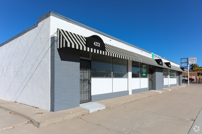
Property Record
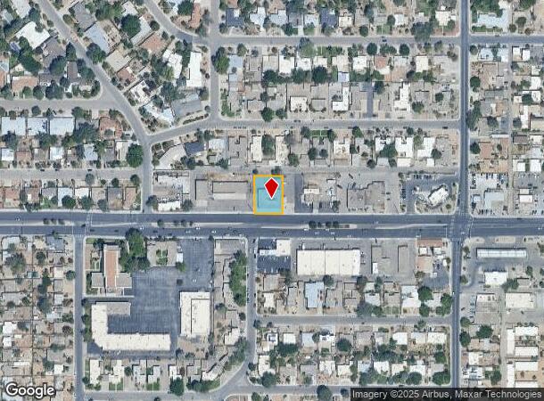
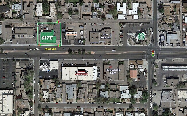
4201 Lomas Blvd Ne, Albuquerque, NM 87110
Current Lease Availabilities
NEARBY LISTINGS FOR SALE OR LEASE
Property Detail
4201 Lomas Blvd Ne
Albuquerque, NM
Joseph L Daileys Subd
1-017-058-195014-3-03-02
LTS 9 THRU 12 BLK 17 JOSEPH L DAILEYS SUBD OF BLK 17 LA HACI ENDA (EXECPT PORT TO LOMAS R/W) CONT 0.3154 AC M/L OR 13,740 SQ
Storebuilding
Bernalillo
X
New Mexico
35001C0353H
9-12
2024
0.32 AC
2025
University
000402
Albuquerque
5,412 SF
DEMOGRAPHICS near 4201 Lomas Blvd Ne
1 Mile
3 Mile
5 Mile
2024 Total Population
14,323
120,553
263,920
2029 Population
14,269
121,329
264,691
Pop Growth 2024-2029
(0.38%)
+ 0.64%
+ 0.29%
Average Age
43
40
40
2024 Total Households
6,911
56,260
119,376
HH Growth 2024-2029
(0.51%)
+ 0.67%
+ 0.30%
Median Household Inc
$81,990
$43,238
$48,101
Avg Household Size
1.90
2.00
2.10
2024 Avg HH Vehicles
2.00
1.00
2.00
Median Home Value
$335,049
$241,256
$242,564
Median Year Built
1954
1964
1969
Nearby Places
- Restaurants
- Banks
- Shops
- Fitness
- Groceries
PUBLIC TRANSPORTATION
COMMUTER RAIL
Downtown Albuquerque (NMRX - Rio Metro Regional Transit District, Rail Runner Express - Rio Metro Regional Transit District)
DRIVE
WALK
Distance
Downtown Albuquerque (NMRX - Rio Metro Regional Transit District, Rail Runner Express - Rio Metro Regional Transit District)
9 min
3.4 mi
Montaño Station (NMRX - Rio Metro Regional Transit District)
DRIVE
WALK
Distance
Montaño Station (NMRX - Rio Metro Regional Transit District)
12 min
5.3 mi
AIRPORT
Albuquerque International Sunport
DRIVE
WALK
Distance
Albuquerque International Sunport
20 min
7.2 mi
Freight Ports
Tulsa Port Of Catoosa
DRIVE
WALK
Distance
Tulsa Port Of Catoosa
687 min
659.5 mi
Nearby Properties
Address
Land Use
TOTAL SIZE
Lot Size
Zoning
Address
Land Use
TOTAL SIZE
Lot Size
Zoning
2,286.01 AC
Address
Land Use
TOTAL SIZE
Lot Size
Zoning
607,287 SF
8.26 AC
Address
Land Use
TOTAL SIZE
Lot Size
Zoning
18,420 SF
18.94 AC
Address
Land Use
TOTAL SIZE
Lot Size
Zoning
849,036 SF
8.12 AC
Address
Land Use
TOTAL SIZE
Lot Size
Zoning
499,989 SF
20.42 AC
Address
Land Use
TOTAL SIZE
Lot Size
Zoning
Address
Land Use
TOTAL SIZE
Lot Size
Zoning
31,252 SF
4.01 AC
Address
Land Use
TOTAL SIZE
Lot Size
Zoning
4,279 SF
13.72 AC
Address
Land Use
TOTAL SIZE
Lot Size
Zoning
179,231 SF
1,213.98 AC
Address
Land Use
TOTAL SIZE
Lot Size
Zoning
362,701 SF
32.55 AC
Address
Land Use
TOTAL SIZE
Lot Size
Zoning
231,258 SF
18.90 AC
Address
Land Use
TOTAL SIZE
Lot Size
Zoning
456.43 AC
Address
Land Use
TOTAL SIZE
Lot Size
Zoning
472,156 SF
1.78 AC
Address
Land Use
TOTAL SIZE
Lot Size
Zoning
Address
Land Use
TOTAL SIZE
Lot Size
Zoning
424,854 SF
20.23 AC
Address
Land Use
TOTAL SIZE
Lot Size
Zoning
26.76 AC
Address
Land Use
TOTAL SIZE
Lot Size
Zoning
Address
Land Use
TOTAL SIZE
Lot Size
Zoning
396,909 SF
3.39 AC
Address
Land Use
TOTAL SIZE
Lot Size
Zoning
355,645 SF
11.98 AC
Address
Land Use
TOTAL SIZE
Lot Size
Zoning
380,018 SF
0.13 AC
Address
Land Use
TOTAL SIZE
Lot Size
Zoning
Address
Land Use
TOTAL SIZE
Lot Size
Zoning
61,072 SF
130.31 AC
Address
Land Use
TOTAL SIZE
Lot Size
Zoning
15,610 SF
17.67 AC
Address
Land Use
TOTAL SIZE
Lot Size
Zoning
370,665 SF
1.66 AC
Address
Land Use
TOTAL SIZE
Lot Size
Zoning
200,652 SF
1.95 AC
Address
Land Use
TOTAL SIZE
Lot Size
Zoning
Address
Land Use
TOTAL SIZE
Lot Size
Zoning
Address
Land Use
TOTAL SIZE
Lot Size
Zoning
267,101 SF
3.40 AC
Address
Land Use
TOTAL SIZE
Lot Size
Zoning
36,200 SF
12.21 AC
Address
Land Use
TOTAL SIZE
Lot Size
Zoning
32.17 AC
The World's #1 Commercial Real Estate Marketplace
Connect with us
© 2025 CoStar Group
The information above has been obtained from sources believed reliable. While we do not doubt its accuracy we have not verified it and make no guarantee, warranty or representation about it. It is your responsibility to independently confirm its accuracy and completeness. Any projections, opinions, assumptions, or estimates used are for example only and do not represent the current or future performance of the property. The value of this transaction to you depends on tax and other factors which should be evaluated by your tax, financial, and legal advisors. You and your advisors should conduct a careful, independent investigation of the property to determine to your satisfaction the suitability of the property for your needs.