Property Record
4201 Bermuda Hundred Rd, Chester, VA 23836
NEARBY LISTINGS FOR SALE OR LEASE
Property Detail
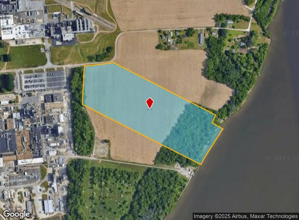
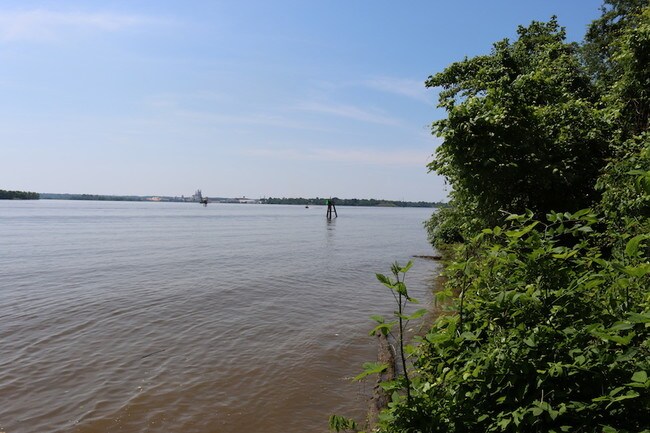
4201 Bermuda Hundred Rd
Richmond, VA
Bermuda Hundred
838-64-98-71-800-000
BERMUDA HUNDRED
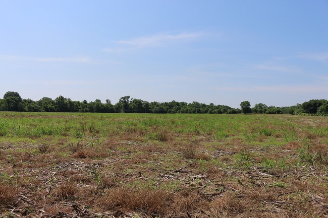
Agriculturalland
Chesterfield
A
Virginia
51041C0360E
26 AC
2025
Iron Bridge Corridor
2025
Richmond VA
100509
DEMOGRAPHICS near 4201 Bermuda Hundred Rd
1 Mile
3 Mile
5 Mile
2024 Total Population
36
7,516
36,804
2029 Population
41
7,873
38,232
Pop Growth 2024-2029
+ 13.89%
+ 4.75%
+ 3.88%
Average Age
41
39
40
2024 Total Households
12
3,047
14,293
HH Growth 2024-2029
+ 16.67%
+ 4.20%
+ 3.58%
Median Household Inc
$81,250
$51,316
$62,976
Avg Household Size
2.60
2.40
2.50
2024 Avg HH Vehicles
2.00
2.00
2.00
Median Home Value
$399,999
$225,000
$215,554
Median Year Built
2005
1967
1977
Nearby Places
Map Layers
Map Styles
 Street
 Aerial
- Restaurants
- Banks
- Shops
- Fitness
- Groceries
PUBLIC TRANSPORTATION
AIRPORT
Richmond International
DRIVE
WALK
Distance
Richmond International
34 min
20.8 mi
Freight Ports
Virginia Port Authority - Richmond
DRIVE
WALK
Distance
Virginia Port Authority - Richmond
31 min
17.8 mi
SALE & LEASE HISTORY
LISTING DATE
SALE/LEASE

Sep 22, 2019
For Sale
Nearby Properties
Address
Land Use
TOTAL SIZE
Lot Size
Zoning
Address
Land Use
TOTAL SIZE
Lot Size
Zoning
99.30 AC
I2 - GEN I
Address
Land Use
TOTAL SIZE
Lot Size
Zoning
252,000 SF
118.66 AC
I3 - HVY I
Address
Land Use
TOTAL SIZE
Lot Size
Zoning
164.03 AC
M2
Address
Land Use
TOTAL SIZE
Lot Size
Zoning
137.06 AC
M2
Address
Land Use
TOTAL SIZE
Lot Size
Zoning
459.55 AC
I3 - HVY I
Address
Land Use
TOTAL SIZE
Lot Size
Zoning
404,200 SF
62.22 AC
I2 - GEN I
Address
Land Use
TOTAL SIZE
Lot Size
Zoning
91,105 SF
10.90 AC
C3 - COMMU
Address
Land Use
TOTAL SIZE
Lot Size
Zoning
13.70 AC
B2
Address
Land Use
TOTAL SIZE
Lot Size
Zoning
219 SF
74.95 AC
I3 - HVY I
Address
Land Use
TOTAL SIZE
Lot Size
Zoning
356.70 AC
I3 - HVY I
Address
Land Use
TOTAL SIZE
Lot Size
Zoning
228,108 SF
19.32 AC
I1 - LT IN
Address
Land Use
TOTAL SIZE
Lot Size
Zoning
35,173 SF
19.30 AC
C3 - COMMU
Address
Land Use
TOTAL SIZE
Lot Size
Zoning
120 SF
100.80 AC
I3 - HVY I
Address
Land Use
TOTAL SIZE
Lot Size
Zoning
296.90 AC
I3 - HVY I
Address
Land Use
TOTAL SIZE
Lot Size
Zoning
136,644 SF
13.24 AC
I3 - HVY I
Address
Land Use
TOTAL SIZE
Lot Size
Zoning
8,000 SF
52.80 AC
M2
Address
Land Use
TOTAL SIZE
Lot Size
Zoning
35,224 SF
3.87 AC
B1
Address
Land Use
TOTAL SIZE
Lot Size
Zoning
11,250 SF
7.36 AC
M2
Address
Land Use
TOTAL SIZE
Lot Size
Zoning
196.75 AC
A - AGRICU
Address
Land Use
TOTAL SIZE
Lot Size
Zoning
45,515 SF
4.28 AC
B2
Address
Land Use
TOTAL SIZE
Lot Size
Zoning
107.38 AC
M2
Address
Land Use
TOTAL SIZE
Lot Size
Zoning
0.25 AC
B1
Address
Land Use
TOTAL SIZE
Lot Size
Zoning
59,850 SF
3.33 AC
C5 - GEN B
Address
Land Use
TOTAL SIZE
Lot Size
Zoning
262.64 AC
I3 - HVY I
Address
Land Use
TOTAL SIZE
Lot Size
Zoning
4.20 AC
R4
Address
Land Use
TOTAL SIZE
Lot Size
Zoning
19,638 SF
3.32 AC
M2
Address
Land Use
TOTAL SIZE
Lot Size
Zoning
12.46 AC
R4
Address
Land Use
TOTAL SIZE
Lot Size
Zoning
83,824 SF
0.80 AC
B1
Address
Land Use
TOTAL SIZE
Lot Size
Zoning
3,021 SF
M2
Address
Land Use
TOTAL SIZE
Lot Size
Zoning
142,970 SF
9.73 AC
I3 - HVY I
The World's #1 Commercial Real Estate Marketplace
Connect with us
© 2026 CoStar Group
The information above has been obtained from sources believed reliable. While we do not doubt its accuracy we have not verified it and make no guarantee, warranty or representation about it. It is your responsibility to independently confirm its accuracy and completeness. Any projections, opinions, assumptions, or estimates used are for example only and do not represent the current or future performance of the property. The value of this transaction to you depends on tax and other factors which should be evaluated by your tax, financial, and legal advisors. You and your advisors should conduct a careful, independent investigation of the property to determine to your satisfaction the suitability of the property for your needs.