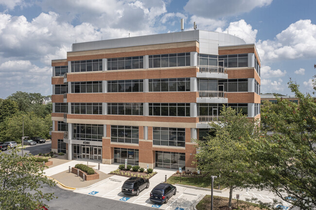
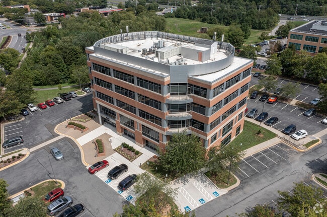
Property Record
4201 Mitchellville Rd, Bowie, MD 20716

Current Lease Availabilities
Property Detail
4201 Mitchellville Rd
07-2920643
CITY OF CAPITALS
Officebuilding
Prince Georges
TACE
Maryland
B and X Area of moderate flood hazard, usually the area between the limits of the 100-year and 500-year floods.
6
2024
2.28 AC
2025
Bowie
800516
Washington, DC
55,754 SF
Washington-Arlington-Alexandria, DC-VA-MD-WV
NEARBY LISTINGS FOR SALE OR LEASE
DEMOGRAPHICS near 4201 Mitchellville Rd
1 mile
3 mile
5 mile
2025 Total Population
6,029
42,646
126,824
2030 Population
6,052
43,340
128,537
Pop Growth 2025-2030
+ 0.38%
+ 1.63%
+ 1.35%
Average Age
40
43
41
2025 Total Households
1,664
14,004
43,885
HH Growth 2025-2030
+ 0.24%
+ 1.79%
+ 1.45%
Median Household Inc
$177,591
$156,499
$137,427
Avg Household Size
2.90
2.90
2.80
2025 Avg HH Vehicles
2.00
2.00
2.00
Median Home Value
$514,949
$496,976
$487,154
Median Year Built
1982
1984
1988
Nearby Places
Map Layers
Map Styles
 Street
 Aerial
Layers
 Traffic
 Biking
Places
Listings with unknown addresses are not visible on the map
- Restaurants
- Banks
- Shops
- Fitness
- Groceries
PUBLIC TRANSPORTATION
COMMUTER RAIL
Drive
Walk
Distance
13 min
6.7 mi
Drive
Walk
Distance
14 min
9.3 mi
AIRPORT
Baltimore/Washington International Thurgood Marshall
Drive
Walk
Distance
Baltimore/Washington International Thurgood Marshall
35 min
22.2 mi
Ronald Reagan Washington Ntl
Drive
Walk
Distance
Ronald Reagan Washington Ntl
38 min
23.6 mi
Freight Ports
Port of Baltimore
Drive
Walk
Distance
Port of Baltimore
41 min
27.5 mi
Nearby Properties
Address
Land Use
TOTAL SIZE
Lot Size
Zoning
Address
Land Use
TOTAL SIZE
Lot Size
Zoning
278,982 SF
22.25 AC
LCD
Address
Land Use
TOTAL SIZE
Lot Size
Zoning
6.34 AC
TACE
Address
Land Use
TOTAL SIZE
Lot Size
Zoning
15.34 AC
LCD
Address
Land Use
TOTAL SIZE
Lot Size
Zoning
286 SF
13.08 AC
RMF20
Address
Land Use
TOTAL SIZE
Lot Size
Zoning
338 SF
20.94 AC
RMF20
Address
Land Use
TOTAL SIZE
Lot Size
Zoning
80,321 SF
11.78 AC
CGO
Address
Land Use
TOTAL SIZE
Lot Size
Zoning
287,439 SF
19.97 AC
CGO
Address
Land Use
TOTAL SIZE
Lot Size
Zoning
120,560 SF
9 AC
TACE
Address
Land Use
TOTAL SIZE
Lot Size
Zoning
283,176 SF
30.51 AC
TACC
Address
Land Use
TOTAL SIZE
Lot Size
Zoning
79,939 SF
6.17 AC
LCD
Address
Land Use
TOTAL SIZE
Lot Size
Zoning
101,475 SF
11.17 AC
CGO
Address
Land Use
TOTAL SIZE
Lot Size
Zoning
166,720 SF
8.72 AC
TACE
Address
Land Use
TOTAL SIZE
Lot Size
Zoning
122,290 SF
3.14 AC
TACE
Address
Land Use
TOTAL SIZE
Lot Size
Zoning
170,641 SF
4.30 AC
IE
Address
Land Use
TOTAL SIZE
Lot Size
Zoning
124,313 SF
12.70 AC
CGO
Address
Land Use
TOTAL SIZE
Lot Size
Zoning
111,009 SF
11.43 AC
CGO
Address
Land Use
TOTAL SIZE
Lot Size
Zoning
140 SF
5.47 AC
RMF20
Address
Land Use
TOTAL SIZE
Lot Size
Zoning
114,327 SF
14.44 AC
TACE
Address
Land Use
TOTAL SIZE
Lot Size
Zoning
124,984 SF
10.30 AC
TACE
Address
Land Use
TOTAL SIZE
Lot Size
Zoning
90,180 SF
6.48 AC
TACE
Address
Land Use
TOTAL SIZE
Lot Size
Zoning
117,622 SF
10.93 AC
CS
Address
Land Use
TOTAL SIZE
Lot Size
Zoning
65,928 SF
6.61 AC
TACC
Address
Land Use
TOTAL SIZE
Lot Size
Zoning
175,036 SF
9.44 AC
TACE
Address
Land Use
TOTAL SIZE
Lot Size
Zoning
159,876 SF
13.62 AC
TACC
Address
Land Use
TOTAL SIZE
Lot Size
Zoning
102,755 SF
7.61 AC
TACE
Address
Land Use
TOTAL SIZE
Lot Size
Zoning
116,798 SF
12.80 AC
CGO
Address
Land Use
TOTAL SIZE
Lot Size
Zoning
60,600 SF
6 AC
RR
Address
Land Use
TOTAL SIZE
Lot Size
Zoning
129,800 SF
3.13 AC
TACE
Address
Land Use
TOTAL SIZE
Lot Size
Zoning
125,731 SF
12.35 AC
TACE
Address
Land Use
TOTAL SIZE
Lot Size
Zoning
104,000 SF
3.30 AC
TACC
The World's #1 Commercial Real Estate Marketplace
Connect with us
© 2026 CoStar Group
The information above has been obtained from sources believed reliable. While we do not doubt its accuracy we have not verified it and make no guarantee, warranty or representation about it. It is your responsibility to independently confirm its accuracy and completeness. Any projections, opinions, assumptions, or estimates used are for example only and do not represent the current or future performance of the property. The value of this transaction to you depends on tax and other factors which should be evaluated by your tax, financial, and legal advisors. You and your advisors should conduct a careful, independent investigation of the property to determine to your satisfaction the suitability of the property for your needs.