Property Record
4201 Prices Fork Rd, Blacksburg, VA 24060
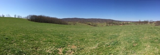

Property Detail
4201 Prices Fork Rd
009818
PRICES FORK RD TRACT 3
Agriculturalland
MONTGOMERY
A1
Virginia
B and X Area of moderate flood hazard, usually the area between the limits of the 100-year and 500-year floods.
23.15 AC
2025
Blacksburg & Wytheville
2025
Other Market Areas
021201
Blacksburg-Christiansburg-Radford, VA
2,408 SF
NEARBY LISTINGS FOR SALE OR LEASE
DEMOGRAPHICS near 4201 Prices Fork Rd
1 mile
3 mile
5 mile
2025 Total Population
1,342
10,056
37,967
2030 Population
1,371
10,082
38,077
Pop Growth 2025-2030
+ 2.16%
+ 0.26%
+ 0.29%
Average Age
43
36
35
2025 Total Households
572
4,248
16,278
HH Growth 2025-2030
+ 2.27%
+ 0.26%
+ 0.28%
Median Household Inc
$68,099
$65,539
$52,425
Avg Household Size
2.30
2.30
2.20
2025 Avg HH Vehicles
2.00
2.00
2.00
Median Home Value
$287,499
$357,777
$357,644
Median Year Built
1987
1986
1987
Nearby Places
Map Layers
Map Styles
 Street
 Aerial
Layers
 Traffic
 Biking
Places
Listings with unknown addresses are not visible on the map
- Restaurants
- Banks
- Shops
- Fitness
- Groceries
PUBLIC TRANSPORTATION
AIRPORT
Roanoke/Blacksburg Regional (Woodrum Field)
Drive
Walk
Distance
Roanoke/Blacksburg Regional (Woodrum Field)
60 min
43.3 mi
Freight Ports
Virginia Port Authority - Richmond
Drive
Walk
Distance
Virginia Port Authority - Richmond
262 min
227.1 mi
SALE & LEASE HISTORY
LISTING DATE
SALE/LEASE

Sep 24, 2016
For Sale
Nearby Properties
Address
Land Use
TOTAL SIZE
Lot Size
Zoning
Address
Land Use
TOTAL SIZE
Lot Size
Zoning
2,983.14 AC
A1
Address
Land Use
TOTAL SIZE
Lot Size
Zoning
190,465 SF
129.62 AC
RR-1
Address
Land Use
TOTAL SIZE
Lot Size
Zoning
41.51 AC
PR
Address
Land Use
TOTAL SIZE
Lot Size
Zoning
230,692 SF
12.90 AC
PR
Address
Land Use
TOTAL SIZE
Lot Size
Zoning
212,497 SF
10.75 AC
PR
Address
Land Use
TOTAL SIZE
Lot Size
Zoning
197,024 SF
9.86 AC
PR
Address
Land Use
TOTAL SIZE
Lot Size
Zoning
183,569 SF
8.38 AC
PR
Address
Land Use
TOTAL SIZE
Lot Size
Zoning
5.58 AC
MXD
Address
Land Use
TOTAL SIZE
Lot Size
Zoning
150,108 SF
8.19 AC
PR
Address
Land Use
TOTAL SIZE
Lot Size
Zoning
98,713 SF
0.02 AC
A1
Address
Land Use
TOTAL SIZE
Lot Size
Zoning
0.09 AC
A1
Address
Land Use
TOTAL SIZE
Lot Size
Zoning
148,695 SF
7.97 AC
PR
Address
Land Use
TOTAL SIZE
Lot Size
Zoning
147,862 SF
7.73 AC
PR
Address
Land Use
TOTAL SIZE
Lot Size
Zoning
3.47 AC
MXD
Address
Land Use
TOTAL SIZE
Lot Size
Zoning
94,900 SF
6.95 AC
PR
Address
Land Use
TOTAL SIZE
Lot Size
Zoning
93,409 SF
11.34 AC
PR
Address
Land Use
TOTAL SIZE
Lot Size
Zoning
81,335 SF
5.09 AC
PR
Address
Land Use
TOTAL SIZE
Lot Size
Zoning
3.23 AC
MXD
Address
Land Use
TOTAL SIZE
Lot Size
Zoning
62,389 SF
2.84 AC
PR
Address
Land Use
TOTAL SIZE
Lot Size
Zoning
73,637 SF
5.45 AC
PR
Address
Land Use
TOTAL SIZE
Lot Size
Zoning
37,056 SF
10.39 AC
A1
Address
Land Use
TOTAL SIZE
Lot Size
Zoning
2,040 SF
45.31 AC
PMR
Address
Land Use
TOTAL SIZE
Lot Size
Zoning
2,852 SF
22.77 AC
PR
Address
Land Use
TOTAL SIZE
Lot Size
Zoning
18,961 SF
9.88 AC
O
Address
Land Use
TOTAL SIZE
Lot Size
Zoning
310.98 AC
RR-1
Address
Land Use
TOTAL SIZE
Lot Size
Zoning
61,120 SF
3.26 AC
PC
Address
Land Use
TOTAL SIZE
Lot Size
Zoning
960 SF
24.76 AC
PMH
Address
Land Use
TOTAL SIZE
Lot Size
Zoning
245.31 AC
RR-1
Address
Land Use
TOTAL SIZE
Lot Size
Zoning
22,830 SF
0.19 AC
PR
Address
Land Use
TOTAL SIZE
Lot Size
Zoning
42,212 SF
5.37 AC
PR
The World's #1 Commercial Real Estate Marketplace
Connect with us
© 2026 CoStar Group
The information above has been obtained from sources believed reliable. While we do not doubt its accuracy we have not verified it and make no guarantee, warranty or representation about it. It is your responsibility to independently confirm its accuracy and completeness. Any projections, opinions, assumptions, or estimates used are for example only and do not represent the current or future performance of the property. The value of this transaction to you depends on tax and other factors which should be evaluated by your tax, financial, and legal advisors. You and your advisors should conduct a careful, independent investigation of the property to determine to your satisfaction the suitability of the property for your needs.