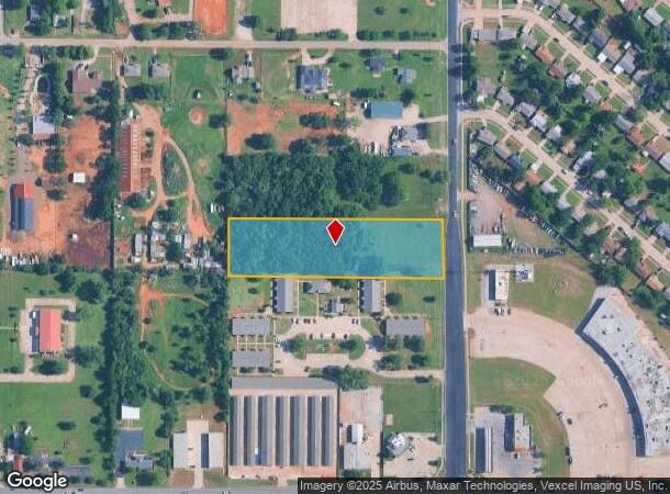
Property Record
4201 S Bryant Ave, Moore, OK 73160

NEARBY LISTINGS FOR SALE OR LEASE
Property Detail
4201 S Bryant Ave
Oklahoma City, OK
Unpltd Pt Sec 13 11N 3W
131902400
UNPLTD PT SEC 13 11N 3W 000 000 PT OF SEC 13 11N 3W S 1/2 OF S 1/2 OF NE4 OF SE4 OF SE4
Commercialacreage
Oklahoma
X
Oklahoma
40109C0315H
2.38 AC
2023
South
2024
Oklahoma City
202201
DEMOGRAPHICS near 4201 S Bryant Ave
1 Mile
3 Mile
5 Mile
2024 Total Population
9,867
64,504
173,757
2029 Population
10,221
67,083
179,816
Pop Growth 2024-2029
+ 3.59%
+ 4.00%
+ 3.49%
Average Age
34
35
36
2024 Total Households
3,597
23,466
67,544
HH Growth 2024-2029
+ 3.61%
+ 3.95%
+ 3.51%
Median Household Inc
$43,992
$46,501
$46,582
Avg Household Size
2.60
2.60
2.50
2024 Avg HH Vehicles
2.00
2.00
2.00
Median Home Value
$74,252
$87,904
$111,073
Median Year Built
1975
1971
1970
Nearby Places
Map Layers
Map Styles
 Street
 Aerial
- Restaurants
- Banks
- Shops
- Fitness
- Groceries
PUBLIC TRANSPORTATION
COMMUTER RAIL
DRIVE
WALK
Distance
10 min
6.1 mi
AIRPORT
Will Rogers World
DRIVE
WALK
Distance
Will Rogers World
23 min
10.1 mi
SALE & LEASE HISTORY
LISTING DATE
SALE/LEASE

Sep 08, 2017
For Sale
Sep 07, 2017
For Sale
Apr 13, 2017
For Sale
Nearby Properties
Address
Land Use
TOTAL SIZE
Lot Size
Zoning
Address
Land Use
TOTAL SIZE
Lot Size
Zoning
32,004 SF
80.40 AC
PUD
Address
Land Use
TOTAL SIZE
Lot Size
Zoning
179,855 SF
36.19 AC
PUD
Address
Land Use
TOTAL SIZE
Lot Size
Zoning
998,813 SF
167.96 AC
I-2
Address
Land Use
TOTAL SIZE
Lot Size
Zoning
232,344 SF
12.98 AC
PUD
Address
Land Use
TOTAL SIZE
Lot Size
Zoning
296,429 SF
33.05 AC
I-2
Address
Land Use
TOTAL SIZE
Lot Size
Zoning
78,452 SF
5.19 AC
I-2
Address
Land Use
TOTAL SIZE
Lot Size
Zoning
312,675 SF
25.01 AC
Address
Land Use
TOTAL SIZE
Lot Size
Zoning
152,302 SF
14 AC
SPUD
Address
Land Use
TOTAL SIZE
Lot Size
Zoning
392,100 SF
7.87 AC
I-2
Address
Land Use
TOTAL SIZE
Lot Size
Zoning
95,330 SF
25.68 AC
Address
Land Use
TOTAL SIZE
Lot Size
Zoning
296,700 SF
9.17 AC
I-2
Address
Land Use
TOTAL SIZE
Lot Size
Zoning
501,811 SF
29.33 AC
I-2
Address
Land Use
TOTAL SIZE
Lot Size
Zoning
141,387 SF
41 AC
PUD
Address
Land Use
TOTAL SIZE
Lot Size
Zoning
65,009 SF
8.72 AC
SPUD
Address
Land Use
TOTAL SIZE
Lot Size
Zoning
119,916 SF
15.06 AC
I-3
Address
Land Use
TOTAL SIZE
Lot Size
Zoning
100,000 SF
11.18 AC
I-2
Address
Land Use
TOTAL SIZE
Lot Size
Zoning
203,263 SF
45.46 AC
Address
Land Use
TOTAL SIZE
Lot Size
Zoning
109,759 SF
7.27 AC
I-1
Address
Land Use
TOTAL SIZE
Lot Size
Zoning
126,556 SF
6.74 AC
R-4
Address
Land Use
TOTAL SIZE
Lot Size
Zoning
145,328 SF
14.95 AC
R-4
Address
Land Use
TOTAL SIZE
Lot Size
Zoning
209,552 SF
11.67 AC
R-4
Address
Land Use
TOTAL SIZE
Lot Size
Zoning
35,245 SF
2.60 AC
Address
Land Use
TOTAL SIZE
Lot Size
Zoning
130,612 SF
20.22 AC
I-2
Address
Land Use
TOTAL SIZE
Lot Size
Zoning
150,995 SF
40.02 AC
I-2
Address
Land Use
TOTAL SIZE
Lot Size
Zoning
75,110 SF
18.53 AC
I-2
Address
Land Use
TOTAL SIZE
Lot Size
Zoning
109,637 SF
10.14 AC
I-2
Address
Land Use
TOTAL SIZE
Lot Size
Zoning
164,256 SF
8.38 AC
R-4
Address
Land Use
TOTAL SIZE
Lot Size
Zoning
180,937 SF
9.92 AC
I-3
Address
Land Use
TOTAL SIZE
Lot Size
Zoning
90,335 SF
15.39 AC
I-2
Address
Land Use
TOTAL SIZE
Lot Size
Zoning
124,932 SF
15.94 AC
I-2
The World's #1 Commercial Real Estate Marketplace
Connect with us
© 2026 CoStar Group
The information above has been obtained from sources believed reliable. While we do not doubt its accuracy we have not verified it and make no guarantee, warranty or representation about it. It is your responsibility to independently confirm its accuracy and completeness. Any projections, opinions, assumptions, or estimates used are for example only and do not represent the current or future performance of the property. The value of this transaction to you depends on tax and other factors which should be evaluated by your tax, financial, and legal advisors. You and your advisors should conduct a careful, independent investigation of the property to determine to your satisfaction the suitability of the property for your needs.