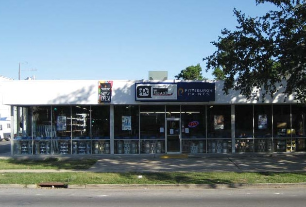
Property Record
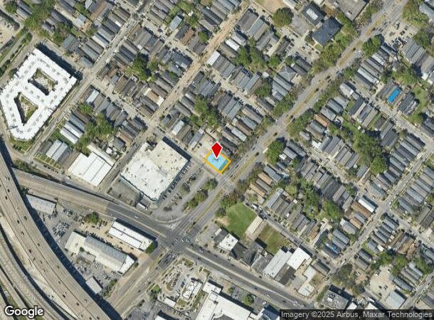
4201 S Carrollton Ave, New Orleans, LA 70119
NEARBY LISTINGS FOR SALE OR LEASE
Property Detail
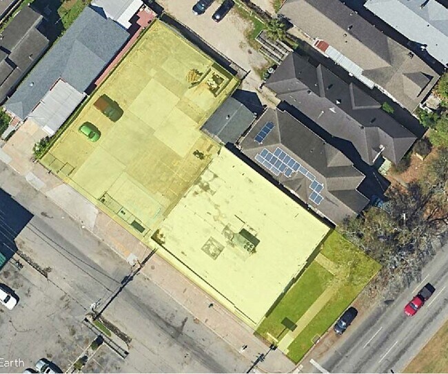
4201 S Carrollton Ave
1-05-3-053-16
SQ 778 LOT 16 SO CARROLLTON 36X99 2 LOT 17 SO CARROLLTON & ULLOA 36X96 4 SALW 29415 & 29417 ULLOA M/A CHNG 3/04
Storebuilding
Orleans
AE
Louisiana
22051C0225F
16,17
2025
0.17 AC
2025
Mid-City/Central City
006500
New Orleans/Metairie/Kenner
4,680 SF
New Orleans-Metairie, LA
DEMOGRAPHICS near 4201 S Carrollton Ave
1 Mile
3 Mile
5 Mile
2024 Total Population
21,565
174,335
356,175
2029 Population
20,740
168,651
343,791
Pop Growth 2024-2029
(3.83%)
(3.26%)
(3.48%)
Average Age
40
41
41
2024 Total Households
10,023
80,698
163,071
HH Growth 2024-2029
(4.05%)
(3.17%)
(3.49%)
Median Household Inc
$47,620
$53,391
$54,907
Avg Household Size
1.90
2.00
2.10
2024 Avg HH Vehicles
1.00
1.00
1.00
Median Home Value
$323,897
$380,073
$333,012
Median Year Built
1948
1948
1955
Nearby Places
Map Layers
Map Styles
 Street
 Aerial
- Restaurants
- Banks
- Shops
- Fitness
- Groceries
PUBLIC TRANSPORTATION
AIRPORT
Louis Armstrong New Orleans International
DRIVE
WALK
Distance
Louis Armstrong New Orleans International
18 min
12.3 mi
SALE & LEASE HISTORY
LISTING DATE
SALE/LEASE

Feb 29, 2024
For Lease
Dec 28, 2016
For Lease
Nearby Properties
Address
Land Use
TOTAL SIZE
Lot Size
Zoning
Address
Land Use
TOTAL SIZE
Lot Size
Zoning
300 SF
2.19 AC
LS
Address
Land Use
TOTAL SIZE
Lot Size
Zoning
85,052 SF
2.19 AC
LS
Address
Land Use
TOTAL SIZE
Lot Size
Zoning
80.92 AC
EC
Address
Land Use
TOTAL SIZE
Lot Size
Zoning
22.63 AC
Address
Land Use
TOTAL SIZE
Lot Size
Zoning
66.23 AC
CBD-4
Address
Land Use
TOTAL SIZE
Lot Size
Zoning
834,043 SF
1.40 AC
CBD-2
Address
Land Use
TOTAL SIZE
Lot Size
Zoning
1.87 AC
CBD-2
Address
Land Use
TOTAL SIZE
Lot Size
Zoning
844,362 SF
5.85 AC
CBD-4
Address
Land Use
TOTAL SIZE
Lot Size
Zoning
444,121 SF
1.46 AC
CBD-1
Address
Land Use
TOTAL SIZE
Lot Size
Zoning
0.88 AC
CBD-2
Address
Land Use
TOTAL SIZE
Lot Size
Zoning
725,677 SF
54.19 AC
EC
Address
Land Use
TOTAL SIZE
Lot Size
Zoning
1.91 AC
CBD-1
Address
Land Use
TOTAL SIZE
Lot Size
Zoning
576,962 SF
3.31 AC
CBD-4
Address
Land Use
TOTAL SIZE
Lot Size
Zoning
1.79 AC
Address
Land Use
TOTAL SIZE
Lot Size
Zoning
609,449 SF
2 AC
EC
Address
Land Use
TOTAL SIZE
Lot Size
Zoning
1.24 AC
CBD-1
Address
Land Use
TOTAL SIZE
Lot Size
Zoning
190,708 SF
1.09 AC
CBD-2
Address
Land Use
TOTAL SIZE
Lot Size
Zoning
225,284 SF
16.83 AC
S-RD
Address
Land Use
TOTAL SIZE
Lot Size
Zoning
499,287 SF
1.44 AC
VCE
Address
Land Use
TOTAL SIZE
Lot Size
Zoning
0.67 AC
CBD-3
Address
Land Use
TOTAL SIZE
Lot Size
Zoning
162,382 SF
1.25 AC
CBD-2
Address
Land Use
TOTAL SIZE
Lot Size
Zoning
35.06 AC
Address
Land Use
TOTAL SIZE
Lot Size
Zoning
258,024 SF
0.63 AC
CBD-2
Address
Land Use
TOTAL SIZE
Lot Size
Zoning
2.94 AC
CBD-1
Address
Land Use
TOTAL SIZE
Lot Size
Zoning
3.36 AC
EC
Address
Land Use
TOTAL SIZE
Lot Size
Zoning
462,672 SF
1.11 AC
CBD-1
Address
Land Use
TOTAL SIZE
Lot Size
Zoning
1.84 AC
CBD-7
Address
Land Use
TOTAL SIZE
Lot Size
Zoning
224,374 SF
92.67 AC
HU-RD1
Address
Land Use
TOTAL SIZE
Lot Size
Zoning
2.20 AC
EC
Address
Land Use
TOTAL SIZE
Lot Size
Zoning
1.26 AC
CBD-1
The World's #1 Commercial Real Estate Marketplace
Connect with us
© 2025 CoStar Group
The information above has been obtained from sources believed reliable. While we do not doubt its accuracy we have not verified it and make no guarantee, warranty or representation about it. It is your responsibility to independently confirm its accuracy and completeness. Any projections, opinions, assumptions, or estimates used are for example only and do not represent the current or future performance of the property. The value of this transaction to you depends on tax and other factors which should be evaluated by your tax, financial, and legal advisors. You and your advisors should conduct a careful, independent investigation of the property to determine to your satisfaction the suitability of the property for your needs.