Property Record
4201 Sawyer Cir, Saint Cloud, FL 34772


NEARBY LISTINGS FOR SALE OR LEASE
-
-
View all Saint Cloud listings for sale on LoopNet.com
Property Detail
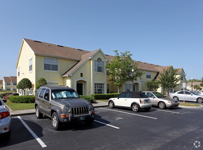
4201 Sawyer Cir
Orlando-Kissimmee-Sanford, FL
Acreage & Unrec
16-26-30-00U0-0105-0000
BEG AT NW COR LOT 22, CYPRESS POINT UN 2 PB 9 PG 37 W 1252.10 FT TO ELY R/W KISSIMMEE PARK RD, S 13 DEG E 790 FT ALONG R/W, N 76 DEG E 237.50 FT, E 843.91 FT, N 703.03 FT TO POB LESS COM AT NE COR PARCEL 3, A REPLAT OF TERA VILLAGE TRACT 3 PB 7 PG 11
Multifamilydwelling
Osceola
A
Florida
12097C0252G
22
2024
18.57 AC
2025
Lake Toho
043208
Orlando
227,194 SF
DEMOGRAPHICS near 4201 Sawyer Cir
1 Mile
3 Mile
5 Mile
2024 Total Population
6,919
45,377
90,050
2029 Population
8,207
54,065
107,962
Pop Growth 2024-2029
+ 18.62%
+ 19.15%
+ 19.89%
Average Age
39
38
38
2024 Total Households
2,330
15,412
30,604
HH Growth 2024-2029
+ 18.45%
+ 18.92%
+ 19.80%
Median Household Inc
$58,922
$63,973
$64,067
Avg Household Size
2.90
2.90
2.90
2024 Avg HH Vehicles
2.00
2.00
2.00
Median Home Value
$306,694
$272,810
$292,827
Median Year Built
2002
2001
2003
Nearby Places
Map Layers
Map Styles
 Street
 Aerial
- Restaurants
- Banks
- Shops
- Fitness
- Groceries
PUBLIC TRANSPORTATION
COMMUTER RAIL
DRIVE
WALK
Distance
16 min
8.1 mi
AIRPORT
Orlando International
DRIVE
WALK
Distance
Orlando International
30 min
22.5 mi
Nearby Properties
Address
Land Use
TOTAL SIZE
Lot Size
Zoning
Address
Land Use
TOTAL SIZE
Lot Size
Zoning
270,959 SF
10.84 AC
SPUD
Address
Land Use
TOTAL SIZE
Lot Size
Zoning
275,507 SF
22.19 AC
RM-2
Address
Land Use
TOTAL SIZE
Lot Size
Zoning
187,302 SF
20.85 AC
Address
Land Use
TOTAL SIZE
Lot Size
Zoning
313,120 SF
54.86 AC
SP
Address
Land Use
TOTAL SIZE
Lot Size
Zoning
118,121 SF
237.16 AC
SP
Address
Land Use
TOTAL SIZE
Lot Size
Zoning
208,677 SF
12.64 AC
Address
Land Use
TOTAL SIZE
Lot Size
Zoning
198,144 SF
12.18 AC
SR4
Address
Land Use
TOTAL SIZE
Lot Size
Zoning
185,953 SF
63.41 AC
SP
Address
Land Use
TOTAL SIZE
Lot Size
Zoning
82,614 SF
9.89 AC
SHB
Address
Land Use
TOTAL SIZE
Lot Size
Zoning
188,778 SF
15.62 AC
SR4
Address
Land Use
TOTAL SIZE
Lot Size
Zoning
106,078 SF
15.04 AC
SP
Address
Land Use
TOTAL SIZE
Lot Size
Zoning
50,025 SF
4.45 AC
SP
Address
Land Use
TOTAL SIZE
Lot Size
Zoning
79,854 SF
8.89 AC
SHB
Address
Land Use
TOTAL SIZE
Lot Size
Zoning
136,124 SF
14.46 AC
SAC
Address
Land Use
TOTAL SIZE
Lot Size
Zoning
68,306 SF
9.59 AC
SPUD
Address
Land Use
TOTAL SIZE
Lot Size
Zoning
137,208 SF
37.64 AC
OAC
Address
Land Use
TOTAL SIZE
Lot Size
Zoning
122,514 SF
22.15 AC
OAC
Address
Land Use
TOTAL SIZE
Lot Size
Zoning
102,869 SF
1.71 AC
Address
Land Use
TOTAL SIZE
Lot Size
Zoning
187,534 SF
19.79 AC
Address
Land Use
TOTAL SIZE
Lot Size
Zoning
107,129 SF
7.87 AC
SPUD
Address
Land Use
TOTAL SIZE
Lot Size
Zoning
4,940 SF
280.16 AC
AC
Address
Land Use
TOTAL SIZE
Lot Size
Zoning
60,772 SF
6.42 AC
SP
Address
Land Use
TOTAL SIZE
Lot Size
Zoning
84,902 SF
11.12 AC
SPUD
Address
Land Use
TOTAL SIZE
Lot Size
Zoning
66,682 SF
8.42 AC
SHB
Address
Land Use
TOTAL SIZE
Lot Size
Zoning
88,725 SF
5.79 AC
SHB
Address
Land Use
TOTAL SIZE
Lot Size
Zoning
46.97 AC
Address
Land Use
TOTAL SIZE
Lot Size
Zoning
252.62 AC
Address
Land Use
TOTAL SIZE
Lot Size
Zoning
59,852 SF
8.13 AC
SHB
Address
Land Use
TOTAL SIZE
Lot Size
Zoning
78,510 SF
3.95 AC
SI1
The World's #1 Commercial Real Estate Marketplace
Connect with us
© 2025 CoStar Group
The information above has been obtained from sources believed reliable. While we do not doubt its accuracy we have not verified it and make no guarantee, warranty or representation about it. It is your responsibility to independently confirm its accuracy and completeness. Any projections, opinions, assumptions, or estimates used are for example only and do not represent the current or future performance of the property. The value of this transaction to you depends on tax and other factors which should be evaluated by your tax, financial, and legal advisors. You and your advisors should conduct a careful, independent investigation of the property to determine to your satisfaction the suitability of the property for your needs.