Property Record
4205 Apple Creek Rd, Bismarck, ND 58504


NEARBY LISTINGS FOR SALE OR LEASE
Property Detail
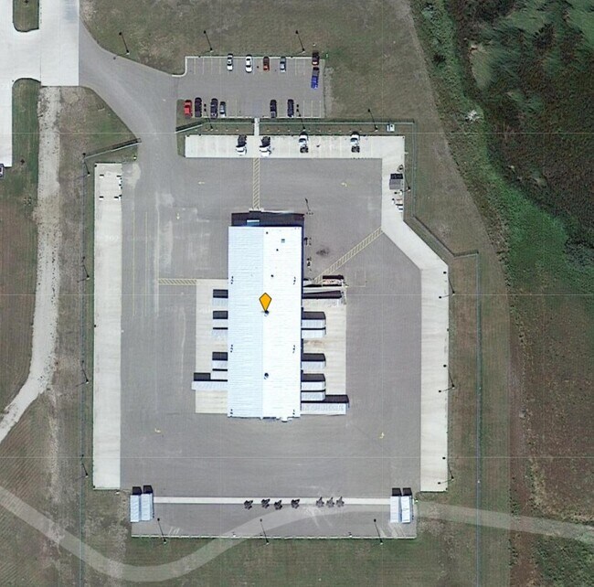
4205 Apple Creek Rd
Bismarck, ND
Expressway Industrial Park
2030-002-150
EXPRESSWAY INDUSTRIAL PARK LOTS 7 - 8 & E 1/2 VACATED ARLON PLADJACENT
Lightindustrial
Burleigh
AE
North Dakota
38015C0815E
7-8
2024
8.36 AC
2024
East Bismarck
011300
Other Market Areas
12,000 SF
DEMOGRAPHICS near 4205 Apple Creek Rd
1 Mile
3 Mile
5 Mile
2024 Total Population
89
29,947
77,451
2029 Population
91
30,725
79,624
Pop Growth 2024-2029
+ 2.25%
+ 2.60%
+ 2.81%
Average Age
38
39
40
2024 Total Households
28
12,436
33,043
HH Growth 2024-2029
+ 3.57%
+ 2.72%
+ 2.88%
Median Household Inc
$87,500
$58,666
$63,884
Avg Household Size
2.70
2.20
2.20
2024 Avg HH Vehicles
2.00
2.00
2.00
Median Home Value
$363,636
$230,850
$250,365
Median Year Built
1997
1977
1983
Nearby Places
Map Layers
Map Styles
 Street
 Aerial
- Restaurants
- Banks
- Shops
- Fitness
- Groceries
PUBLIC TRANSPORTATION
AIRPORT
Bismarck Municipal
DRIVE
WALK
Distance
Bismarck Municipal
14 min
3.4 mi
Nearby Properties
Address
Land Use
TOTAL SIZE
Lot Size
Zoning
Address
Land Use
TOTAL SIZE
Lot Size
Zoning
45.23 AC
CG
Address
Land Use
TOTAL SIZE
Lot Size
Zoning
26.42 AC
MA
Address
Land Use
TOTAL SIZE
Lot Size
Zoning
93,860 SF
1.44 AC
HM
Address
Land Use
TOTAL SIZE
Lot Size
Zoning
35.42 AC
MA
Address
Land Use
TOTAL SIZE
Lot Size
Zoning
Address
Land Use
TOTAL SIZE
Lot Size
Zoning
6.29 AC
RM30
Address
Land Use
TOTAL SIZE
Lot Size
Zoning
81,092 SF
4.17 AC
HM
Address
Land Use
TOTAL SIZE
Lot Size
Zoning
20.41 AC
MA
Address
Land Use
TOTAL SIZE
Lot Size
Zoning
51,723 SF
1.69 AC
HM
Address
Land Use
TOTAL SIZE
Lot Size
Zoning
10.84 AC
CG
Address
Land Use
TOTAL SIZE
Lot Size
Zoning
14.22 AC
MA
Address
Land Use
TOTAL SIZE
Lot Size
Zoning
14.70 AC
MA
Address
Land Use
TOTAL SIZE
Lot Size
Zoning
7,288 SF
7.50 AC
CG
Address
Land Use
TOTAL SIZE
Lot Size
Zoning
62,652 SF
2.34 AC
HM
Address
Land Use
TOTAL SIZE
Lot Size
Zoning
42,908 SF
12.44 AC
MA
Address
Land Use
TOTAL SIZE
Lot Size
Zoning
99,684 SF
2.33 AC
MA
Address
Land Use
TOTAL SIZE
Lot Size
Zoning
84,342 SF
11.63 AC
MA
Address
Land Use
TOTAL SIZE
Lot Size
Zoning
64,008 SF
12.61 AC
MA
Address
Land Use
TOTAL SIZE
Lot Size
Zoning
79,200 SF
6.01 AC
MA
Address
Land Use
TOTAL SIZE
Lot Size
Zoning
8.16 AC
MA
Address
Land Use
TOTAL SIZE
Lot Size
Zoning
40,876 SF
2.07 AC
CG
Address
Land Use
TOTAL SIZE
Lot Size
Zoning
13,853 SF
0.78 AC
DC
Address
Land Use
TOTAL SIZE
Lot Size
Zoning
Address
Land Use
TOTAL SIZE
Lot Size
Zoning
63,247 SF
6.80 AC
MA
Address
Land Use
TOTAL SIZE
Lot Size
Zoning
92,982 SF
3.80 AC
RM30
Address
Land Use
TOTAL SIZE
Lot Size
Zoning
48,440 SF
4.51 AC
CG
Address
Land Use
TOTAL SIZE
Lot Size
Zoning
16,005 SF
5.46 AC
MA
Address
Land Use
TOTAL SIZE
Lot Size
Zoning
87,783 SF
3.86 AC
RM30
Address
Land Use
TOTAL SIZE
Lot Size
Zoning
87,783 SF
4.08 AC
RM30
Address
Land Use
TOTAL SIZE
Lot Size
Zoning
87,783 SF
3.76 AC
RM30
The World's #1 Commercial Real Estate Marketplace
Connect with us
© 2026 CoStar Group
The information above has been obtained from sources believed reliable. While we do not doubt its accuracy we have not verified it and make no guarantee, warranty or representation about it. It is your responsibility to independently confirm its accuracy and completeness. Any projections, opinions, assumptions, or estimates used are for example only and do not represent the current or future performance of the property. The value of this transaction to you depends on tax and other factors which should be evaluated by your tax, financial, and legal advisors. You and your advisors should conduct a careful, independent investigation of the property to determine to your satisfaction the suitability of the property for your needs.