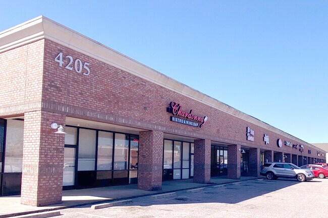
Property Record
4205 Hacks Cross Rd, Memphis, TN 38125
NEARBY LISTINGS FOR SALE OR LEASE
Property Detail
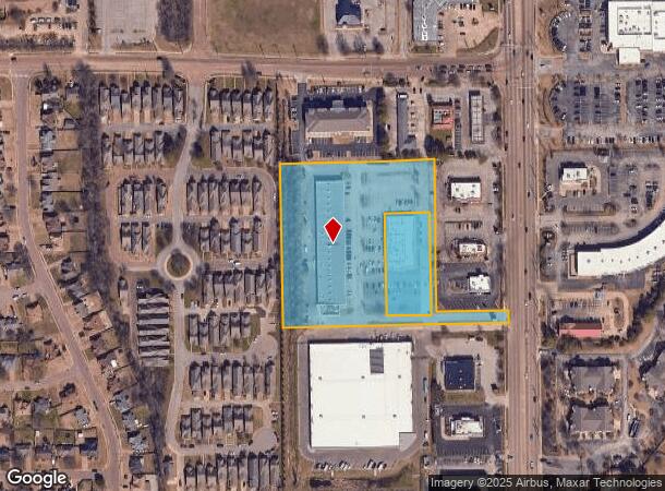
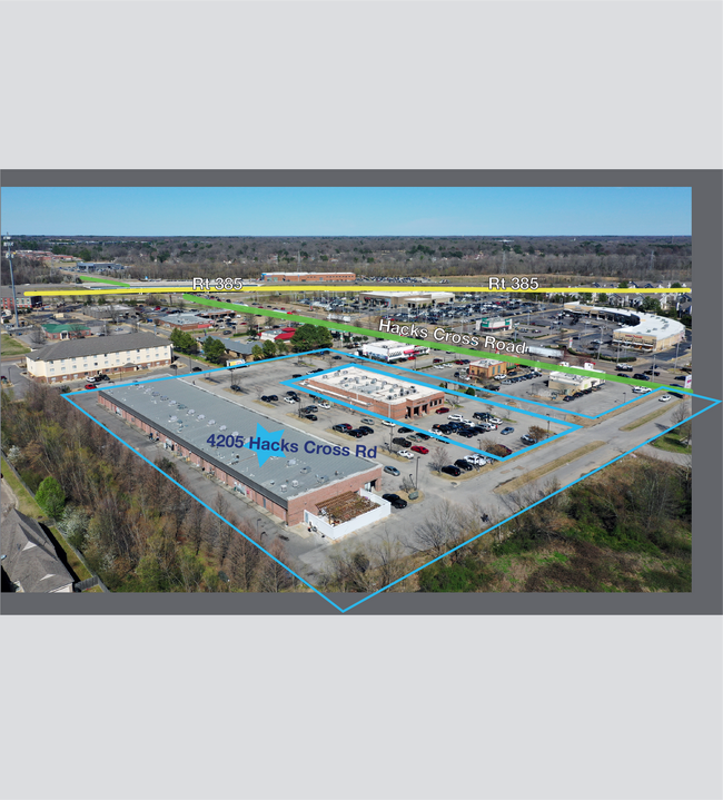
4205 Hacks Cross Rd
D0-242-0-0452
Barry Farms Pd Amended Pt Of Par A Ph 8
Regionalshoppingcenterormallwithanchorstore
WS HACKS CROSS RD SEE MAP GRID# 208 D
X
Shelby
47157C0470F
Tennessee
2024
4.18 AC
2025
Southeast
021745
Memphis
25,631 SF
Memphis, TN-MS-AR
DEMOGRAPHICS near 4205 Hacks Cross Rd
1 Mile
3 Mile
5 Mile
2024 Total Population
10,912
66,721
155,986
2029 Population
10,638
64,987
153,643
Pop Growth 2024-2029
(2.51%)
(2.60%)
(1.50%)
Average Age
38
38
38
2024 Total Households
4,243
26,159
60,669
HH Growth 2024-2029
(2.62%)
(2.56%)
(1.48%)
Median Household Inc
$79,472
$75,199
$73,183
Avg Household Size
2.50
2.50
2.50
2024 Avg HH Vehicles
2.00
2.00
2.00
Median Home Value
$187,197
$217,581
$265,022
Median Year Built
1996
1991
1987
Nearby Places
Map Layers
Map Styles
 Street
 Aerial
- Restaurants
- Banks
- Shops
- Fitness
- Groceries
PUBLIC TRANSPORTATION
AIRPORT
Memphis International
DRIVE
WALK
Distance
Memphis International
26 min
12.2 mi
SALE & LEASE HISTORY
LISTING DATE
SALE/LEASE

Jun 14, 2017
For Lease
Jun 10, 2020
For Sale
Jan 24, 2022
For Lease
Jan 05, 2018
For Lease
Apr 04, 2019
For Lease
Nearby Properties
Address
Land Use
TOTAL SIZE
Lot Size
Zoning
Address
Land Use
TOTAL SIZE
Lot Size
Zoning
73.56 AC
CA
Address
Land Use
TOTAL SIZE
Lot Size
Zoning
184,120 SF
11.11 AC
EMP
Address
Land Use
TOTAL SIZE
Lot Size
Zoning
56,237 SF
20.51 AC
CA
Address
Land Use
TOTAL SIZE
Lot Size
Zoning
55,888 SF
44.01 AC
CA
Address
Land Use
TOTAL SIZE
Lot Size
Zoning
160,832 SF
19.89 AC
CA
Address
Land Use
TOTAL SIZE
Lot Size
Zoning
164,074 SF
14.18 AC
CA
Address
Land Use
TOTAL SIZE
Lot Size
Zoning
52,688 SF
24.38 AC
CA
Address
Land Use
TOTAL SIZE
Lot Size
Zoning
62,013 SF
20 AC
CA
Address
Land Use
TOTAL SIZE
Lot Size
Zoning
251,597 SF
26.90 AC
EMP
Address
Land Use
TOTAL SIZE
Lot Size
Zoning
117,381 SF
27.16 AC
RU-2
Address
Land Use
TOTAL SIZE
Lot Size
Zoning
67,052 SF
21.65 AC
R-15
Address
Land Use
TOTAL SIZE
Lot Size
Zoning
38,566 SF
27.90 AC
CA
Address
Land Use
TOTAL SIZE
Lot Size
Zoning
64,994 SF
19.07 AC
RU-2
Address
Land Use
TOTAL SIZE
Lot Size
Zoning
70,038 SF
17.95 AC
CA
Address
Land Use
TOTAL SIZE
Lot Size
Zoning
48,768 SF
7.51 AC
R-8
Address
Land Use
TOTAL SIZE
Lot Size
Zoning
95,023 SF
33.86 AC
O-51
Address
Land Use
TOTAL SIZE
Lot Size
Zoning
142,971 SF
29.84 AC
R-15
Address
Land Use
TOTAL SIZE
Lot Size
Zoning
813,591 SF
37.02 AC
EMP
Address
Land Use
TOTAL SIZE
Lot Size
Zoning
10,128 SF
23.35 AC
CA
Address
Land Use
TOTAL SIZE
Lot Size
Zoning
71,363 SF
10 AC
R-T
Address
Land Use
TOTAL SIZE
Lot Size
Zoning
107,938 SF
9.16 AC
CA
Address
Land Use
TOTAL SIZE
Lot Size
Zoning
113,990 SF
9.07 AC
R-15
Address
Land Use
TOTAL SIZE
Lot Size
Zoning
88,484 SF
15.28 AC
RU-3
Address
Land Use
TOTAL SIZE
Lot Size
Zoning
35,001 SF
33.60 AC
R-10
Address
Land Use
TOTAL SIZE
Lot Size
Zoning
87,346 SF
15.02 AC
EMP
Address
Land Use
TOTAL SIZE
Lot Size
Zoning
216,086 SF
26.69 AC
R-15
Address
Land Use
TOTAL SIZE
Lot Size
Zoning
78,770 SF
18.67 AC
CA
Address
Land Use
TOTAL SIZE
Lot Size
Zoning
95,456 SF
21.96 AC
R-15
Address
Land Use
TOTAL SIZE
Lot Size
Zoning
58,227 SF
15.44 AC
R-15
Address
Land Use
TOTAL SIZE
Lot Size
Zoning
43,415 SF
6.84 AC
CA
The World's #1 Commercial Real Estate Marketplace
Connect with us
© 2025 CoStar Group
The information above has been obtained from sources believed reliable. While we do not doubt its accuracy we have not verified it and make no guarantee, warranty or representation about it. It is your responsibility to independently confirm its accuracy and completeness. Any projections, opinions, assumptions, or estimates used are for example only and do not represent the current or future performance of the property. The value of this transaction to you depends on tax and other factors which should be evaluated by your tax, financial, and legal advisors. You and your advisors should conduct a careful, independent investigation of the property to determine to your satisfaction the suitability of the property for your needs.