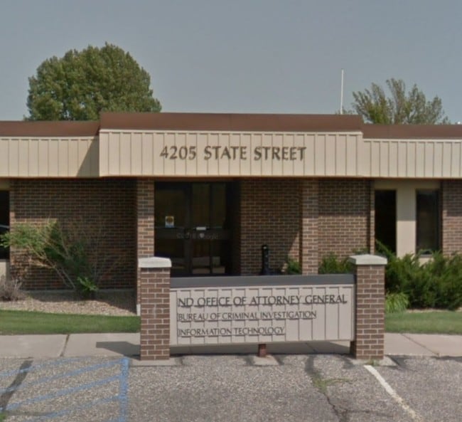
Property Record
4205 State St, Bismarck, ND 58503


Property Detail
4205 State St
1625-001-050
CAPITAL ELEC HEADQUARTERS LOT 2
Officebuilding
Burleigh
CG
North Dakota
B and X Area of moderate flood hazard, usually the area between the limits of the 100-year and 500-year floods.
2
2025
1.60 AC
2025
North Bismarck
011001
Other Market Areas
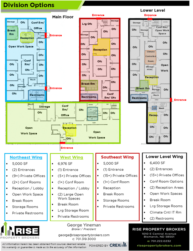
16,976 SF
Bismarck, ND
NEARBY LISTINGS FOR SALE OR LEASE
-
-
View all Bismarck listings for lease on LoopNet.com
DEMOGRAPHICS near 4205 State St
1 mile
3 mile
5 mile
2025 Total Population
8,360
53,074
85,180
2030 Population
8,645
54,745
87,988
Pop Growth 2025-2030
+ 3.41%
+ 3.15%
+ 3.30%
Average Age
42
41
41
2025 Total Households
3,673
22,467
35,819
HH Growth 2025-2030
+ 3.65%
+ 3.50%
+ 3.60%
Median Household Inc
$84,801
$89,251
$84,897
Avg Household Size
2.20
2.30
2.20
2025 Avg HH Vehicles
2.00
2.00
2.00
Median Home Value
$343,504
$309,483
$307,694
Median Year Built
2005
1990
1987
Nearby Places
Map Layers
Map Styles
 Street
 Aerial
Layers
 Traffic
 Biking
Places
Listings with unknown addresses are not visible on the map
- Restaurants
- Banks
- Shops
- Fitness
- Groceries
SALE & LEASE HISTORY
LISTING DATE
SALE/LEASE

May 03, 2021
For Sale
Jan 17, 2022
For Lease
Nearby Properties
Address
Land Use
TOTAL SIZE
Lot Size
Zoning
Address
Land Use
TOTAL SIZE
Lot Size
Zoning
13.47 AC
PUD
Address
Land Use
TOTAL SIZE
Lot Size
Zoning
28.06 AC
CG
Address
Land Use
TOTAL SIZE
Lot Size
Zoning
76,233 SF
14.71 AC
RM20
Address
Land Use
TOTAL SIZE
Lot Size
Zoning
70,182 SF
3.83 AC
PUD
Address
Land Use
TOTAL SIZE
Lot Size
Zoning
18.70 AC
RM15
Address
Land Use
TOTAL SIZE
Lot Size
Zoning
27.48 AC
CG
Address
Land Use
TOTAL SIZE
Lot Size
Zoning
20.87 AC
CG
Address
Land Use
TOTAL SIZE
Lot Size
Zoning
7.67 AC
CG
Address
Land Use
TOTAL SIZE
Lot Size
Zoning
25,831 SF
17.10 AC
CG
Address
Land Use
TOTAL SIZE
Lot Size
Zoning
16.12 AC
CG
Address
Land Use
TOTAL SIZE
Lot Size
Zoning
81,092 SF
4.17 AC
HM
Address
Land Use
TOTAL SIZE
Lot Size
Zoning
15.90 AC
CG
Address
Land Use
TOTAL SIZE
Lot Size
Zoning
38,467 SF
13.89 AC
CG
Address
Land Use
TOTAL SIZE
Lot Size
Zoning
68,211 SF
10 AC
RT
Address
Land Use
TOTAL SIZE
Lot Size
Zoning
31,202 SF
9.05 AC
RM30
Address
Land Use
TOTAL SIZE
Lot Size
Zoning
27,639 SF
4.28 AC
RT
Address
Land Use
TOTAL SIZE
Lot Size
Zoning
7.83 AC
RM20
Address
Land Use
TOTAL SIZE
Lot Size
Zoning
38,275 SF
10.53 AC
RM30
Address
Land Use
TOTAL SIZE
Lot Size
Zoning
39,771 SF
9.65 AC
CG
Address
Land Use
TOTAL SIZE
Lot Size
Zoning
40,647 SF
2.67 AC
PUD
Address
Land Use
TOTAL SIZE
Lot Size
Zoning
11.48 AC
CG
Address
Land Use
TOTAL SIZE
Lot Size
Zoning
8,685 SF
12.51 AC
CG
Address
Land Use
TOTAL SIZE
Lot Size
Zoning
65,001 SF
9.88 AC
RT
Address
Land Use
TOTAL SIZE
Lot Size
Zoning
13.98 AC
CG
Address
Land Use
TOTAL SIZE
Lot Size
Zoning
52,718 SF
2.67 AC
RM15
Address
Land Use
TOTAL SIZE
Lot Size
Zoning
52,710 SF
7.13 AC
RM30
Address
Land Use
TOTAL SIZE
Lot Size
Zoning
77,694 SF
8.66 AC
RT
Address
Land Use
TOTAL SIZE
Lot Size
Zoning
7,560 SF
4.39 AC
PUD
Address
Land Use
TOTAL SIZE
Lot Size
Zoning
74,564 SF
6.67 AC
RT
Address
Land Use
TOTAL SIZE
Lot Size
Zoning
57,580 SF
8.85 AC
CG
The World's #1 Commercial Real Estate Marketplace
Connect with us
© 2026 CoStar Group
The information above has been obtained from sources believed reliable. While we do not doubt its accuracy we have not verified it and make no guarantee, warranty or representation about it. It is your responsibility to independently confirm its accuracy and completeness. Any projections, opinions, assumptions, or estimates used are for example only and do not represent the current or future performance of the property. The value of this transaction to you depends on tax and other factors which should be evaluated by your tax, financial, and legal advisors. You and your advisors should conduct a careful, independent investigation of the property to determine to your satisfaction the suitability of the property for your needs.