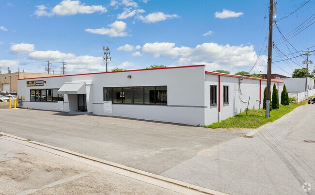
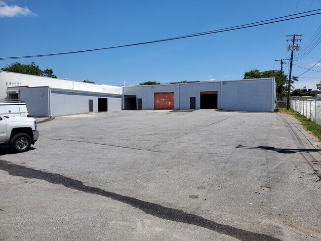
Property Record
4207 Menlo Dr, Baltimore, MD 21215

Current Lease Availabilities
Property Detail
4207 Menlo Dr
4416-008D
1.033 ACRES
Religious
Baltimore City
I-1
Maryland
B and X Area of moderate flood hazard, usually the area between the limits of the 100-year and 500-year floods.
8d
2024
1.03 AC
2025
Baltimore NW
280101
Baltimore
20,281 SF
Baltimore-Columbia-Towson, MD
NEARBY LISTINGS FOR SALE OR LEASE
DEMOGRAPHICS near 4207 Menlo Dr
1 mile
3 mile
5 mile
2025 Total Population
19,284
146,421
385,471
2030 Population
18,574
144,484
383,269
Pop Growth 2025-2030
(3.68%)
(1.32%)
(0.57%)
Average Age
43
42
41
2025 Total Households
8,081
59,847
157,184
HH Growth 2025-2030
(3.65%)
(1.45%)
(0.70%)
Median Household Inc
$49,937
$65,595
$66,178
Avg Household Size
2.30
2.40
2.30
2025 Avg HH Vehicles
1.00
1.00
1.00
Median Home Value
$241,881
$282,654
$284,177
Median Year Built
1955
1958
1956
Nearby Places
Map Layers
Map Styles
 Street
 Aerial
Layers
 Traffic
 Biking
Places
Listings with unknown addresses are not visible on the map
- Restaurants
- Banks
- Shops
- Fitness
- Groceries
PUBLIC TRANSPORTATION
TRANSIT/SUBWAY
Rogers Avenue (Metro Subway - Maryland Transit Administration Metro Subway (Baltimore Metro))
Drive
Walk
Distance
Rogers Avenue (Metro Subway - Maryland Transit Administration Metro Subway (Baltimore Metro))
4 min
18 min
0.9 mi
Reisterstown Plaza (Metro Subway - Maryland Transit Administration Metro Subway (Baltimore Metro))
Drive
Walk
Distance
Reisterstown Plaza (Metro Subway - Maryland Transit Administration Metro Subway (Baltimore Metro))
4 min
20 min
1.0 mi
COMMUTER RAIL
Drive
Walk
Distance
16 min
5.8 mi
Penn Station (Penn Line - Maryland Area Regional Commuter Trains (The MARC))
Drive
Walk
Distance
Penn Station (Penn Line - Maryland Area Regional Commuter Trains (The MARC))
16 min
6.9 mi
AIRPORT
Baltimore/Washington International Thurgood Marshall
Drive
Walk
Distance
Baltimore/Washington International Thurgood Marshall
31 min
14.9 mi
Ronald Reagan Washington Ntl
Drive
Walk
Distance
Ronald Reagan Washington Ntl
75 min
47.7 mi
Freight Ports
Port of Baltimore
Drive
Walk
Distance
Port of Baltimore
19 min
8.5 mi
Nearby Properties
Address
Land Use
TOTAL SIZE
Lot Size
Zoning
Address
Land Use
TOTAL SIZE
Lot Size
Zoning
941,727 SF
36.89 AC
TOD-3
Address
Land Use
TOTAL SIZE
Lot Size
Zoning
810,716 SF
28.88 AC
H
Address
Land Use
TOTAL SIZE
Lot Size
Zoning
34.99 AC
R-5
Address
Land Use
TOTAL SIZE
Lot Size
Zoning
117,000 SF
71.11 AC
EC-2
Address
Land Use
TOTAL SIZE
Lot Size
Zoning
507,813 SF
4.94 AC
TOD-2
Address
Land Use
TOTAL SIZE
Lot Size
Zoning
173,057 SF
17.22 AC
Address
Land Use
TOTAL SIZE
Lot Size
Zoning
33.46 AC
DR16
Address
Land Use
TOTAL SIZE
Lot Size
Zoning
27.30 AC
DR16
Address
Land Use
TOTAL SIZE
Lot Size
Zoning
29.11 AC
DR16
Address
Land Use
TOTAL SIZE
Lot Size
Zoning
27.75 AC
DR16
Address
Land Use
TOTAL SIZE
Lot Size
Zoning
814,033 SF
23.60 AC
OR-2
Address
Land Use
TOTAL SIZE
Lot Size
Zoning
117,680 SF
23.12 AC
H
Address
Land Use
TOTAL SIZE
Lot Size
Zoning
334,557 SF
52 AC
R-6
Address
Land Use
TOTAL SIZE
Lot Size
Zoning
24 AC
02
Address
Land Use
TOTAL SIZE
Lot Size
Zoning
13.26 AC
EC-2
Address
Land Use
TOTAL SIZE
Lot Size
Zoning
289,194 SF
19.57 AC
H
Address
Land Use
TOTAL SIZE
Lot Size
Zoning
325,851 SF
19 AC
EC-2
Address
Land Use
TOTAL SIZE
Lot Size
Zoning
3,032 SF
87 SF
H
Address
Land Use
TOTAL SIZE
Lot Size
Zoning
293,603 SF
13.54 AC
R-1-C
Address
Land Use
TOTAL SIZE
Lot Size
Zoning
316,150 SF
14.28 AC
R-6
Address
Land Use
TOTAL SIZE
Lot Size
Zoning
14.41 AC
Address
Land Use
TOTAL SIZE
Lot Size
Zoning
182,160 SF
23.55 AC
Address
Land Use
TOTAL SIZE
Lot Size
Zoning
330,025 SF
13.16 AC
R-3
Address
Land Use
TOTAL SIZE
Lot Size
Zoning
Address
Land Use
TOTAL SIZE
Lot Size
Zoning
190,243 SF
3.28 AC
R-9
Address
Land Use
TOTAL SIZE
Lot Size
Zoning
5.64 AC
R-8
Address
Land Use
TOTAL SIZE
Lot Size
Zoning
8.76 AC
RAE1
Address
Land Use
TOTAL SIZE
Lot Size
Zoning
162,386 SF
30.68 AC
DR5.5
Address
Land Use
TOTAL SIZE
Lot Size
Zoning
180,274 SF
46 AC
DR5.5
Address
Land Use
TOTAL SIZE
Lot Size
Zoning
12.06 AC
DR16
The World's #1 Commercial Real Estate Marketplace
Connect with us
© 2026 CoStar Group
The information above has been obtained from sources believed reliable. While we do not doubt its accuracy we have not verified it and make no guarantee, warranty or representation about it. It is your responsibility to independently confirm its accuracy and completeness. Any projections, opinions, assumptions, or estimates used are for example only and do not represent the current or future performance of the property. The value of this transaction to you depends on tax and other factors which should be evaluated by your tax, financial, and legal advisors. You and your advisors should conduct a careful, independent investigation of the property to determine to your satisfaction the suitability of the property for your needs.