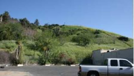
Property Record
4208 Huntington Dr S, Los Angeles, CA 90032


NEARBY LISTINGS FOR SALE OR LEASE
Property Detail
4208 Huntington Dr S
Los Angeles-Long Beach-Glendale, CA
Omaha Heights
5214-001-002
OMAHA HEIGHTS EX OF ST LOT 4 AND EX OF ST SW 1.61 ACS OF LOT 5
Multifamilydwelling
Los Angeles
X
California
06037C1629F
4,5
2024
5.26 AC
2025
Glendale
201401
Los Angeles
72,598 SF
DEMOGRAPHICS near 4208 Huntington Dr S
1 Mile
3 Mile
5 Mile
2024 Total Population
25,020
266,723
790,775
2029 Population
24,195
257,075
764,385
Pop Growth 2024-2029
(3.30%)
(3.62%)
(3.34%)
Average Age
39
39
40
2024 Total Households
7,562
83,440
281,253
HH Growth 2024-2029
(3.58%)
(3.90%)
(3.32%)
Median Household Inc
$65,594
$70,054
$71,091
Avg Household Size
3.10
3.00
2.60
2024 Avg HH Vehicles
2.00
2.00
2.00
Median Home Value
$750,463
$774,105
$823,651
Median Year Built
1952
1951
1957
Nearby Places
Map Layers
Map Styles
 Street
 Aerial
- Restaurants
- Banks
- Shops
- Fitness
- Groceries
PUBLIC TRANSPORTATION
COMMUTER RAIL
Union Station (91 Line - Southern California Regional Rail Authority (Metrolink), Antelope Valley Line - Southern California Regional Rail Authority (Metrolink), Orange County Line - Southern California Regional Rail Authority (Metrolink), Riverside Line - Southern California Regional Rail Authority (Metrolink), San Bernardino Line - Southern California Regional Rail Authority (Metrolink), Ventura County Line - Southern California Regional Rail Authority (Metrolink))
DRIVE
WALK
Distance
Union Station (91 Line - Southern California Regional Rail Authority (Metrolink), Antelope Valley Line - Southern California Regional Rail Authority (Metrolink), Orange County Line - Southern California Regional Rail Authority (Metrolink), Riverside Line - Southern California Regional Rail Authority (Metrolink), San Bernardino Line - Southern California Regional Rail Authority (Metrolink), Ventura County Line - Southern California Regional Rail Authority (Metrolink))
11 min
3.7 mi
DRIVE
WALK
Distance
9 min
3.8 mi
AIRPORT
Bob Hope
DRIVE
WALK
Distance
Bob Hope
27 min
17.0 mi
Los Angeles International
DRIVE
WALK
Distance
Los Angeles International
35 min
20.8 mi
Long Beach (Daugherty Field)
DRIVE
WALK
Distance
Long Beach (Daugherty Field)
36 min
23.9 mi
Freight Ports
Port of Long Beach
DRIVE
WALK
Distance
Port of Long Beach
39 min
25.8 mi
Nearby Properties
Address
Land Use
TOTAL SIZE
Lot Size
Zoning
Address
Land Use
TOTAL SIZE
Lot Size
Zoning
816,046 SF
15.37 AC
LAA1
Address
Land Use
TOTAL SIZE
Lot Size
Zoning
635,233 SF
12.02 AC
LAR5
Address
Land Use
TOTAL SIZE
Lot Size
Zoning
513,825 SF
4.28 AC
LAC2
Address
Land Use
TOTAL SIZE
Lot Size
Zoning
534,225 SF
Address
Land Use
TOTAL SIZE
Lot Size
Zoning
460,590 SF
23.95 AC
ALMPD*
Address
Land Use
TOTAL SIZE
Lot Size
Zoning
175.69 AC
LAA1
Address
Land Use
TOTAL SIZE
Lot Size
Zoning
328,737 SF
7.92 AC
LAC2
Address
Land Use
TOTAL SIZE
Lot Size
Zoning
642,160 SF
8.26 AC
LAADP
Address
Land Use
TOTAL SIZE
Lot Size
Zoning
368,058 SF
2.65 AC
LAUC (CA)
Address
Land Use
TOTAL SIZE
Lot Size
Zoning
354,299 SF
2.18 AC
LAC2
Address
Land Use
TOTAL SIZE
Lot Size
Zoning
150,608 SF
0.88 AC
LAC2
Address
Land Use
TOTAL SIZE
Lot Size
Zoning
119,455 SF
5.04 AC
LACM
Address
Land Use
TOTAL SIZE
Lot Size
Zoning
252,559 SF
2.87 AC
LAC2
Address
Land Use
TOTAL SIZE
Lot Size
Zoning
195,526 SF
2.81 AC
LAADP
Address
Land Use
TOTAL SIZE
Lot Size
Zoning
329,063 SF
0.23 AC
LAC2
Address
Land Use
TOTAL SIZE
Lot Size
Zoning
172,072 SF
1.82 AC
LAC2
Address
Land Use
TOTAL SIZE
Lot Size
Zoning
75,589 SF
0.98 AC
LAC2
Address
Land Use
TOTAL SIZE
Lot Size
Zoning
198,958 SF
7.50 AC
LCM2*
Address
Land Use
TOTAL SIZE
Lot Size
Zoning
1,086,660 SF
26.15 AC
LAM3
Address
Land Use
TOTAL SIZE
Lot Size
Zoning
116,109 SF
0.92 AC
LACM
Address
Land Use
TOTAL SIZE
Lot Size
Zoning
22,584 SF
62.57 AC
LAA1
Address
Land Use
TOTAL SIZE
Lot Size
Zoning
116,480 SF
11.81 AC
MPC2
Address
Land Use
TOTAL SIZE
Lot Size
Zoning
66,557 SF
1.53 AC
LAUV(CA)
Address
Land Use
TOTAL SIZE
Lot Size
Zoning
77,778 SF
2.87 AC
ALRPD*
Address
Land Use
TOTAL SIZE
Lot Size
Zoning
213,960 SF
1.83 AC
LAUC(CA)
Address
Land Use
TOTAL SIZE
Lot Size
Zoning
188,634 SF
1.07 AC
LAUI(CA)
Address
Land Use
TOTAL SIZE
Lot Size
Zoning
90,017 SF
2.42 AC
LAC2
Address
Land Use
TOTAL SIZE
Lot Size
Zoning
296,309 SF
5.29 AC
LAM1
Address
Land Use
TOTAL SIZE
Lot Size
Zoning
146,264 SF
1.87 AC
LAMR1
Address
Land Use
TOTAL SIZE
Lot Size
Zoning
32 AC
LAGW(CA)
The World's #1 Commercial Real Estate Marketplace
Connect with us
© 2026 CoStar Group
The information above has been obtained from sources believed reliable. While we do not doubt its accuracy we have not verified it and make no guarantee, warranty or representation about it. It is your responsibility to independently confirm its accuracy and completeness. Any projections, opinions, assumptions, or estimates used are for example only and do not represent the current or future performance of the property. The value of this transaction to you depends on tax and other factors which should be evaluated by your tax, financial, and legal advisors. You and your advisors should conduct a careful, independent investigation of the property to determine to your satisfaction the suitability of the property for your needs.