Property Record
4209 Burlington Rd, Greensboro, NC 27405

This Property Is For Sale
NEARBY LISTINGS FOR SALE OR LEASE
Property Detail
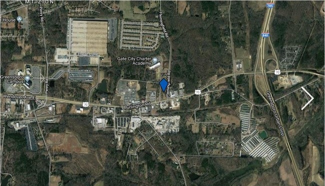
4209 Burlington Rd
Greensboro-High Point, NC
Elsie B Lee
0115247
PT 28&37 PB11-92 ELSIE B LEE
Commercialnec
Guilford
X
North Carolina
3710789500J
28,37
2024
1.95 AC
2025
NE Guilford County
012803
Greensboro/Winston-Salem
6,894 SF
DEMOGRAPHICS near 4209 Burlington Rd
1 Mile
3 Mile
5 Mile
2024 Total Population
1,449
27,952
96,536
2029 Population
1,449
27,955
97,034
Pop Growth 2024-2029
0.00%
+ 0.01%
+ 0.52%
Average Age
35
37
37
2024 Total Households
532
10,540
36,346
HH Growth 2024-2029
0.00%
+ 0.04%
+ 0.63%
Median Household Inc
$47,388
$42,624
$44,762
Avg Household Size
2.60
2.50
2.40
2024 Avg HH Vehicles
2.00
2.00
2.00
Median Home Value
$152,547
$137,889
$151,741
Median Year Built
1981
1977
1977
Nearby Places
Map Layers
Map Styles
 Street
 Aerial
- Restaurants
- Banks
- Shops
- Fitness
- Groceries
PUBLIC TRANSPORTATION
COMMUTER RAIL
Greensboro Station (Piedmont - North Carolina by Train (NC Train))
DRIVE
WALK
Distance
Greensboro Station (Piedmont - North Carolina by Train (NC Train))
8 min
5.4 mi
AIRPORT
Piedmont Triad International
DRIVE
WALK
Distance
Piedmont Triad International
27 min
16.3 mi
Freight Ports
Virginia Port Authority - Richmond
DRIVE
WALK
Distance
Virginia Port Authority - Richmond
222 min
193.9 mi
Nearby Properties
Address
Land Use
TOTAL SIZE
Lot Size
Zoning
Address
Land Use
TOTAL SIZE
Lot Size
Zoning
2,340,205 SF
338.69 AC
LI
Address
Land Use
TOTAL SIZE
Lot Size
Zoning
1,546,815 SF
93.94 AC
CU-LI
Address
Land Use
TOTAL SIZE
Lot Size
Zoning
313,033 SF
71.38 AC
O
Address
Land Use
TOTAL SIZE
Lot Size
Zoning
364,783 SF
30.12 AC
RM-18
Address
Land Use
TOTAL SIZE
Lot Size
Zoning
418,596 SF
23.53 AC
LI
Address
Land Use
TOTAL SIZE
Lot Size
Zoning
224,444 SF
80.09 AC
PI
Address
Land Use
TOTAL SIZE
Lot Size
Zoning
275,282 SF
43.43 AC
PI
Address
Land Use
TOTAL SIZE
Lot Size
Zoning
505,615 SF
39.50 AC
LI
Address
Land Use
TOTAL SIZE
Lot Size
Zoning
344,972 SF
65.45 AC
LI
Address
Land Use
TOTAL SIZE
Lot Size
Zoning
293,760 SF
21.94 AC
LI
Address
Land Use
TOTAL SIZE
Lot Size
Zoning
363,920 SF
34.27 AC
LI
Address
Land Use
TOTAL SIZE
Lot Size
Zoning
112,050 SF
9.24 AC
LI
Address
Land Use
TOTAL SIZE
Lot Size
Zoning
419,126 SF
33.68 AC
LI
Address
Land Use
TOTAL SIZE
Lot Size
Zoning
240,170 SF
14.01 AC
LI
Address
Land Use
TOTAL SIZE
Lot Size
Zoning
301,592 SF
19.38 AC
LI
Address
Land Use
TOTAL SIZE
Lot Size
Zoning
238,315 SF
19.63 AC
RM-12
Address
Land Use
TOTAL SIZE
Lot Size
Zoning
214,583 SF
20.64 AC
C-H
Address
Land Use
TOTAL SIZE
Lot Size
Zoning
109,948 SF
392.35 AC
HI
Address
Land Use
TOTAL SIZE
Lot Size
Zoning
128,500 SF
14.15 AC
LI
Address
Land Use
TOTAL SIZE
Lot Size
Zoning
1,097,293 SF
73.53 AC
HI
Address
Land Use
TOTAL SIZE
Lot Size
Zoning
204,260 SF
11.83 AC
RM-18
Address
Land Use
TOTAL SIZE
Lot Size
Zoning
152,857 SF
11.58 AC
RM-18
Address
Land Use
TOTAL SIZE
Lot Size
Zoning
153,900 SF
14.23 AC
LI
Address
Land Use
TOTAL SIZE
Lot Size
Zoning
67,872 SF
9.94 AC
GO-M
Address
Land Use
TOTAL SIZE
Lot Size
Zoning
83,057 SF
10.24 AC
R-3
Address
Land Use
TOTAL SIZE
Lot Size
Zoning
86,872 SF
8.50 AC
PI
Address
Land Use
TOTAL SIZE
Lot Size
Zoning
6,910 SF
173.96 AC
HI
Address
Land Use
TOTAL SIZE
Lot Size
Zoning
46,528 SF
38.51 AC
LI
Address
Land Use
TOTAL SIZE
Lot Size
Zoning
100,000 SF
8.70 AC
LI
Address
Land Use
TOTAL SIZE
Lot Size
Zoning
167,812 SF
16.59 AC
RM-12
The World's #1 Commercial Real Estate Marketplace
Connect with us
© 2025 CoStar Group
The information above has been obtained from sources believed reliable. While we do not doubt its accuracy we have not verified it and make no guarantee, warranty or representation about it. It is your responsibility to independently confirm its accuracy and completeness. Any projections, opinions, assumptions, or estimates used are for example only and do not represent the current or future performance of the property. The value of this transaction to you depends on tax and other factors which should be evaluated by your tax, financial, and legal advisors. You and your advisors should conduct a careful, independent investigation of the property to determine to your satisfaction the suitability of the property for your needs.