Property Record
421 Breaden Dr, Monroe, OH 45050


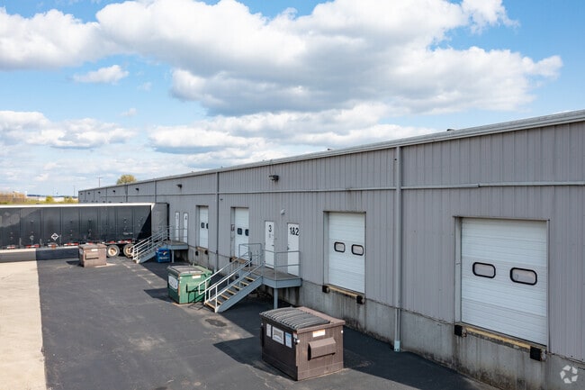
Property Detail
421 Breaden Dr
Cincinnati, OH-KY-IN
3100 ENT
C1800-009-000-074
Butler
Warehouse
Ohio
B and X Area of moderate flood hazard, usually the area between the limits of the 100-year and 500-year floods.
333
2024
3.43 AC
2025
Monroe/Middletown
011200
Cincinnati/Dayton
39,850 SF
NEARBY LISTINGS FOR SALE OR LEASE
DEMOGRAPHICS near 421 Breaden Dr
1 mile
3 mile
5 mile
2025 Total Population
3,567
19,654
86,258
2030 Population
3,586
20,136
89,302
Pop Growth 2025-2030
+ 0.53%
+ 2.45%
+ 3.53%
Average Age
37
39
39
2025 Total Households
1,280
6,092
30,668
HH Growth 2025-2030
+ 0.55%
+ 2.72%
+ 3.67%
Median Household Inc
$119,435
$117,010
$100,372
Avg Household Size
2.80
2.80
2.70
2025 Avg HH Vehicles
2.00
2.00
2.00
Median Home Value
$299,461
$362,529
$361,597
Median Year Built
1997
1999
1994
Nearby Places
Map Layers
Map Styles
 Street
 Aerial
Layers
 Traffic
 Biking
Places
Listings with unknown addresses are not visible on the map
- Restaurants
- Banks
- Shops
- Fitness
- Groceries
PUBLIC TRANSPORTATION
AIRPORT
James M Cox Dayton International
Drive
Walk
Distance
James M Cox Dayton International
51 min
38.1 mi
Cincinnati/Northern Kentucky International
Drive
Walk
Distance
Cincinnati/Northern Kentucky International
63 min
42.4 mi
SALE & LEASE HISTORY
LISTING DATE
SALE/LEASE

Oct 12, 2023
For Lease
May 10, 2017
For Lease
Jan 04, 2019
For Lease
Feb 17, 2021
For Lease
Feb 01, 2023
For Lease
Nearby Properties
Address
Land Use
TOTAL SIZE
Lot Size
Zoning
Address
Land Use
TOTAL SIZE
Lot Size
Zoning
198,204 SF
360 AC
Address
Land Use
TOTAL SIZE
Lot Size
Zoning
140,607 SF
314.07 AC
Address
Land Use
TOTAL SIZE
Lot Size
Zoning
258.67 AC
Address
Land Use
TOTAL SIZE
Lot Size
Zoning
40.93 AC
Address
Land Use
TOTAL SIZE
Lot Size
Zoning
130.58 AC
Address
Land Use
TOTAL SIZE
Lot Size
Zoning
157.32 AC
Address
Land Use
TOTAL SIZE
Lot Size
Zoning
369,922 SF
28.10 AC
Address
Land Use
TOTAL SIZE
Lot Size
Zoning
67.56 AC
Address
Land Use
TOTAL SIZE
Lot Size
Zoning
1,380,095 SF
47.11 AC
Address
Land Use
TOTAL SIZE
Lot Size
Zoning
112.09 AC
Address
Land Use
TOTAL SIZE
Lot Size
Zoning
3,956 SF
186.57 AC
Address
Land Use
TOTAL SIZE
Lot Size
Zoning
99.22 AC
Address
Land Use
TOTAL SIZE
Lot Size
Zoning
542,679 SF
24.92 AC
Address
Land Use
TOTAL SIZE
Lot Size
Zoning
369,922 SF
28.10 AC
Address
Land Use
TOTAL SIZE
Lot Size
Zoning
201,476 SF
22.21 AC
Address
Land Use
TOTAL SIZE
Lot Size
Zoning
478,217 SF
61.13 AC
Address
Land Use
TOTAL SIZE
Lot Size
Zoning
612,886 SF
30.51 AC
Address
Land Use
TOTAL SIZE
Lot Size
Zoning
148,762 SF
5.01 AC
Address
Land Use
TOTAL SIZE
Lot Size
Zoning
46.86 AC
Address
Land Use
TOTAL SIZE
Lot Size
Zoning
93,038 SF
25.80 AC
Address
Land Use
TOTAL SIZE
Lot Size
Zoning
36.40 AC
Address
Land Use
TOTAL SIZE
Lot Size
Zoning
485,080 SF
15.10 AC
Address
Land Use
TOTAL SIZE
Lot Size
Zoning
142,005 SF
12.06 AC
Address
Land Use
TOTAL SIZE
Lot Size
Zoning
34 AC
Address
Land Use
TOTAL SIZE
Lot Size
Zoning
97,550 SF
44 AC
Address
Land Use
TOTAL SIZE
Lot Size
Zoning
6.04 AC
Address
Land Use
TOTAL SIZE
Lot Size
Zoning
73,178 SF
5.12 AC
Address
Land Use
TOTAL SIZE
Lot Size
Zoning
Address
Land Use
TOTAL SIZE
Lot Size
Zoning
1.48 AC
Address
Land Use
TOTAL SIZE
Lot Size
Zoning
71,525 SF
6.87 AC
The World's #1 Commercial Real Estate Marketplace
Connect with us
© 2026 CoStar Group
The information above has been obtained from sources believed reliable. While we do not doubt its accuracy we have not verified it and make no guarantee, warranty or representation about it. It is your responsibility to independently confirm its accuracy and completeness. Any projections, opinions, assumptions, or estimates used are for example only and do not represent the current or future performance of the property. The value of this transaction to you depends on tax and other factors which should be evaluated by your tax, financial, and legal advisors. You and your advisors should conduct a careful, independent investigation of the property to determine to your satisfaction the suitability of the property for your needs.