Property Record
421 Clanton Rd, Charlotte, NC 28217


NEARBY LISTINGS FOR SALE OR LEASE
-
-
View all Charlotte listings for sale on LoopNet.com
Property Detail
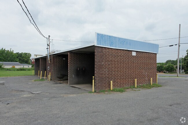
421 Clanton Rd
145-133-02
P1&2 B9 M4-261
Commercialnec
Mecklenburg
X
North Carolina
3710453300K
2
2022
2.15 AC
2025
Midtown/Southend
003802
Charlotte
6,841 SF
Charlotte-Concord-Gastonia, NC-SC
DEMOGRAPHICS near 421 Clanton Rd
1 Mile
3 Mile
5 Mile
2024 Total Population
11,338
99,265
250,314
2029 Population
12,105
106,115
267,272
Pop Growth 2024-2029
+ 6.76%
+ 6.90%
+ 6.77%
Average Age
35
36
36
2024 Total Households
5,707
49,792
116,456
HH Growth 2024-2029
+ 6.82%
+ 7.09%
+ 6.94%
Median Household Inc
$65,034
$79,576
$73,287
Avg Household Size
2.00
1.90
2.10
2024 Avg HH Vehicles
1.00
1.00
2.00
Median Home Value
$412,903
$459,407
$425,474
Median Year Built
1999
2000
1994
Nearby Places
Map Layers
Map Styles
 Street
 Aerial
- Restaurants
- Banks
- Shops
- Fitness
- Groceries
PUBLIC TRANSPORTATION
COMMUTER RAIL
DRIVE
WALK
Distance
9 min
4.6 mi
AIRPORT
Charlotte/Douglas International
DRIVE
WALK
Distance
Charlotte/Douglas International
14 min
6.0 mi
Concord-Padgett Regional
DRIVE
WALK
Distance
Concord-Padgett Regional
29 min
19.3 mi
Nearby Properties
Address
Land Use
TOTAL SIZE
Lot Size
Zoning
Address
Land Use
TOTAL SIZE
Lot Size
Zoning
3,286,640 SF
55.70 AC
O6CD
Address
Land Use
TOTAL SIZE
Lot Size
Zoning
1,652,470 SF
10.96 AC
UMUD
Address
Land Use
TOTAL SIZE
Lot Size
Zoning
780,000 SF
7.69 AC
UMUD-O
Address
Land Use
TOTAL SIZE
Lot Size
Zoning
1,498,190 SF
2.09 AC
UMUD
Address
Land Use
TOTAL SIZE
Lot Size
Zoning
1,483,634 SF
1.49 AC
Address
Land Use
TOTAL SIZE
Lot Size
Zoning
1,097,857 SF
2.40 AC
UMUDO
Address
Land Use
TOTAL SIZE
Lot Size
Zoning
1,752,744 SF
3.20 AC
UMUDO
Address
Land Use
TOTAL SIZE
Lot Size
Zoning
1,266,700 SF
2.98 AC
Address
Land Use
TOTAL SIZE
Lot Size
Zoning
1,325,933 SF
34.09 AC
Address
Land Use
TOTAL SIZE
Lot Size
Zoning
925,808 SF
1.84 AC
UMUD-O
Address
Land Use
TOTAL SIZE
Lot Size
Zoning
1,435,616 SF
33.78 AC
UMUD
Address
Land Use
TOTAL SIZE
Lot Size
Zoning
1,250,926 SF
4.89 AC
I2
Address
Land Use
TOTAL SIZE
Lot Size
Zoning
582,357 SF
1.13 AC
MUDD-O
Address
Land Use
TOTAL SIZE
Lot Size
Zoning
865,160 SF
2.80 AC
UMUD
Address
Land Use
TOTAL SIZE
Lot Size
Zoning
839,976 SF
1.62 AC
UMUD
Address
Land Use
TOTAL SIZE
Lot Size
Zoning
894,108 SF
4.52 AC
UMUDO
Address
Land Use
TOTAL SIZE
Lot Size
Zoning
696,527 SF
1.96 AC
UMUDO
Address
Land Use
TOTAL SIZE
Lot Size
Zoning
1,025,674 SF
3.43 AC
UMUD
Address
Land Use
TOTAL SIZE
Lot Size
Zoning
916,725 SF
2.35 AC
UMUD
Address
Land Use
TOTAL SIZE
Lot Size
Zoning
626,053 SF
2.77 AC
I2
Address
Land Use
TOTAL SIZE
Lot Size
Zoning
944,863 SF
3.58 AC
UMUD
Address
Land Use
TOTAL SIZE
Lot Size
Zoning
416,225 SF
0.64 AC
Address
Land Use
TOTAL SIZE
Lot Size
Zoning
645,212 SF
3.76 AC
UMUD
Address
Land Use
TOTAL SIZE
Lot Size
Zoning
588,300 SF
1.45 AC
Address
Land Use
TOTAL SIZE
Lot Size
Zoning
680,348 SF
0.94 AC
Address
Land Use
TOTAL SIZE
Lot Size
Zoning
768,780 SF
6.84 AC
UMUDO
Address
Land Use
TOTAL SIZE
Lot Size
Zoning
766,215 SF
1.17 AC
UMUD
Address
Land Use
TOTAL SIZE
Lot Size
Zoning
743,550 SF
4.69 AC
I2
Address
Land Use
TOTAL SIZE
Lot Size
Zoning
471,602 SF
1.82 AC
UMUD
Address
Land Use
TOTAL SIZE
Lot Size
Zoning
505,747 SF
3.87 AC
The World's #1 Commercial Real Estate Marketplace
Connect with us
© 2026 CoStar Group
The information above has been obtained from sources believed reliable. While we do not doubt its accuracy we have not verified it and make no guarantee, warranty or representation about it. It is your responsibility to independently confirm its accuracy and completeness. Any projections, opinions, assumptions, or estimates used are for example only and do not represent the current or future performance of the property. The value of this transaction to you depends on tax and other factors which should be evaluated by your tax, financial, and legal advisors. You and your advisors should conduct a careful, independent investigation of the property to determine to your satisfaction the suitability of the property for your needs.