Property Record
421 W 112Th Ave, Northglenn, CO 80234

Property Detail
421 W 112Th Ave
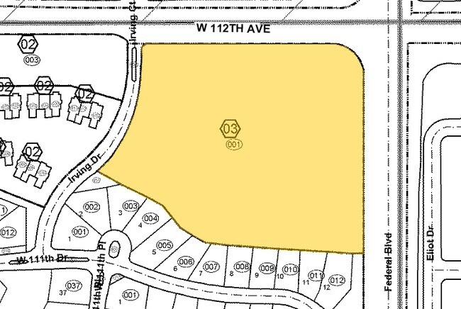
1719-03-0-00-005
SECT,TWN,RNG:3-2-68 DESC: BEG AT SE COR SW4 SW4 SEC 3/2/68 TH N 383/73 FT TH S 82D 43M W 231/42 FT TO PT OF CURVE TO THE LEFT SD CURVE HAV A DELTA OF 34D 39M A RAD OF 346/78 FT AND A CHD WHICH BRS S 65D 24M W 206/54 FT TH ALG THE ARC OF SD CURVE 209/
Municipalproperty
Adams
B and X Area of moderate flood hazard, usually the area between the limits of the 100-year and 500-year floods.
Colorado
0
3.43 AC
2025
North Denver
009323
Denver
4,970 SF
Denver-Aurora-Centennial, CO
NEARBY LISTINGS FOR SALE OR LEASE
DEMOGRAPHICS near 421 W 112Th Ave
1 mile
3 mile
5 mile
2025 Total Population
18,453
147,228
345,496
2030 Population
19,055
152,063
356,228
Pop Growth 2025-2030
+ 3.26%
+ 3.28%
+ 3.11%
Average Age
37
38
38
2025 Total Households
7,389
55,356
125,592
HH Growth 2025-2030
+ 3.44%
+ 3.59%
+ 3.40%
Median Household Inc
$74,186
$90,564
$99,119
Avg Household Size
2.40
2.60
2.70
2025 Avg HH Vehicles
2.00
2.00
2.00
Median Home Value
$462,221
$476,114
$496,346
Median Year Built
1978
1991
1990
Nearby Places
Map Layers
Map Styles
 Street
 Aerial
Transit
 Traffic
 Biking
Places
Listings with unknown addresses are not visible on the map
- Restaurants
- Banks
- Shops
- Fitness
- Groceries
PUBLIC TRANSPORTATION
COMMUTER RAIL
Drive
Walk
Distance
10 min
3.9 mi
Drive
Walk
Distance
11 min
4.0 mi
AIRPORT
Denver International
Drive
Walk
Distance
Denver International
38 min
23.0 mi
Nearby Properties
Address
Land Use
TOTAL SIZE
Lot Size
Zoning
Address
Land Use
TOTAL SIZE
Lot Size
Zoning
21,306 SF
2.43 AC
Address
Land Use
TOTAL SIZE
Lot Size
Zoning
332,908 SF
10.49 AC
Address
Land Use
TOTAL SIZE
Lot Size
Zoning
271,631 SF
12.84 AC
Address
Land Use
TOTAL SIZE
Lot Size
Zoning
216,285 SF
6 AC
Address
Land Use
TOTAL SIZE
Lot Size
Zoning
140,430 SF
8.39 AC
Address
Land Use
TOTAL SIZE
Lot Size
Zoning
1,031,000 SF
31.98 AC
Address
Land Use
TOTAL SIZE
Lot Size
Zoning
154,914 SF
11.39 AC
Address
Land Use
TOTAL SIZE
Lot Size
Zoning
424,498 SF
42.85 AC
Address
Land Use
TOTAL SIZE
Lot Size
Zoning
261,540 SF
19.23 AC
Address
Land Use
TOTAL SIZE
Lot Size
Zoning
79,636 SF
4.91 AC
Address
Land Use
TOTAL SIZE
Lot Size
Zoning
539,891 SF
30.35 AC
Address
Land Use
TOTAL SIZE
Lot Size
Zoning
506,255 SF
19.10 AC
Address
Land Use
TOTAL SIZE
Lot Size
Zoning
99,497 SF
11.02 AC
Address
Land Use
TOTAL SIZE
Lot Size
Zoning
406,811 SF
50.96 AC
Address
Land Use
TOTAL SIZE
Lot Size
Zoning
244,459 SF
50.30 AC
Address
Land Use
TOTAL SIZE
Lot Size
Zoning
1,440 SF
41.30 AC
Address
Land Use
TOTAL SIZE
Lot Size
Zoning
282,144 SF
4.01 AC
Address
Land Use
TOTAL SIZE
Lot Size
Zoning
309,126 SF
5.75 AC
Address
Land Use
TOTAL SIZE
Lot Size
Zoning
512,780 SF
25.11 AC
Address
Land Use
TOTAL SIZE
Lot Size
Zoning
141,124 SF
22.35 AC
Address
Land Use
TOTAL SIZE
Lot Size
Zoning
13,224 SF
9.72 AC
Address
Land Use
TOTAL SIZE
Lot Size
Zoning
10,883 SF
4.54 AC
Address
Land Use
TOTAL SIZE
Lot Size
Zoning
1 SF
13.55 AC
Address
Land Use
TOTAL SIZE
Lot Size
Zoning
616,346 SF
30.04 AC
Address
Land Use
TOTAL SIZE
Lot Size
Zoning
317,619 SF
32.28 AC
Address
Land Use
TOTAL SIZE
Lot Size
Zoning
428,341 SF
22.35 AC
Address
Land Use
TOTAL SIZE
Lot Size
Zoning
547,908 SF
12.24 AC
Address
Land Use
TOTAL SIZE
Lot Size
Zoning
149,769 SF
20.71 AC
Address
Land Use
TOTAL SIZE
Lot Size
Zoning
445,016 SF
23.77 AC
Address
Land Use
TOTAL SIZE
Lot Size
Zoning
411,708 SF
22.39 AC
The World's #1 Commercial Real Estate Marketplace
Connect with us
© 2026 CoStar Group
The information above has been obtained from sources believed reliable. While we do not doubt its accuracy we have not verified it and make no guarantee, warranty or representation about it. It is your responsibility to independently confirm its accuracy and completeness. Any projections, opinions, assumptions, or estimates used are for example only and do not represent the current or future performance of the property. The value of this transaction to you depends on tax and other factors which should be evaluated by your tax, financial, and legal advisors. You and your advisors should conduct a careful, independent investigation of the property to determine to your satisfaction the suitability of the property for your needs.