Property Record
4210 82Nd St, Lubbock, TX 79423
Property Detail
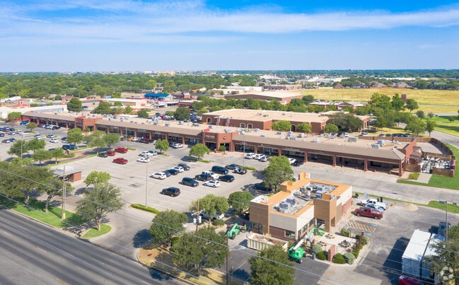
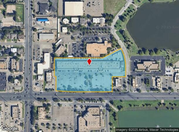
4210 82Nd St
Lubbock, TX
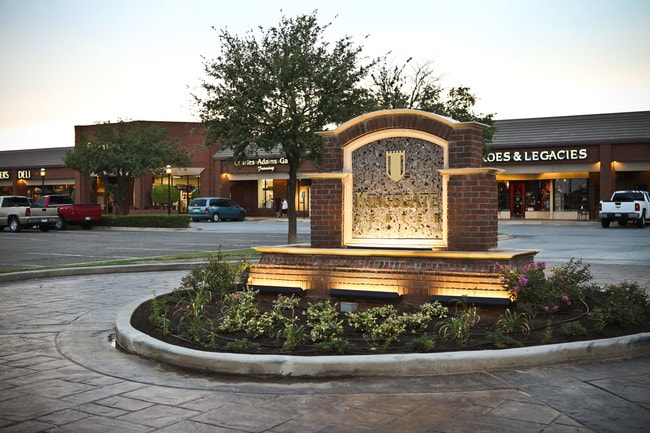
Kings Gate North
R113841
KINGS GATE NORTH L 5-A (LESS BLDG ONLY)
Commercialnec
Lubbock
AE
Texas
48303C0295G
5
2024
6.45 AC
2025
South Outer Lubbock
001904
Lubbock
56,720 SF
NEARBY LISTINGS FOR SALE OR LEASE
DEMOGRAPHICS near 4210 82Nd St
1 mile
3 mile
5 mile
2024 Total Population
10,621
110,680
198,763
2029 Population
11,197
117,218
211,008
Pop Growth 2024-2029
+ 5.42%
+ 5.91%
+ 6.16%
Average Age
42
37
36
2024 Total Households
4,713
45,410
80,372
HH Growth 2024-2029
+ 5.86%
+ 6.12%
+ 6.45%
Median Household Inc
$84,693
$68,482
$61,145
Avg Household Size
2.20
2.40
2.40
2024 Avg HH Vehicles
2.00
2.00
2.00
Median Home Value
$271,488
$201,349
$196,284
Median Year Built
1979
1983
1982
Nearby Places
Map Layers
Map Styles
 Street
 Aerial
Transit
 Traffic
 Biking
Places
Listings with unknown addresses are not visible on the map
- Restaurants
- Banks
- Shops
- Fitness
- Groceries
PUBLIC TRANSPORTATION
AIRPORT
Lubbock Preston Smith International
Drive
Walk
Distance
Lubbock Preston Smith International
33 min
18.9 mi
SALE & LEASE HISTORY
LISTING DATE
SALE/LEASE

Sep 26, 2016
For Lease
Mar 30, 2017
For Lease
Feb 07, 2017
For Lease
Nearby Properties
Address
Land Use
TOTAL SIZE
Lot Size
Zoning
Address
Land Use
TOTAL SIZE
Lot Size
Zoning
791,096 SF
63.76 AC
Address
Land Use
TOTAL SIZE
Lot Size
Zoning
391,942 SF
17.89 AC
Address
Land Use
TOTAL SIZE
Lot Size
Zoning
290,322 SF
11.96 AC
Address
Land Use
TOTAL SIZE
Lot Size
Zoning
329,448 SF
13.27 AC
Address
Land Use
TOTAL SIZE
Lot Size
Zoning
176,165 SF
36.61 AC
Address
Land Use
TOTAL SIZE
Lot Size
Zoning
289,796 SF
14.67 AC
Address
Land Use
TOTAL SIZE
Lot Size
Zoning
247,870 SF
11.48 AC
Address
Land Use
TOTAL SIZE
Lot Size
Zoning
219,352 SF
21.90 AC
Address
Land Use
TOTAL SIZE
Lot Size
Zoning
137,860 SF
13.89 AC
Address
Land Use
TOTAL SIZE
Lot Size
Zoning
196,103 SF
12.33 AC
Address
Land Use
TOTAL SIZE
Lot Size
Zoning
189,540 SF
20.95 AC
Address
Land Use
TOTAL SIZE
Lot Size
Zoning
138,202 SF
11.33 AC
Address
Land Use
TOTAL SIZE
Lot Size
Zoning
172,263 SF
11.01 AC
Address
Land Use
TOTAL SIZE
Lot Size
Zoning
167,208 SF
10.09 AC
Address
Land Use
TOTAL SIZE
Lot Size
Zoning
169,139 SF
12.07 AC
Address
Land Use
TOTAL SIZE
Lot Size
Zoning
157,644 SF
9.69 AC
Address
Land Use
TOTAL SIZE
Lot Size
Zoning
172,627 SF
8.12 AC
Address
Land Use
TOTAL SIZE
Lot Size
Zoning
199,854 SF
19.21 AC
Address
Land Use
TOTAL SIZE
Lot Size
Zoning
220,236 SF
13.42 AC
Address
Land Use
TOTAL SIZE
Lot Size
Zoning
198,209 SF
9.98 AC
Address
Land Use
TOTAL SIZE
Lot Size
Zoning
75,154 SF
6.95 AC
Address
Land Use
TOTAL SIZE
Lot Size
Zoning
60,258 SF
8.99 AC
Address
Land Use
TOTAL SIZE
Lot Size
Zoning
49,538 SF
3.65 AC
Address
Land Use
TOTAL SIZE
Lot Size
Zoning
65,582 SF
3.74 AC
Address
Land Use
TOTAL SIZE
Lot Size
Zoning
57,897 SF
4.24 AC
Address
Land Use
TOTAL SIZE
Lot Size
Zoning
75,080 SF
0.04 AC
Address
Land Use
TOTAL SIZE
Lot Size
Zoning
63,341 SF
9.31 AC
Address
Land Use
TOTAL SIZE
Lot Size
Zoning
177,154 SF
8.79 AC
Address
Land Use
TOTAL SIZE
Lot Size
Zoning
83,300 SF
2.07 AC
Address
Land Use
TOTAL SIZE
Lot Size
Zoning
175,958 SF
8.13 AC
The World's #1 Commercial Real Estate Marketplace
Connect with us
© 2026 CoStar Group
The information above has been obtained from sources believed reliable. While we do not doubt its accuracy we have not verified it and make no guarantee, warranty or representation about it. It is your responsibility to independently confirm its accuracy and completeness. Any projections, opinions, assumptions, or estimates used are for example only and do not represent the current or future performance of the property. The value of this transaction to you depends on tax and other factors which should be evaluated by your tax, financial, and legal advisors. You and your advisors should conduct a careful, independent investigation of the property to determine to your satisfaction the suitability of the property for your needs.