Property Record
4210 N State Highway 123, San Marcos, TX 78666
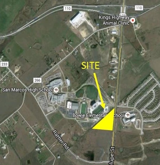


Property Detail
4210 N State Highway 123
Austin-Round Rock-San Marcos, TX
THE RESERVES AT SAN MARCOS, LOT 1, ACRES 20.941 (AND BUSINESS PERSONAL PROPERTY)
R174142
Hays
Multifamilydwelling
Texas
B and X Area of moderate flood hazard, usually the area between the limits of the 100-year and 500-year floods.
1
2024
20.94 AC
2025
Hays County
010402
Austin
341,111 SF
NEARBY LISTINGS FOR SALE OR LEASE
DEMOGRAPHICS near 4210 N State Highway 123
1 mile
3 mile
5 mile
2025 Total Population
3,977
22,154
56,997
2030 Population
4,700
25,714
65,640
Pop Growth 2025-2030
+ 18.18%
+ 16.07%
+ 15.16%
Average Age
36
36
35
2025 Total Households
1,414
8,582
21,705
HH Growth 2025-2030
+ 19.45%
+ 17.46%
+ 16.67%
Median Household Inc
$88,785
$61,649
$58,974
Avg Household Size
2.70
2.40
2.40
2025 Avg HH Vehicles
2.00
2.00
2.00
Median Home Value
$253,289
$241,606
$306,977
Median Year Built
2010
2006
2000
Nearby Places
Map Layers
Map Styles
 Street
 Aerial
Layers
 Traffic
 Biking
Places
Listings with unknown addresses are not visible on the map
- Restaurants
- Banks
- Shops
- Fitness
- Groceries
PUBLIC TRANSPORTATION
COMMUTER RAIL
Drive
Walk
Distance
9 min
4.5 mi
AIRPORT
Austin-Bergstrom International
Drive
Walk
Distance
Austin-Bergstrom International
51 min
39.5 mi
SALE & LEASE HISTORY
LISTING DATE
SALE/LEASE

Nov 04, 2016
For Sale
Nov 04, 2016
For Sale
Jul 27, 2017
For Sale
Nearby Properties
Address
Land Use
TOTAL SIZE
Lot Size
Zoning
Address
Land Use
TOTAL SIZE
Lot Size
Zoning
70,432 SF
45.07 AC
Address
Land Use
TOTAL SIZE
Lot Size
Zoning
855,000 SF
95.65 AC
Address
Land Use
TOTAL SIZE
Lot Size
Zoning
289,554 SF
76.50 AC
Address
Land Use
TOTAL SIZE
Lot Size
Zoning
250,811 SF
23.88 AC
Address
Land Use
TOTAL SIZE
Lot Size
Zoning
239,345 SF
23.41 AC
Address
Land Use
TOTAL SIZE
Lot Size
Zoning
466,968 SF
15.19 AC
Address
Land Use
TOTAL SIZE
Lot Size
Zoning
352,285 SF
12.75 AC
Address
Land Use
TOTAL SIZE
Lot Size
Zoning
283,033 SF
19.46 AC
Address
Land Use
TOTAL SIZE
Lot Size
Zoning
223,401 SF
9.75 AC
Address
Land Use
TOTAL SIZE
Lot Size
Zoning
184,438 SF
12.57 AC
Address
Land Use
TOTAL SIZE
Lot Size
Zoning
343,560 SF
10.40 AC
Address
Land Use
TOTAL SIZE
Lot Size
Zoning
255,621 SF
8.83 AC
Address
Land Use
TOTAL SIZE
Lot Size
Zoning
277,659 SF
10.77 AC
Address
Land Use
TOTAL SIZE
Lot Size
Zoning
307,962 SF
14.23 AC
Address
Land Use
TOTAL SIZE
Lot Size
Zoning
24.14 AC
Address
Land Use
TOTAL SIZE
Lot Size
Zoning
115.78 AC
Address
Land Use
TOTAL SIZE
Lot Size
Zoning
190,554 SF
5.59 AC
Address
Land Use
TOTAL SIZE
Lot Size
Zoning
195,018 SF
7.37 AC
Address
Land Use
TOTAL SIZE
Lot Size
Zoning
305,644 SF
27.93 AC
Address
Land Use
TOTAL SIZE
Lot Size
Zoning
160,056 SF
10.05 AC
Address
Land Use
TOTAL SIZE
Lot Size
Zoning
222,984 SF
12.85 AC
Address
Land Use
TOTAL SIZE
Lot Size
Zoning
240,123 SF
8.75 AC
Address
Land Use
TOTAL SIZE
Lot Size
Zoning
535,134 SF
29.28 AC
Address
Land Use
TOTAL SIZE
Lot Size
Zoning
127,306 SF
20.85 AC
Address
Land Use
TOTAL SIZE
Lot Size
Zoning
141,735 SF
6.62 AC
Address
Land Use
TOTAL SIZE
Lot Size
Zoning
296,034 SF
7.78 AC
Address
Land Use
TOTAL SIZE
Lot Size
Zoning
230,979 SF
7.54 AC
Address
Land Use
TOTAL SIZE
Lot Size
Zoning
152,046 SF
8 AC
Address
Land Use
TOTAL SIZE
Lot Size
Zoning
146,295 SF
5.08 AC
The World's #1 Commercial Real Estate Marketplace
Connect with us
© 2026 CoStar Group
The information above has been obtained from sources believed reliable. While we do not doubt its accuracy we have not verified it and make no guarantee, warranty or representation about it. It is your responsibility to independently confirm its accuracy and completeness. Any projections, opinions, assumptions, or estimates used are for example only and do not represent the current or future performance of the property. The value of this transaction to you depends on tax and other factors which should be evaluated by your tax, financial, and legal advisors. You and your advisors should conduct a careful, independent investigation of the property to determine to your satisfaction the suitability of the property for your needs.