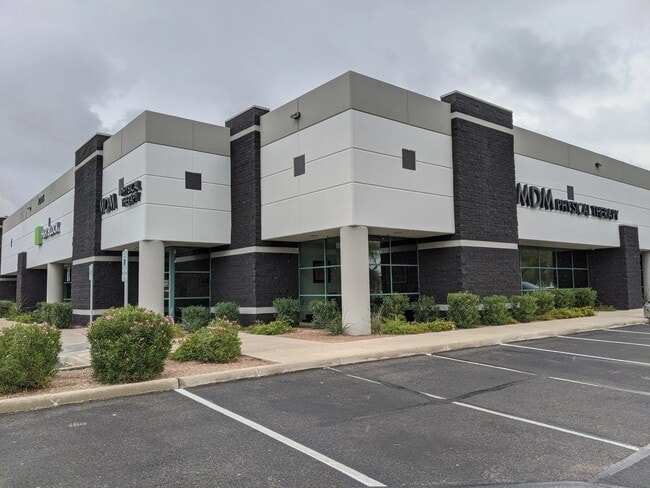
Property Record
4210 S 36Th St, Phoenix, AZ 85040


NEARBY LISTINGS FOR SALE OR LEASE
Property Detail
4210 S 36Th St
Phoenix-Mesa-Scottsdale, AZ
Okemah Acres Blk 2
122-12-024A
OKEMAH ACRES BLK 2 MCR 29/30
Industrialgeneral
Maricopa
X
Arizona
04013C2220M
1
2025
1.44 AC
2025
S Airport N of Roeser
115200
Phoenix
25,183 SF
DEMOGRAPHICS near 4210 S 36Th St
1 Mile
3 Mile
5 Mile
2024 Total Population
2,960
63,102
300,284
2029 Population
3,206
68,054
325,618
Pop Growth 2024-2029
+ 8.31%
+ 7.85%
+ 8.44%
Average Age
31
35
34
2024 Total Households
978
22,022
111,614
HH Growth 2024-2029
+ 8.79%
+ 7.94%
+ 8.77%
Median Household Inc
$42,722
$61,471
$57,181
Avg Household Size
3.00
2.70
2.50
2024 Avg HH Vehicles
2.00
2.00
2.00
Median Home Value
$327,388
$295,276
$324,360
Median Year Built
1982
1983
1983
Nearby Places
Map Layers
Map Styles
 Street
 Aerial
- Restaurants
- Banks
- Shops
- Fitness
- Groceries
PUBLIC TRANSPORTATION
AIRPORT
Phoenix Sky Harbor International
DRIVE
WALK
Distance
Phoenix Sky Harbor International
11 min
4.9 mi
Phoenix-Mesa Gateway
DRIVE
WALK
Distance
Phoenix-Mesa Gateway
38 min
26.9 mi
SALE & LEASE HISTORY
LISTING DATE
SALE/LEASE

Sep 25, 2016
For Lease
Sep 23, 2016
For Sale
Jun 18, 2024
For Lease
Jan 20, 2021
For Sale
Nearby Properties
Address
Land Use
TOTAL SIZE
Lot Size
Zoning
Address
Land Use
TOTAL SIZE
Lot Size
Zoning
12.93 AC
I-P
Address
Land Use
TOTAL SIZE
Lot Size
Zoning
2,901,193 SF
20.73 AC
A-1
Address
Land Use
TOTAL SIZE
Lot Size
Zoning
1,949,842 SF
40 AC
I-1
Address
Land Use
TOTAL SIZE
Lot Size
Zoning
2.63 AC
I-1
Address
Land Use
TOTAL SIZE
Lot Size
Zoning
2,705,875 SF
133.42 AC
I-1
Address
Land Use
TOTAL SIZE
Lot Size
Zoning
199,677 SF
14.55 AC
C-3
Address
Land Use
TOTAL SIZE
Lot Size
Zoning
81,816 SF
7.95 AC
Address
Land Use
TOTAL SIZE
Lot Size
Zoning
106,575 SF
2.50 AC
I-1
Address
Land Use
TOTAL SIZE
Lot Size
Zoning
94,162 SF
9.40 AC
I-2
Address
Land Use
TOTAL SIZE
Lot Size
Zoning
1,479,006 SF
84.96 AC
C-R
Address
Land Use
TOTAL SIZE
Lot Size
Zoning
Address
Land Use
TOTAL SIZE
Lot Size
Zoning
10,776 SF
10.14 AC
C-C
Address
Land Use
TOTAL SIZE
Lot Size
Zoning
1,020,776 SF
11.33 AC
I-1
Address
Land Use
TOTAL SIZE
Lot Size
Zoning
331,050 SF
39 AC
I-1
Address
Land Use
TOTAL SIZE
Lot Size
Zoning
462,201 SF
6.74 AC
I-1
Address
Land Use
TOTAL SIZE
Lot Size
Zoning
522,676 SF
264.16 AC
I-1
Address
Land Use
TOTAL SIZE
Lot Size
Zoning
32,968 SF
2.10 AC
I-P
Address
Land Use
TOTAL SIZE
Lot Size
Zoning
635,169 SF
92.76 AC
I-1
Address
Land Use
TOTAL SIZE
Lot Size
Zoning
9,344 SF
134.45 AC
R3
Address
Land Use
TOTAL SIZE
Lot Size
Zoning
746,457 SF
20.95 AC
I-1
Address
Land Use
TOTAL SIZE
Lot Size
Zoning
1,524,499 SF
159.88 AC
I-1
Address
Land Use
TOTAL SIZE
Lot Size
Zoning
13.72 AC
Address
Land Use
TOTAL SIZE
Lot Size
Zoning
469,025 SF
199.15 AC
A-1
Address
Land Use
TOTAL SIZE
Lot Size
Zoning
277,910 SF
53.82 AC
A-1
Address
Land Use
TOTAL SIZE
Lot Size
Zoning
359,401 SF
96.70 AC
R-6
Address
Land Use
TOTAL SIZE
Lot Size
Zoning
34,642 SF
2.37 AC
I-1
Address
Land Use
TOTAL SIZE
Lot Size
Zoning
252,306 SF
112.57 AC
A-2
Address
Land Use
TOTAL SIZE
Lot Size
Zoning
180,690 SF
11.20 AC
I-P
Address
Land Use
TOTAL SIZE
Lot Size
Zoning
351,199 SF
22.04 AC
I-1
Address
Land Use
TOTAL SIZE
Lot Size
Zoning
586,083 SF
69.82 AC
The World's #1 Commercial Real Estate Marketplace
Connect with us
© 2025 CoStar Group
The information above has been obtained from sources believed reliable. While we do not doubt its accuracy we have not verified it and make no guarantee, warranty or representation about it. It is your responsibility to independently confirm its accuracy and completeness. Any projections, opinions, assumptions, or estimates used are for example only and do not represent the current or future performance of the property. The value of this transaction to you depends on tax and other factors which should be evaluated by your tax, financial, and legal advisors. You and your advisors should conduct a careful, independent investigation of the property to determine to your satisfaction the suitability of the property for your needs.