Property Record
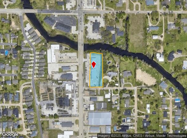
4211 Lake St, Lake Charles, LA 70605


NEARBY LISTINGS FOR SALE OR LEASE
Property Detail
4211 Lake St
Lake Charles, LA
Subdivision
00431966B
@191008-0000-440000703 0000 COMM AT THE INTERSECTION OF THE S BANK OF CONTRABAND R/W AND THE NEW E RIGHT OF LINE OF LAKE ST,
Stripcommercialcenter
Calcasieu
AE
Louisiana
22019C0490F
7
2024
1.39 AC
2024
Lake Charles
001000
Other Market Areas
DEMOGRAPHICS near 4211 Lake St
1 Mile
3 Mile
5 Mile
2024 Total Population
8,518
56,729
90,645
2029 Population
7,884
52,841
84,843
Pop Growth 2024-2029
(7.44%)
(6.85%)
(6.40%)
Average Age
42
39
39
2024 Total Households
3,708
23,682
37,005
HH Growth 2024-2029
(6.88%)
(6.30%)
(5.83%)
Median Household Inc
$65,649
$56,884
$53,957
Avg Household Size
2.20
2.30
2.40
2024 Avg HH Vehicles
2.00
2.00
2.00
Median Home Value
$245,619
$236,526
$218,870
Median Year Built
1977
1981
1982
Nearby Places
Map Layers
Map Styles
 Street
 Aerial
- Restaurants
- Banks
- Shops
- Fitness
- Groceries
PUBLIC TRANSPORTATION
COMMUTER RAIL
Lake Charles (Sunset Limited - Amtrak)
DRIVE
WALK
Distance
Lake Charles (Sunset Limited - Amtrak)
9 min
4.7 mi
AIRPORT
Lake Charles Regional
DRIVE
WALK
Distance
Lake Charles Regional
10 min
5.3 mi
Freight Ports
Port of Lake Charles
DRIVE
WALK
Distance
Port of Lake Charles
6 min
3.0 mi
SALE & LEASE HISTORY
LISTING DATE
SALE/LEASE

Feb 16, 2022
For Lease
Nearby Properties
Address
Land Use
TOTAL SIZE
Lot Size
Zoning
Address
Land Use
TOTAL SIZE
Lot Size
Zoning
Address
Land Use
TOTAL SIZE
Lot Size
Zoning
548.50 AC
Address
Land Use
TOTAL SIZE
Lot Size
Zoning
64.85 AC
Address
Land Use
TOTAL SIZE
Lot Size
Zoning
157.09 AC
Address
Land Use
TOTAL SIZE
Lot Size
Zoning
0.01 AC
Address
Land Use
TOTAL SIZE
Lot Size
Zoning
Address
Land Use
TOTAL SIZE
Lot Size
Zoning
Address
Land Use
TOTAL SIZE
Lot Size
Zoning
Address
Land Use
TOTAL SIZE
Lot Size
Zoning
Address
Land Use
TOTAL SIZE
Lot Size
Zoning
27.73 AC
Address
Land Use
TOTAL SIZE
Lot Size
Zoning
Address
Land Use
TOTAL SIZE
Lot Size
Zoning
46.76 AC
Address
Land Use
TOTAL SIZE
Lot Size
Zoning
Address
Land Use
TOTAL SIZE
Lot Size
Zoning
Address
Land Use
TOTAL SIZE
Lot Size
Zoning
69.07 AC
Address
Land Use
TOTAL SIZE
Lot Size
Zoning
Address
Land Use
TOTAL SIZE
Lot Size
Zoning
15.31 AC
Address
Land Use
TOTAL SIZE
Lot Size
Zoning
Address
Land Use
TOTAL SIZE
Lot Size
Zoning
Address
Land Use
TOTAL SIZE
Lot Size
Zoning
Address
Land Use
TOTAL SIZE
Lot Size
Zoning
19.15 AC
Address
Land Use
TOTAL SIZE
Lot Size
Zoning
Address
Land Use
TOTAL SIZE
Lot Size
Zoning
23.51 AC
Address
Land Use
TOTAL SIZE
Lot Size
Zoning
Address
Land Use
TOTAL SIZE
Lot Size
Zoning
Address
Land Use
TOTAL SIZE
Lot Size
Zoning
7,920 SF
0.52 AC
MPR2YY
Address
Land Use
TOTAL SIZE
Lot Size
Zoning
2.29 AC
Address
Land Use
TOTAL SIZE
Lot Size
Zoning
Address
Land Use
TOTAL SIZE
Lot Size
Zoning
14.55 AC
Address
Land Use
TOTAL SIZE
Lot Size
Zoning
12.78 AC
The World's #1 Commercial Real Estate Marketplace
Connect with us
© 2025 CoStar Group
The information above has been obtained from sources believed reliable. While we do not doubt its accuracy we have not verified it and make no guarantee, warranty or representation about it. It is your responsibility to independently confirm its accuracy and completeness. Any projections, opinions, assumptions, or estimates used are for example only and do not represent the current or future performance of the property. The value of this transaction to you depends on tax and other factors which should be evaluated by your tax, financial, and legal advisors. You and your advisors should conduct a careful, independent investigation of the property to determine to your satisfaction the suitability of the property for your needs.