Property Record
4211 Sterlington Rd, Monroe, LA 71203
NEARBY LISTINGS FOR SALE OR LEASE
-
-
View all Monroe listings for sale on LoopNet.com
Property Detail
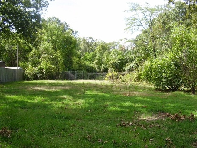
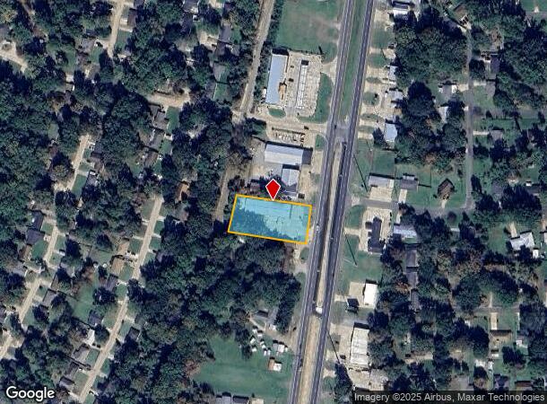
4211 Sterlington Rd
Monroe, LA
Dysarts Addition
7036
LOTS 3 & 4 SQ 1 DYSART ADDN -LESS E 25.88 FT TO HWY BK 999-92-
Industrialgeneral
Ouachita
X
Louisiana
22073C0155F
3-4
2025
0.92 AC
2024
Louisiana North Area
010302
Other Market Areas
1,232 SF
DEMOGRAPHICS near 4211 Sterlington Rd
1 mile
3 mile
5 mile
2024 Total Population
4,404
19,787
50,624
2029 Population
4,269
19,253
49,504
Pop Growth 2024-2029
(3.07%)
(2.70%)
(2.21%)
Average Age
38
38
39
2024 Total Households
1,914
8,150
21,017
HH Growth 2024-2029
(3.19%)
(2.81%)
(2.26%)
Median Household Inc
$42,624
$50,668
$46,272
Avg Household Size
2.30
2.20
2.30
2024 Avg HH Vehicles
2.00
2.00
2.00
Median Home Value
$169,871
$245,632
$202,654
Median Year Built
1984
1981
1977
Nearby Places
Map Layers
Map Styles
 Street
 Aerial
Transit
 Traffic
 Biking
Places
Listings with unknown addresses are not visible on the map
- Restaurants
- Banks
- Shops
- Fitness
- Groceries
PUBLIC TRANSPORTATION
AIRPORT
Monroe Regional
Drive
Walk
Distance
Monroe Regional
11 min
7.0 mi
Freight Ports
Port of Shreveport
Drive
Walk
Distance
Port of Shreveport
136 min
117.4 mi
Nearby Properties
Address
Land Use
TOTAL SIZE
Lot Size
Zoning
Address
Land Use
TOTAL SIZE
Lot Size
Zoning
7.09 AC
Address
Land Use
TOTAL SIZE
Lot Size
Zoning
20.74 AC
Address
Land Use
TOTAL SIZE
Lot Size
Zoning
1.37 AC
Address
Land Use
TOTAL SIZE
Lot Size
Zoning
Address
Land Use
TOTAL SIZE
Lot Size
Zoning
5.21 AC
Address
Land Use
TOTAL SIZE
Lot Size
Zoning
Address
Land Use
TOTAL SIZE
Lot Size
Zoning
1.67 AC
Address
Land Use
TOTAL SIZE
Lot Size
Zoning
37.47 AC
Address
Land Use
TOTAL SIZE
Lot Size
Zoning
6.83 AC
Address
Land Use
TOTAL SIZE
Lot Size
Zoning
Address
Land Use
TOTAL SIZE
Lot Size
Zoning
Address
Land Use
TOTAL SIZE
Lot Size
Zoning
5.86 AC
Address
Land Use
TOTAL SIZE
Lot Size
Zoning
Address
Land Use
TOTAL SIZE
Lot Size
Zoning
3.18 AC
Address
Land Use
TOTAL SIZE
Lot Size
Zoning
Address
Land Use
TOTAL SIZE
Lot Size
Zoning
Address
Land Use
TOTAL SIZE
Lot Size
Zoning
0.91 AC
Address
Land Use
TOTAL SIZE
Lot Size
Zoning
4.20 AC
Address
Land Use
TOTAL SIZE
Lot Size
Zoning
4.16 AC
Address
Land Use
TOTAL SIZE
Lot Size
Zoning
4.97 AC
Address
Land Use
TOTAL SIZE
Lot Size
Zoning
Address
Land Use
TOTAL SIZE
Lot Size
Zoning
1.68 AC
Address
Land Use
TOTAL SIZE
Lot Size
Zoning
37.93 AC
Address
Land Use
TOTAL SIZE
Lot Size
Zoning
5.51 AC
Address
Land Use
TOTAL SIZE
Lot Size
Zoning
Address
Land Use
TOTAL SIZE
Lot Size
Zoning
4.16 AC
Address
Land Use
TOTAL SIZE
Lot Size
Zoning
0.83 AC
Address
Land Use
TOTAL SIZE
Lot Size
Zoning
Address
Land Use
TOTAL SIZE
Lot Size
Zoning
5.20 AC
Address
Land Use
TOTAL SIZE
Lot Size
Zoning
5.02 AC
The World's #1 Commercial Real Estate Marketplace
Connect with us
© 2026 CoStar Group
The information above has been obtained from sources believed reliable. While we do not doubt its accuracy we have not verified it and make no guarantee, warranty or representation about it. It is your responsibility to independently confirm its accuracy and completeness. Any projections, opinions, assumptions, or estimates used are for example only and do not represent the current or future performance of the property. The value of this transaction to you depends on tax and other factors which should be evaluated by your tax, financial, and legal advisors. You and your advisors should conduct a careful, independent investigation of the property to determine to your satisfaction the suitability of the property for your needs.