Property Record
4212 Auburn St, Rockford, IL 61101


NEARBY LISTINGS FOR SALE OR LEASE
-
-
View all Rockford listings for sale on LoopNet.com
Property Detail
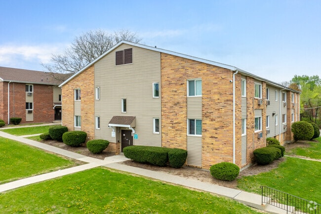
4212 Auburn St
11-16-401-009
S 160 FT N 260 FT W 240.68 FT MEAS S LN (EXC W 33 FT FOR ROW) NW1/4 SE1/4 SEC 16-44-1 ALSO AUBURN MANOR NO 3 PT SE1/4 SEC 16-44-1 LTS 1 & 2 ALSO AUBURN
Commercialnec
Winnebago
X
Illinois
17201C0261E
1-2
2024
3.82 AC
2024
Outer Northwest Rockford
003200
Chicago
104,956 SF
Rockford, IL
DEMOGRAPHICS near 4212 Auburn St
1 Mile
3 Mile
5 Mile
2024 Total Population
9,597
61,478
120,279
2029 Population
9,716
61,428
119,240
Pop Growth 2024-2029
+ 1.24%
(0.08%)
(0.86%)
Average Age
35
38
38
2024 Total Households
3,472
24,664
48,512
HH Growth 2024-2029
+ 1.21%
(0.20%)
(0.96%)
Median Household Inc
$35,146
$33,871
$42,214
Avg Household Size
2.60
2.40
2.40
2024 Avg HH Vehicles
2.00
1.00
2.00
Median Home Value
$57,745
$77,536
$89,101
Median Year Built
1953
1954
1955
Nearby Places
Map Layers
Map Styles
 Street
 Aerial
- Restaurants
- Banks
- Shops
- Fitness
- Groceries
PUBLIC TRANSPORTATION
AIRPORT
Chicago/Rockford International
DRIVE
WALK
Distance
Chicago/Rockford International
21 min
10.4 mi
Freight Ports
Port Milwaukee
DRIVE
WALK
Distance
Port Milwaukee
118 min
95.9 mi
Nearby Properties
Address
Land Use
TOTAL SIZE
Lot Size
Zoning
Address
Land Use
TOTAL SIZE
Lot Size
Zoning
256,236 SF
29.33 AC
R3
Address
Land Use
TOTAL SIZE
Lot Size
Zoning
216,540 SF
22 AC
C3
Address
Land Use
TOTAL SIZE
Lot Size
Zoning
201,507 SF
C4
Address
Land Use
TOTAL SIZE
Lot Size
Zoning
106,145 SF
8.54 AC
R3
Address
Land Use
TOTAL SIZE
Lot Size
Zoning
115,095 SF
0.25 AC
C4
Address
Land Use
TOTAL SIZE
Lot Size
Zoning
117,360 SF
1.52 AC
R4
Address
Land Use
TOTAL SIZE
Lot Size
Zoning
111,491 SF
0.32 AC
C4
Address
Land Use
TOTAL SIZE
Lot Size
Zoning
151,517 SF
7.52 AC
R3
Address
Land Use
TOTAL SIZE
Lot Size
Zoning
78,968 SF
13.65 AC
R2
Address
Land Use
TOTAL SIZE
Lot Size
Zoning
79,318 SF
1.55 AC
C4
Address
Land Use
TOTAL SIZE
Lot Size
Zoning
58,526 SF
134.42 AC
RE
Address
Land Use
TOTAL SIZE
Lot Size
Zoning
238,884 SF
15.96 AC
R3
Address
Land Use
TOTAL SIZE
Lot Size
Zoning
645,384 SF
25.22 AC
I1
Address
Land Use
TOTAL SIZE
Lot Size
Zoning
57,888 SF
12.37 AC
R2
Address
Land Use
TOTAL SIZE
Lot Size
Zoning
44,213 SF
12.04 AC
R2
Address
Land Use
TOTAL SIZE
Lot Size
Zoning
108,233 SF
0.34 AC
C4
Address
Land Use
TOTAL SIZE
Lot Size
Zoning
158,754 SF
0.91 AC
C4
Address
Land Use
TOTAL SIZE
Lot Size
Zoning
39,184 SF
3.10 AC
C2
Address
Land Use
TOTAL SIZE
Lot Size
Zoning
77,936 SF
1.71 AC
C4
Address
Land Use
TOTAL SIZE
Lot Size
Zoning
63,952 SF
10.70 AC
R2
Address
Land Use
TOTAL SIZE
Lot Size
Zoning
239,792 SF
0.25 AC
C4
Address
Land Use
TOTAL SIZE
Lot Size
Zoning
299,238 SF
18.84 AC
I2
Address
Land Use
TOTAL SIZE
Lot Size
Zoning
137,546 SF
0.71 AC
C4
Address
Land Use
TOTAL SIZE
Lot Size
Zoning
51,571 SF
6.41 AC
R2
Address
Land Use
TOTAL SIZE
Lot Size
Zoning
47,424 SF
6.94 AC
R2
Address
Land Use
TOTAL SIZE
Lot Size
Zoning
111,696 SF
11.99 AC
CG
Address
Land Use
TOTAL SIZE
Lot Size
Zoning
64,896 SF
8.35 AC
R4
Address
Land Use
TOTAL SIZE
Lot Size
Zoning
118,780 SF
30.47 AC
I2
Address
Land Use
TOTAL SIZE
Lot Size
Zoning
191,265 SF
9.67 AC
I1
Address
Land Use
TOTAL SIZE
Lot Size
Zoning
17,665 SF
1.27 AC
C2
The World's #1 Commercial Real Estate Marketplace
Connect with us
© 2026 CoStar Group
The information above has been obtained from sources believed reliable. While we do not doubt its accuracy we have not verified it and make no guarantee, warranty or representation about it. It is your responsibility to independently confirm its accuracy and completeness. Any projections, opinions, assumptions, or estimates used are for example only and do not represent the current or future performance of the property. The value of this transaction to you depends on tax and other factors which should be evaluated by your tax, financial, and legal advisors. You and your advisors should conduct a careful, independent investigation of the property to determine to your satisfaction the suitability of the property for your needs.