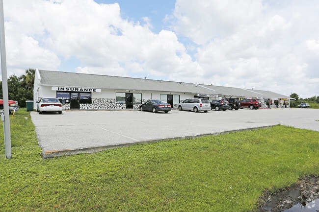
Property Record
4212 N Access Rd, Englewood, FL 34224


NEARBY LISTINGS FOR SALE OR LEASE
Property Detail
4212 N Access Rd
Punta Gorda, FL
Port Charlotte
412001354003
PORT CHARLOTTE SEC63 BLK3697 LT 67 508/116 926/1821 998/1621 RE1007/1829 1242/271 1373/2051 1392/2048 PCH 063 3697 0068 PORT CHARLOTTE SEC63 BLK3697 LTS 68 69 & 70 503/810 508/116 508/810 508/963 851/1382 E871/691 E87
Storemultistory
Charlotte
X
Florida
12015C0192G
67
2024
0.69 AC
2025
Charlotte County
030201
Southwest Florida
9,832 SF
DEMOGRAPHICS near 4212 N Access Rd
1 Mile
3 Mile
5 Mile
2024 Total Population
4,427
26,610
54,986
2029 Population
5,277
32,120
66,806
Pop Growth 2024-2029
+ 19.20%
+ 20.71%
+ 21.50%
Average Age
49
55
57
2024 Total Households
1,976
12,594
26,648
HH Growth 2024-2029
+ 19.33%
+ 20.93%
+ 21.72%
Median Household Inc
$59,770
$56,436
$58,875
Avg Household Size
2.20
2.10
2.00
2024 Avg HH Vehicles
2.00
2.00
2.00
Median Home Value
$224,918
$249,817
$271,758
Median Year Built
1991
1993
1993
Nearby Places
Map Layers
Map Styles
 Street
 Aerial
- Restaurants
- Banks
- Shops
- Fitness
- Groceries
PUBLIC TRANSPORTATION
AIRPORT
Punta Gorda
DRIVE
WALK
Distance
Punta Gorda
39 min
23.5 mi
Freight Ports
Port Manatee
DRIVE
WALK
Distance
Port Manatee
81 min
59.7 mi
SALE & LEASE HISTORY
LISTING DATE
SALE/LEASE

Nov 10, 2017
For Sale
Aug 22, 2017
For Lease
Nearby Properties
Address
Land Use
TOTAL SIZE
Lot Size
Zoning
Address
Land Use
TOTAL SIZE
Lot Size
Zoning
193,100 SF
26.30 AC
PD
Address
Land Use
TOTAL SIZE
Lot Size
Zoning
28,490 SF
172 AC
PKR
Address
Land Use
TOTAL SIZE
Lot Size
Zoning
91,934 SF
8.39 AC
PD
Address
Land Use
TOTAL SIZE
Lot Size
Zoning
107,736 SF
35.90 AC
RMF5
Address
Land Use
TOTAL SIZE
Lot Size
Zoning
99,840 SF
7.60 AC
IG
Address
Land Use
TOTAL SIZE
Lot Size
Zoning
67,466 SF
16.30 AC
CG
Address
Land Use
TOTAL SIZE
Lot Size
Zoning
27.65 AC
RMF15
Address
Land Use
TOTAL SIZE
Lot Size
Zoning
58,185 SF
3.40 AC
IG
Address
Land Use
TOTAL SIZE
Lot Size
Zoning
108,048 SF
14.84 AC
CG
Address
Land Use
TOTAL SIZE
Lot Size
Zoning
25,777 SF
12.18 AC
PD
Address
Land Use
TOTAL SIZE
Lot Size
Zoning
132.79 AC
PKR
Address
Land Use
TOTAL SIZE
Lot Size
Zoning
25,478 SF
11.06 AC
IG
Address
Land Use
TOTAL SIZE
Lot Size
Zoning
51,683 SF
7.16 AC
CG
Address
Land Use
TOTAL SIZE
Lot Size
Zoning
100,910 SF
22.85 AC
RSF3.5
Address
Land Use
TOTAL SIZE
Lot Size
Zoning
106,737 SF
20.80 AC
RMF5
Address
Land Use
TOTAL SIZE
Lot Size
Zoning
34.11 AC
CG
Address
Land Use
TOTAL SIZE
Lot Size
Zoning
33,047 SF
10.17 AC
PKR
Address
Land Use
TOTAL SIZE
Lot Size
Zoning
25,568 SF
2.73 AC
CG
Address
Land Use
TOTAL SIZE
Lot Size
Zoning
20.12 AC
CG
Address
Land Use
TOTAL SIZE
Lot Size
Zoning
24,708 SF
14.89 AC
CT
Address
Land Use
TOTAL SIZE
Lot Size
Zoning
38.14 AC
IG
Address
Land Use
TOTAL SIZE
Lot Size
Zoning
14,200 SF
2.26 AC
IG
Address
Land Use
TOTAL SIZE
Lot Size
Zoning
12,300 SF
5.02 AC
IG
Address
Land Use
TOTAL SIZE
Lot Size
Zoning
38.60 AC
PD
Address
Land Use
TOTAL SIZE
Lot Size
Zoning
26,248 SF
6.32 AC
PD
Address
Land Use
TOTAL SIZE
Lot Size
Zoning
11,509 SF
12.06 AC
RSF3.5
Address
Land Use
TOTAL SIZE
Lot Size
Zoning
14,482 SF
1.89 AC
CG
Address
Land Use
TOTAL SIZE
Lot Size
Zoning
15,190 SF
154.40 AC
RSF5
Address
Land Use
TOTAL SIZE
Lot Size
Zoning
560 SF
10.23 AC
IG
The World's #1 Commercial Real Estate Marketplace
Connect with us
© 2025 CoStar Group
The information above has been obtained from sources believed reliable. While we do not doubt its accuracy we have not verified it and make no guarantee, warranty or representation about it. It is your responsibility to independently confirm its accuracy and completeness. Any projections, opinions, assumptions, or estimates used are for example only and do not represent the current or future performance of the property. The value of this transaction to you depends on tax and other factors which should be evaluated by your tax, financial, and legal advisors. You and your advisors should conduct a careful, independent investigation of the property to determine to your satisfaction the suitability of the property for your needs.