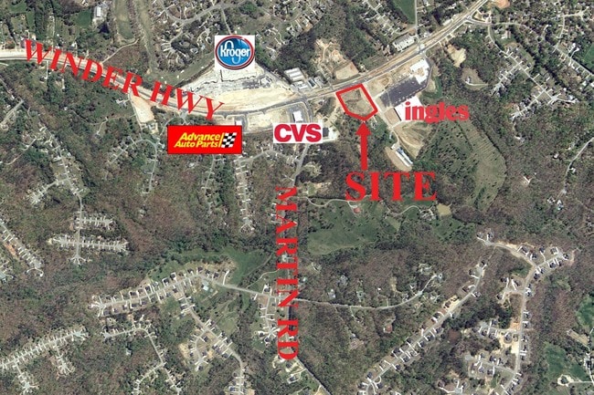
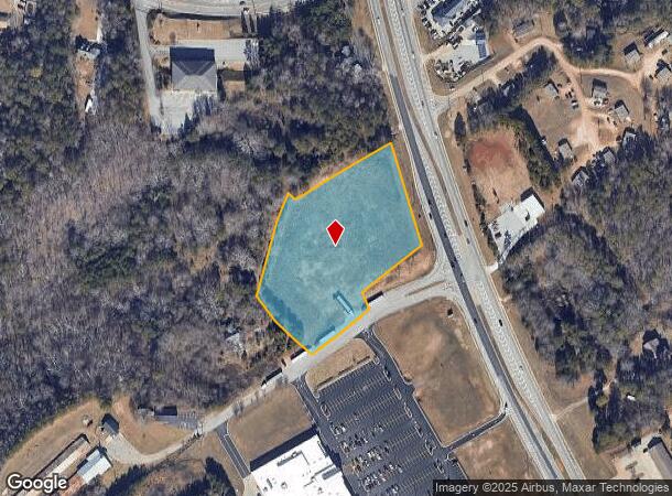
Property Record
4216 Winder Hwy, Flowery Branch, GA 30542
NEARBY LISTINGS FOR SALE OR LEASE
-
-
-
-
-
-
-
No Photo
-
View all Flowery Branch listings for sale on LoopNet.com
Property Detail
4216 Winder Hwy
Gainesville, GA
Jones S/D
15-0044B-00-011
LOTS 1 2 3 & 7 - 12 JONES S/D
Commercialnec
Hall
X
Georgia
13013C0025D
1
2025
3.95 AC
2025
Gainesville/Hall County
001603
Atlanta
106,814 SF
DEMOGRAPHICS near 4216 Winder Hwy
1 Mile
3 Mile
5 Mile
2024 Total Population
2,792
21,768
72,850
2029 Population
3,111
24,282
81,564
Pop Growth 2024-2029
+ 11.43%
+ 11.55%
+ 11.96%
Average Age
40
39
39
2024 Total Households
943
7,435
25,636
HH Growth 2024-2029
+ 11.35%
+ 11.43%
+ 11.94%
Median Household Inc
$73,059
$72,947
$74,893
Avg Household Size
2.90
2.90
2.80
2024 Avg HH Vehicles
2.00
2.00
2.00
Median Home Value
$299,773
$268,804
$277,307
Median Year Built
1999
1997
2001
Nearby Places
Map Layers
Map Styles
 Street
 Aerial
- Restaurants
- Banks
- Shops
- Fitness
- Groceries
PUBLIC TRANSPORTATION
COMMUTER RAIL
Gainesville Amtrak Station (Crescent - Amtrak)
DRIVE
WALK
Distance
Gainesville Amtrak Station (Crescent - Amtrak)
14 min
8.7 mi
Freight Ports
Georgia Ports - Savannah
DRIVE
WALK
Distance
Georgia Ports - Savannah
316 min
251.2 mi
SALE & LEASE HISTORY
LISTING DATE
SALE/LEASE

Sep 24, 2016
For Sale
Nearby Properties
Address
Land Use
TOTAL SIZE
Lot Size
Zoning
Address
Land Use
TOTAL SIZE
Lot Size
Zoning
102,060 SF
31.90 AC
R-1I/H-B
Address
Land Use
TOTAL SIZE
Lot Size
Zoning
164,815 SF
29.93 AC
R-IV
Address
Land Use
TOTAL SIZE
Lot Size
Zoning
150,738 SF
43.34 AC
M-1
Address
Land Use
TOTAL SIZE
Lot Size
Zoning
656,200 SF
70.29 AC
M-1
Address
Land Use
TOTAL SIZE
Lot Size
Zoning
112,734 SF
32.02 AC
R-4
Address
Land Use
TOTAL SIZE
Lot Size
Zoning
144,744 SF
35.47 AC
C-2
Address
Land Use
TOTAL SIZE
Lot Size
Zoning
3,881 SF
27.86 AC
R-IV
Address
Land Use
TOTAL SIZE
Lot Size
Zoning
447,120 SF
35 AC
M-1
Address
Land Use
TOTAL SIZE
Lot Size
Zoning
174,720 SF
50.23 AC
M-2
Address
Land Use
TOTAL SIZE
Lot Size
Zoning
351,550 SF
26.91 AC
M-2
Address
Land Use
TOTAL SIZE
Lot Size
Zoning
104,340 SF
42.22 AC
INST
Address
Land Use
TOTAL SIZE
Lot Size
Zoning
225,378 SF
24.42 AC
M-1
Address
Land Use
TOTAL SIZE
Lot Size
Zoning
515,468 SF
92 AC
I-1
Address
Land Use
TOTAL SIZE
Lot Size
Zoning
255,201 SF
21.75 AC
M-1
Address
Land Use
TOTAL SIZE
Lot Size
Zoning
192,177 SF
12.43 AC
PRD
Address
Land Use
TOTAL SIZE
Lot Size
Zoning
183,700 SF
19.94 AC
M-1
Address
Land Use
TOTAL SIZE
Lot Size
Zoning
58.61 AC
INST
Address
Land Use
TOTAL SIZE
Lot Size
Zoning
201,322 SF
10 AC
M-1
Address
Land Use
TOTAL SIZE
Lot Size
Zoning
87,714 SF
17.16 AC
C-2
Address
Land Use
TOTAL SIZE
Lot Size
Zoning
184,800 SF
15.60 AC
M-1
Address
Land Use
TOTAL SIZE
Lot Size
Zoning
148,068 SF
31.65 AC
M-1
Address
Land Use
TOTAL SIZE
Lot Size
Zoning
110,886 SF
34.34 AC
POD
Address
Land Use
TOTAL SIZE
Lot Size
Zoning
120,204 SF
14.77 AC
H-B
Address
Land Use
TOTAL SIZE
Lot Size
Zoning
95,843 SF
15.90 AC
C-2
Address
Land Use
TOTAL SIZE
Lot Size
Zoning
287,366 SF
61.55 AC
I-2
Address
Land Use
TOTAL SIZE
Lot Size
Zoning
95,723 SF
84 AC
AR-1
Address
Land Use
TOTAL SIZE
Lot Size
Zoning
1,920 SF
10.31 AC
R-4
Address
Land Use
TOTAL SIZE
Lot Size
Zoning
45,056 SF
8.71 AC
PRD
Address
Land Use
TOTAL SIZE
Lot Size
Zoning
247,171 SF
24.68 AC
M-2
Address
Land Use
TOTAL SIZE
Lot Size
Zoning
13,250 SF
17.37 AC
EX
The World's #1 Commercial Real Estate Marketplace
Connect with us
© 2025 CoStar Group
The information above has been obtained from sources believed reliable. While we do not doubt its accuracy we have not verified it and make no guarantee, warranty or representation about it. It is your responsibility to independently confirm its accuracy and completeness. Any projections, opinions, assumptions, or estimates used are for example only and do not represent the current or future performance of the property. The value of this transaction to you depends on tax and other factors which should be evaluated by your tax, financial, and legal advisors. You and your advisors should conduct a careful, independent investigation of the property to determine to your satisfaction the suitability of the property for your needs.