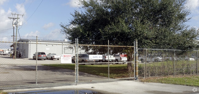
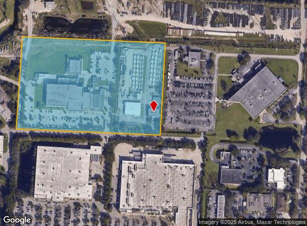
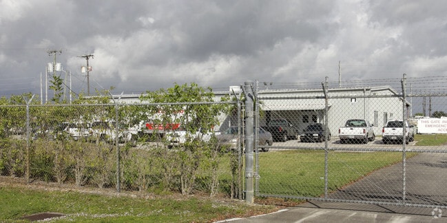
Property Record
4217 Upthegrove Ln, West Palm Beach, FL 33407
NEARBY LISTINGS FOR SALE OR LEASE
Property Detail
4217 Upthegrove Ln
74-42-43-01-00-000-1030
Acreage & Unrec
Utilities
1-43-42~ W 990 FT OF E 1986.41FT OF N 1/4 OF NE 1/4 (LESS S 25 FT RD R/W)
X
Palm Beach
12099C0388F
Florida
2024
14.65 AC
2025
45th Street
001002
South Florida
107,158 SF
West Palm Beach-Boca Raton-Delray Beach, FL
DEMOGRAPHICS near 4217 Upthegrove Ln
1 Mile
3 Mile
5 Mile
2024 Total Population
8,928
90,038
231,661
2029 Population
9,353
94,210
242,641
Pop Growth 2024-2029
+ 4.76%
+ 4.63%
+ 4.74%
Average Age
38
38
42
2024 Total Households
3,103
33,491
95,986
HH Growth 2024-2029
+ 3.93%
+ 3.93%
+ 4.50%
Median Household Inc
$59,044
$54,274
$56,506
Avg Household Size
2.70
2.50
2.30
2024 Avg HH Vehicles
2.00
2.00
1.00
Median Home Value
$234,138
$229,504
$286,099
Median Year Built
1985
1987
1984
Nearby Places
- Restaurants
- Banks
- Shops
- Fitness
- Groceries
PUBLIC TRANSPORTATION
COMMUTER RAIL
Mangonia Park (Tri-County Commuter - South Florida Regional Transportation Authority (Tri-Rail))
DRIVE
WALK
Distance
Mangonia Park (Tri-County Commuter - South Florida Regional Transportation Authority (Tri-Rail))
9 min
3.3 mi
West Palm Beach (Tri-County Commuter - South Florida Regional Transportation Authority (Tri-Rail))
DRIVE
WALK
Distance
West Palm Beach (Tri-County Commuter - South Florida Regional Transportation Authority (Tri-Rail))
12 min
6.6 mi
AIRPORT
Palm Beach International
DRIVE
WALK
Distance
Palm Beach International
17 min
9.2 mi
Freight Ports
Port of Palm Beach
DRIVE
WALK
Distance
Port of Palm Beach
12 min
5.0 mi
Nearby Properties
Address
Land Use
TOTAL SIZE
Lot Size
Zoning
Address
Land Use
TOTAL SIZE
Lot Size
Zoning
1,778,741 SF
69.19 AC
CF
Address
Land Use
TOTAL SIZE
Lot Size
Zoning
492,288 SF
58.55 AC
CPD
Address
Land Use
TOTAL SIZE
Lot Size
Zoning
770,163 SF
571.53 AC
CS
Address
Land Use
TOTAL SIZE
Lot Size
Zoning
303,776 SF
27.63 AC
CPD
Address
Land Use
TOTAL SIZE
Lot Size
Zoning
586,386 SF
19.67 AC
RPD
Address
Land Use
TOTAL SIZE
Lot Size
Zoning
739,813 SF
81.18 AC
CSPD
Address
Land Use
TOTAL SIZE
Lot Size
Zoning
546,847 SF
19.50 AC
RPD
Address
Land Use
TOTAL SIZE
Lot Size
Zoning
411,080 SF
7.59 AC
CPD
Address
Land Use
TOTAL SIZE
Lot Size
Zoning
292,706 SF
30.75 AC
RPD
Address
Land Use
TOTAL SIZE
Lot Size
Zoning
416,171 SF
19.24 AC
R-PUD
Address
Land Use
TOTAL SIZE
Lot Size
Zoning
368,320 SF
23.07 AC
CLIC
Address
Land Use
TOTAL SIZE
Lot Size
Zoning
224,212 SF
141.33 AC
CSPD
Address
Land Use
TOTAL SIZE
Lot Size
Zoning
232,751 SF
12.67 AC
RPD
Address
Land Use
TOTAL SIZE
Lot Size
Zoning
433,243 SF
40.26 AC
RM-15
Address
Land Use
TOTAL SIZE
Lot Size
Zoning
366,446 SF
67.91 AC
CPD
Address
Land Use
TOTAL SIZE
Lot Size
Zoning
307,554 SF
6.10 AC
CSPD
Address
Land Use
TOTAL SIZE
Lot Size
Zoning
247,028 SF
14.30 AC
RS
Address
Land Use
TOTAL SIZE
Lot Size
Zoning
177,585 SF
9.90 AC
CPD
Address
Land Use
TOTAL SIZE
Lot Size
Zoning
219,117 SF
4.15 AC
CPD
Address
Land Use
TOTAL SIZE
Lot Size
Zoning
314,993 SF
38.46 AC
CF
Address
Land Use
TOTAL SIZE
Lot Size
Zoning
416,165 SF
42.48 AC
CSPD
Address
Land Use
TOTAL SIZE
Lot Size
Zoning
248,196 SF
8.74 AC
RPD
Address
Land Use
TOTAL SIZE
Lot Size
Zoning
270,686 SF
56.14 AC
IG
Address
Land Use
TOTAL SIZE
Lot Size
Zoning
185,238 SF
16.63 AC
CLIC
Address
Land Use
TOTAL SIZE
Lot Size
Zoning
299,161 SF
16.85 AC
CSPD
Address
Land Use
TOTAL SIZE
Lot Size
Zoning
323,628 SF
48.15 AC
IG
Address
Land Use
TOTAL SIZE
Lot Size
Zoning
236,554 SF
14.37 AC
IG
Address
Land Use
TOTAL SIZE
Lot Size
Zoning
212,468 SF
10.39 AC
RPD
Address
Land Use
TOTAL SIZE
Lot Size
Zoning
216,255 SF
25.37 AC
CSPD
Address
Land Use
TOTAL SIZE
Lot Size
Zoning
178,043 SF
11.60 AC
RPD
The World's #1 Commercial Real Estate Marketplace
Connect with us
© 2025 CoStar Group
The information above has been obtained from sources believed reliable. While we do not doubt its accuracy we have not verified it and make no guarantee, warranty or representation about it. It is your responsibility to independently confirm its accuracy and completeness. Any projections, opinions, assumptions, or estimates used are for example only and do not represent the current or future performance of the property. The value of this transaction to you depends on tax and other factors which should be evaluated by your tax, financial, and legal advisors. You and your advisors should conduct a careful, independent investigation of the property to determine to your satisfaction the suitability of the property for your needs.