Property Record
4218 Ruby Vista Dr, Elko, NV 89801
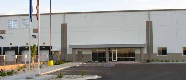

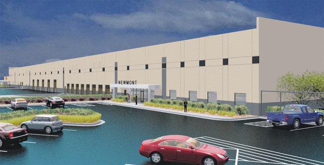
Property Detail
4218 Ruby Vista Dr
001-860-111
CASHMAN EQUIPMENT
Lightindustrial
Elko
ZIBP
Nevada
B and X Area of moderate flood hazard, usually the area between the limits of the 100-year and 500-year floods.
2
2024
13.60 AC
2025
Other Market Areas
950702
Elko, NV
162,124 SF
NEARBY LISTINGS FOR SALE OR LEASE
DEMOGRAPHICS near 4218 Ruby Vista Dr
1 mile
3 mile
5 mile
2025 Total Population
2,177
21,982
25,799
2030 Population
2,239
22,405
26,297
Pop Growth 2025-2030
+ 2.85%
+ 1.92%
+ 1.93%
Average Age
40
36
36
2025 Total Households
880
8,416
9,830
HH Growth 2025-2030
+ 3.18%
+ 1.97%
+ 1.96%
Median Household Inc
$115,657
$77,112
$80,540
Avg Household Size
2.40
2.50
2.60
2025 Avg HH Vehicles
2.00
2.00
2.00
Median Home Value
$339,940
$301,147
$299,123
Median Year Built
1988
1985
1986
Nearby Places
Map Layers
Map Styles
 Street
 Aerial
Transit
 Traffic
 Biking
Places
Listings with unknown addresses are not visible on the map
- Restaurants
- Banks
- Shops
- Fitness
- Groceries
PUBLIC TRANSPORTATION
COMMUTER RAIL
Drive
Walk
Distance
9 min
3.3 mi
Nearby Properties
Address
Land Use
TOTAL SIZE
Lot Size
Zoning
Address
Land Use
TOTAL SIZE
Lot Size
Zoning
215,373 SF
14.03 AC
ZPQP
Address
Land Use
TOTAL SIZE
Lot Size
Zoning
14.71 AC
ZLI
Address
Land Use
TOTAL SIZE
Lot Size
Zoning
184,595 SF
10.79 AC
ZR
Address
Land Use
TOTAL SIZE
Lot Size
Zoning
146,208 SF
36.18 AC
MULT
Address
Land Use
TOTAL SIZE
Lot Size
Zoning
89,473 SF
10.47 AC
ZC
Address
Land Use
TOTAL SIZE
Lot Size
Zoning
57,884 SF
1.89 AC
ZC
Address
Land Use
TOTAL SIZE
Lot Size
Zoning
54,982 SF
2.17 AC
ZC
Address
Land Use
TOTAL SIZE
Lot Size
Zoning
53,073 SF
2.32 AC
ZC
Address
Land Use
TOTAL SIZE
Lot Size
Zoning
3,234 SF
5.38 AC
ZC
Address
Land Use
TOTAL SIZE
Lot Size
Zoning
29,193 SF
3.47 AC
ZPQP
Address
Land Use
TOTAL SIZE
Lot Size
Zoning
43,470 SF
1.82 AC
ZC
Address
Land Use
TOTAL SIZE
Lot Size
Zoning
57,628 SF
2.79 AC
ZC
Address
Land Use
TOTAL SIZE
Lot Size
Zoning
53,002 SF
3.11 AC
ZC
Address
Land Use
TOTAL SIZE
Lot Size
Zoning
96,349 SF
6.49 AC
ZC
Address
Land Use
TOTAL SIZE
Lot Size
Zoning
49,124 SF
1.50 AC
ZC
Address
Land Use
TOTAL SIZE
Lot Size
Zoning
36,897 SF
2.57 AC
ZPQP
Address
Land Use
TOTAL SIZE
Lot Size
Zoning
36,717 SF
3.49 AC
ZC
Address
Land Use
TOTAL SIZE
Lot Size
Zoning
98,533 SF
6.66 AC
MULT
Address
Land Use
TOTAL SIZE
Lot Size
Zoning
79,455 SF
9.99 AC
ZC
Address
Land Use
TOTAL SIZE
Lot Size
Zoning
51,232 SF
20.60 AC
ZPQP
Address
Land Use
TOTAL SIZE
Lot Size
Zoning
44,466 SF
4.70 AC
ZPQP
Address
Land Use
TOTAL SIZE
Lot Size
Zoning
53,252 SF
2.04 AC
ZC
Address
Land Use
TOTAL SIZE
Lot Size
Zoning
28,680 SF
2.99 AC
ZC
Address
Land Use
TOTAL SIZE
Lot Size
Zoning
27,918 SF
6.07 AC
ZC
Address
Land Use
TOTAL SIZE
Lot Size
Zoning
58,679 SF
7.29 AC
ZPQP
Address
Land Use
TOTAL SIZE
Lot Size
Zoning
48,704 SF
2.49 AC
ZCT
Address
Land Use
TOTAL SIZE
Lot Size
Zoning
21,725 SF
5.29 AC
ZLI
Address
Land Use
TOTAL SIZE
Lot Size
Zoning
75,050 SF
8.45 AC
ZPQP
Address
Land Use
TOTAL SIZE
Lot Size
Zoning
64,921 SF
3.21 AC
ZC
The World's #1 Commercial Real Estate Marketplace
Connect with us
© 2026 CoStar Group
The information above has been obtained from sources believed reliable. While we do not doubt its accuracy we have not verified it and make no guarantee, warranty or representation about it. It is your responsibility to independently confirm its accuracy and completeness. Any projections, opinions, assumptions, or estimates used are for example only and do not represent the current or future performance of the property. The value of this transaction to you depends on tax and other factors which should be evaluated by your tax, financial, and legal advisors. You and your advisors should conduct a careful, independent investigation of the property to determine to your satisfaction the suitability of the property for your needs.