Property Record
422 Highway 51 N, Hernando, MS 38632
NEARBY LISTINGS FOR SALE OR LEASE
-
-
View all Hernando listings for lease on LoopNet.com
Property Detail
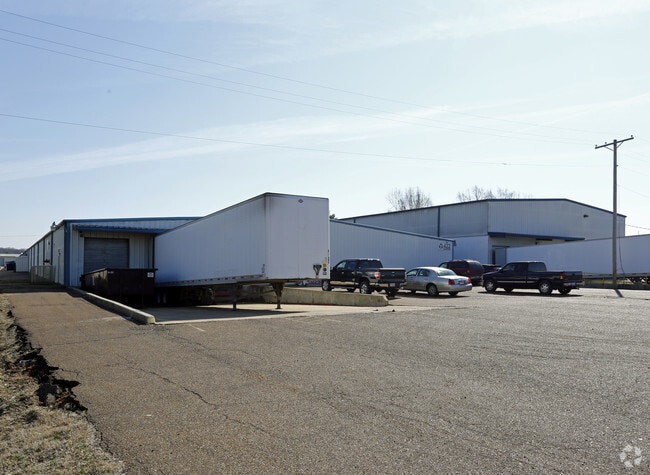
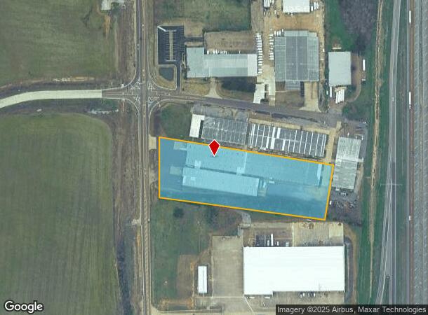
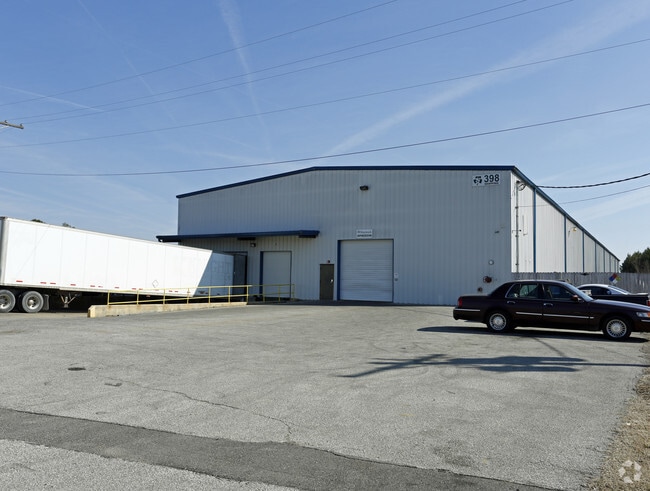
422 Highway 51 N
Memphis, TN-MS-AR
Peck Ind S/D
2087360300000401
PECK IND S/D REV LOT 4 1ST REV LOT 4B PECK INDUSTRIAL 1ST REV LOT 4
Commercialnec
DeSoto
X
Mississippi
28033C0230H
4b
2025
4.72 AC
2025
DeSoto
071121
Memphis
35,000 SF
DEMOGRAPHICS near 422 Highway 51 N
1 Mile
3 Mile
5 Mile
2024 Total Population
511
13,587
42,434
2029 Population
562
14,776
46,879
Pop Growth 2024-2029
+ 9.98%
+ 8.75%
+ 10.48%
Average Age
39
40
38
2024 Total Households
184
5,000
15,451
HH Growth 2024-2029
+ 9.78%
+ 8.70%
+ 10.62%
Median Household Inc
$79,167
$78,217
$77,868
Avg Household Size
2.70
2.70
2.70
2024 Avg HH Vehicles
2.00
2.00
2.00
Median Home Value
$278,204
$268,036
$272,421
Median Year Built
2001
1998
2001
Nearby Places
Map Layers
Map Styles
 Street
 Aerial
- Restaurants
- Banks
- Shops
- Fitness
- Groceries
PUBLIC TRANSPORTATION
AIRPORT
Memphis International
DRIVE
WALK
Distance
Memphis International
24 min
15.3 mi
SALE & LEASE HISTORY
LISTING DATE
SALE/LEASE

Sep 25, 2016
For Lease
Aug 13, 2018
For Lease
Nearby Properties
Address
Land Use
TOTAL SIZE
Lot Size
Zoning
Address
Land Use
TOTAL SIZE
Lot Size
Zoning
436,932 SF
153.19 AC
M-1
Address
Land Use
TOTAL SIZE
Lot Size
Zoning
19,367 SF
20.34 AC
PUD
Address
Land Use
TOTAL SIZE
Lot Size
Zoning
29,738 SF
15 AC
C-2
Address
Land Use
TOTAL SIZE
Lot Size
Zoning
120,095 SF
19.42 AC
C-2
Address
Land Use
TOTAL SIZE
Lot Size
Zoning
64,797 SF
13.91 AC
M-1
Address
Land Use
TOTAL SIZE
Lot Size
Zoning
12,002 SF
1.15 AC
M-1
Address
Land Use
TOTAL SIZE
Lot Size
Zoning
15.10 AC
C-2
Address
Land Use
TOTAL SIZE
Lot Size
Zoning
24,163 SF
1.97 AC
C-2
Address
Land Use
TOTAL SIZE
Lot Size
Zoning
12,201 SF
3.44 AC
M-1
Address
Land Use
TOTAL SIZE
Lot Size
Zoning
23,530 SF
9.35 AC
M-1
Address
Land Use
TOTAL SIZE
Lot Size
Zoning
30,009 SF
4.31 AC
M-1
Address
Land Use
TOTAL SIZE
Lot Size
Zoning
20,386 SF
3.24 AC
C-4
Address
Land Use
TOTAL SIZE
Lot Size
Zoning
40,831 SF
6.11 AC
C-2
Address
Land Use
TOTAL SIZE
Lot Size
Zoning
8,076 SF
4.04 AC
C-2
Address
Land Use
TOTAL SIZE
Lot Size
Zoning
21,206 SF
1.25 AC
C-4
Address
Land Use
TOTAL SIZE
Lot Size
Zoning
9,450 SF
2.49 AC
C-2
Address
Land Use
TOTAL SIZE
Lot Size
Zoning
20,120 SF
3.43 AC
PUD
Address
Land Use
TOTAL SIZE
Lot Size
Zoning
10,200 SF
3.69 AC
C-2
Address
Land Use
TOTAL SIZE
Lot Size
Zoning
17,278 SF
1.73 AC
C-2
Address
Land Use
TOTAL SIZE
Lot Size
Zoning
63,226 SF
3 AC
M-1
Address
Land Use
TOTAL SIZE
Lot Size
Zoning
6,756 SF
2.90 AC
RM-6
Address
Land Use
TOTAL SIZE
Lot Size
Zoning
5,518 SF
128.60 AC
PUD
Address
Land Use
TOTAL SIZE
Lot Size
Zoning
5,031 SF
3.05 AC
C-1
Address
Land Use
TOTAL SIZE
Lot Size
Zoning
7,500 SF
3.90 AC
C-4
Address
Land Use
TOTAL SIZE
Lot Size
Zoning
25,338 SF
2.16 AC
C-2
Address
Land Use
TOTAL SIZE
Lot Size
Zoning
15,654 SF
2.18 AC
C-2
Address
Land Use
TOTAL SIZE
Lot Size
Zoning
987 SF
41.70 AC
A-R
Address
Land Use
TOTAL SIZE
Lot Size
Zoning
14,325 SF
1.32 AC
C-4
Address
Land Use
TOTAL SIZE
Lot Size
Zoning
6,328 SF
1.71 AC
C-1
The World's #1 Commercial Real Estate Marketplace
Connect with us
© 2025 CoStar Group
The information above has been obtained from sources believed reliable. While we do not doubt its accuracy we have not verified it and make no guarantee, warranty or representation about it. It is your responsibility to independently confirm its accuracy and completeness. Any projections, opinions, assumptions, or estimates used are for example only and do not represent the current or future performance of the property. The value of this transaction to you depends on tax and other factors which should be evaluated by your tax, financial, and legal advisors. You and your advisors should conduct a careful, independent investigation of the property to determine to your satisfaction the suitability of the property for your needs.