Property Record
422 N Atlantic Ave, Daytona Beach, FL 32118

NEARBY LISTINGS FOR SALE OR LEASE
Property Detail
422 N Atlantic Ave
Deltona-Daytona Beach-Ormond Beach, FL
Brush & Stewarts Addition
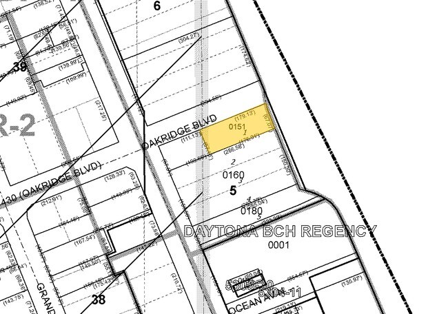
5304-09-05-0151
4-15-33 LOT 1 EXC W 109 FT & LOTS 2 3 4 & 5 BLK 5 1/2 RESUBDIVISION OF BLKS 5 & 6 BRUSH & STEWARTS ADDITION TO SEA BREEZE MB 2 PG 111 MB 14 PG 141 PER OR 3245 PG 0437 PER OR 5409 PG 0928 PER OR 6425 PG 3679 PER OR 6425 PG 3683 PER OR 6692 PG 3400 PER
Hotel
Volusia
VE
Florida
12127C0357J
1,2
2025
1.56 AC
2026
Coastal Daytona Beach
081201
Deltona/Daytona Beach
542,849 SF
DEMOGRAPHICS near 422 N Atlantic Ave
1 Mile
3 Mile
5 Mile
2024 Total Population
5,262
49,224
112,207
2029 Population
5,962
55,404
125,397
Pop Growth 2024-2029
+ 13.30%
+ 12.55%
+ 11.76%
Average Age
45
44
43
2024 Total Households
2,881
22,367
49,741
HH Growth 2024-2029
+ 13.54%
+ 13.08%
+ 12.36%
Median Household Inc
$38,818
$39,878
$42,930
Avg Household Size
1.80
2.00
2.10
2024 Avg HH Vehicles
1.00
1.00
1.00
Median Home Value
$220,934
$192,892
$190,503
Median Year Built
1966
1971
1975
Nearby Places
Map Layers
Map Styles
 Street
 Aerial
- Restaurants
- Banks
- Shops
- Fitness
- Groceries
PUBLIC TRANSPORTATION
AIRPORT
Daytona Beach International
DRIVE
WALK
Distance
Daytona Beach International
17 min
7.6 mi
Orlando Sanford International
DRIVE
WALK
Distance
Orlando Sanford International
65 min
46.3 mi
Nearby Properties
Address
Land Use
TOTAL SIZE
Lot Size
Zoning
Address
Land Use
TOTAL SIZE
Lot Size
Zoning
664,082 SF
38.16 AC
02BA
Address
Land Use
TOTAL SIZE
Lot Size
Zoning
880,289 SF
4.98 AC
02T3
Address
Land Use
TOTAL SIZE
Lot Size
Zoning
Address
Land Use
TOTAL SIZE
Lot Size
Zoning
472,750 SF
16.76 AC
Address
Land Use
TOTAL SIZE
Lot Size
Zoning
223,127 SF
14.47 AC
Address
Land Use
TOTAL SIZE
Lot Size
Zoning
Address
Land Use
TOTAL SIZE
Lot Size
Zoning
300,038 SF
0.22 AC
Address
Land Use
TOTAL SIZE
Lot Size
Zoning
300,760 SF
20.75 AC
Address
Land Use
TOTAL SIZE
Lot Size
Zoning
243,418 SF
2.91 AC
02T1
Address
Land Use
TOTAL SIZE
Lot Size
Zoning
155,620 SF
1.81 AC
02T1
Address
Land Use
TOTAL SIZE
Lot Size
Zoning
403,130 SF
28.45 AC
Address
Land Use
TOTAL SIZE
Lot Size
Zoning
146,732 SF
2.12 AC
02T1
Address
Land Use
TOTAL SIZE
Lot Size
Zoning
105,866 SF
5.14 AC
Address
Land Use
TOTAL SIZE
Lot Size
Zoning
460,245 SF
2.92 AC
Address
Land Use
TOTAL SIZE
Lot Size
Zoning
259,453 SF
2.07 AC
Address
Land Use
TOTAL SIZE
Lot Size
Zoning
209,027 SF
1.37 AC
03T
Address
Land Use
TOTAL SIZE
Lot Size
Zoning
185,175 SF
7.50 AC
Address
Land Use
TOTAL SIZE
Lot Size
Zoning
116,858 SF
5.45 AC
Address
Land Use
TOTAL SIZE
Lot Size
Zoning
195,700 SF
2.61 AC
02BR1
Address
Land Use
TOTAL SIZE
Lot Size
Zoning
102,495 SF
10.81 AC
02R2
Address
Land Use
TOTAL SIZE
Lot Size
Zoning
339,961 SF
6.02 AC
Address
Land Use
TOTAL SIZE
Lot Size
Zoning
191,450 SF
27.21 AC
02R3
Address
Land Use
TOTAL SIZE
Lot Size
Zoning
5,426 SF
6.28 AC
09R9
Address
Land Use
TOTAL SIZE
Lot Size
Zoning
87,317 SF
5.84 AC
Address
Land Use
TOTAL SIZE
Lot Size
Zoning
149,872 SF
20 AC
09R6
Address
Land Use
TOTAL SIZE
Lot Size
Zoning
268,938 SF
0.52 AC
Address
Land Use
TOTAL SIZE
Lot Size
Zoning
204,985 SF
4.02 AC
03T
Address
Land Use
TOTAL SIZE
Lot Size
Zoning
102,266 SF
2.20 AC
02T1
Address
Land Use
TOTAL SIZE
Lot Size
Zoning
78,451 SF
2.32 AC
03T
The World's #1 Commercial Real Estate Marketplace
Connect with us
© 2026 CoStar Group
The information above has been obtained from sources believed reliable. While we do not doubt its accuracy we have not verified it and make no guarantee, warranty or representation about it. It is your responsibility to independently confirm its accuracy and completeness. Any projections, opinions, assumptions, or estimates used are for example only and do not represent the current or future performance of the property. The value of this transaction to you depends on tax and other factors which should be evaluated by your tax, financial, and legal advisors. You and your advisors should conduct a careful, independent investigation of the property to determine to your satisfaction the suitability of the property for your needs.