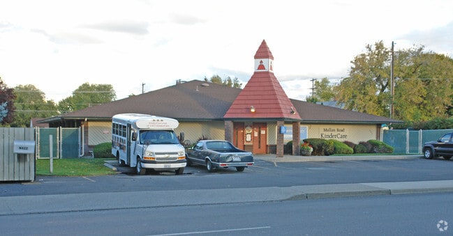
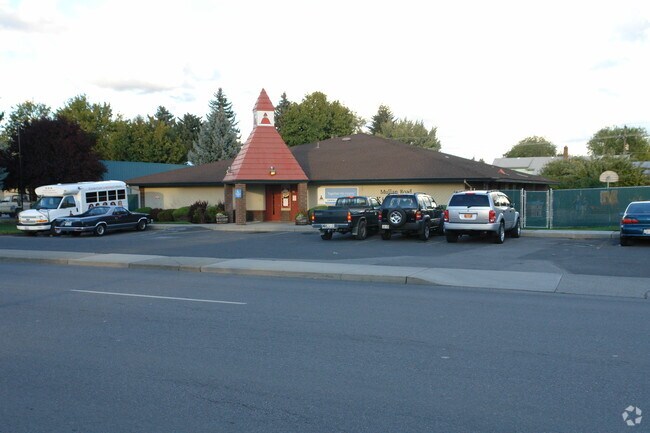
Property Record
422 N Mullan Rd, Spokane Valley, WA 99206
NEARBY LISTINGS FOR SALE OR LEASE
Property Detail
422 N Mullan Rd
45173.0620
Sp#83-220
Publichealthcarefacility
OPPORTUNITY TR B OF SP83-220 BEING A PTN OF SE1/4 OF BLK 101 8306100306
X
Spokane
53063C0567D
Washington
2025
0.52 AC
2025
Valley
012000
Spokane
5,479 SF
Spokane-Spokane Valley, WA
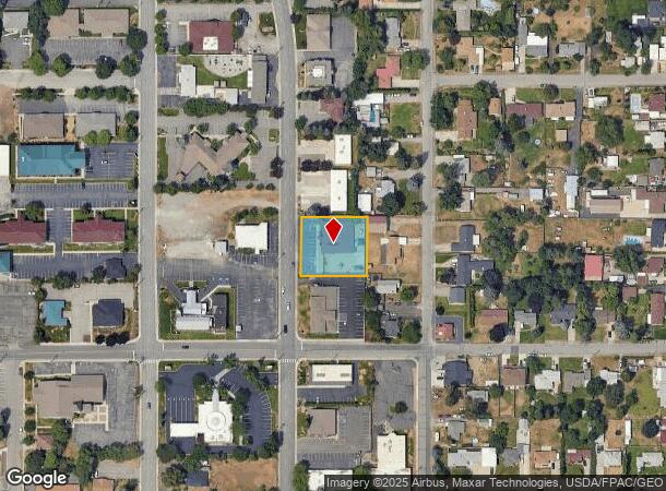
DEMOGRAPHICS near 422 N Mullan Rd
1 Mile
3 Mile
5 Mile
2024 Total Population
9,960
70,816
161,467
2029 Population
10,517
75,370
172,185
Pop Growth 2024-2029
+ 5.59%
+ 6.43%
+ 6.64%
Average Age
40
40
40
2024 Total Households
4,127
29,349
64,269
HH Growth 2024-2029
+ 5.69%
+ 6.59%
+ 6.79%
Median Household Inc
$56,420
$60,027
$65,529
Avg Household Size
2.30
2.30
2.40
2024 Avg HH Vehicles
2.00
2.00
2.00
Median Home Value
$269,073
$307,192
$330,879
Median Year Built
1966
1976
1978
Nearby Places
Map Layers
Map Styles
 Street
 Aerial
- Restaurants
- Banks
- Shops
- Fitness
- Groceries
PUBLIC TRANSPORTATION
COMMUTER RAIL
DRIVE
WALK
Distance
13 min
7.1 mi
AIRPORT
Spokane International
DRIVE
WALK
Distance
Spokane International
20 min
13.0 mi
Nearby Properties
Address
Land Use
TOTAL SIZE
Lot Size
Zoning
Address
Land Use
TOTAL SIZE
Lot Size
Zoning
355,192 SF
35.83 AC
I-2
Address
Land Use
TOTAL SIZE
Lot Size
Zoning
259,169 SF
13.42 AC
MF-2
Address
Land Use
TOTAL SIZE
Lot Size
Zoning
318,756 SF
13.64 AC
MF-2
Address
Land Use
TOTAL SIZE
Lot Size
Zoning
378,750 SF
17.38 AC
R-2
Address
Land Use
TOTAL SIZE
Lot Size
Zoning
204,730 SF
8.60 AC
MUC
Address
Land Use
TOTAL SIZE
Lot Size
Zoning
161,130 SF
6.45 AC
GO
Address
Land Use
TOTAL SIZE
Lot Size
Zoning
240,663 SF
8.90 AC
MF-2
Address
Land Use
TOTAL SIZE
Lot Size
Zoning
84,600 SF
17.95 AC
MF-1
Address
Land Use
TOTAL SIZE
Lot Size
Zoning
136,518 SF
7.96 AC
O
Address
Land Use
TOTAL SIZE
Lot Size
Zoning
175,936 SF
12.16 AC
MF-2
Address
Land Use
TOTAL SIZE
Lot Size
Zoning
69,202 SF
9.99 AC
R-2
Address
Land Use
TOTAL SIZE
Lot Size
Zoning
87,848 SF
7.36 AC
MF-2
Address
Land Use
TOTAL SIZE
Lot Size
Zoning
72,443 SF
8.90 AC
R-3
Address
Land Use
TOTAL SIZE
Lot Size
Zoning
87,989 SF
5.38 AC
MF-2
Address
Land Use
TOTAL SIZE
Lot Size
Zoning
151,690 SF
7.89 AC
MF-2
Address
Land Use
TOTAL SIZE
Lot Size
Zoning
61,059 SF
54.20 AC
P/OS
Address
Land Use
TOTAL SIZE
Lot Size
Zoning
143,772 SF
10.67 AC
MF-2
Address
Land Use
TOTAL SIZE
Lot Size
Zoning
157,232 SF
3.28 AC
MF-2
Address
Land Use
TOTAL SIZE
Lot Size
Zoning
96,424 SF
9.04 AC
I-1
Address
Land Use
TOTAL SIZE
Lot Size
Zoning
120,296 SF
9.26 AC
MF-2
Address
Land Use
TOTAL SIZE
Lot Size
Zoning
115,536 SF
6.17 AC
MUC
Address
Land Use
TOTAL SIZE
Lot Size
Zoning
107,442 SF
5.57 AC
MF-2
Address
Land Use
TOTAL SIZE
Lot Size
Zoning
139,164 SF
5.62 AC
MUC
Address
Land Use
TOTAL SIZE
Lot Size
Zoning
47,612 SF
3.38 AC
CMU
Address
Land Use
TOTAL SIZE
Lot Size
Zoning
134,104 SF
5.89 AC
HDR
Address
Land Use
TOTAL SIZE
Lot Size
Zoning
150,812 SF
17.49 AC
RC
Address
Land Use
TOTAL SIZE
Lot Size
Zoning
105,659 SF
4.40 AC
MF-1
Address
Land Use
TOTAL SIZE
Lot Size
Zoning
123,938 SF
7.70 AC
MF-2
Address
Land Use
TOTAL SIZE
Lot Size
Zoning
102,441 SF
8.38 AC
Address
Land Use
TOTAL SIZE
Lot Size
Zoning
76,190 SF
4.03 AC
MUC
The World's #1 Commercial Real Estate Marketplace
Connect with us
© 2025 CoStar Group
The information above has been obtained from sources believed reliable. While we do not doubt its accuracy we have not verified it and make no guarantee, warranty or representation about it. It is your responsibility to independently confirm its accuracy and completeness. Any projections, opinions, assumptions, or estimates used are for example only and do not represent the current or future performance of the property. The value of this transaction to you depends on tax and other factors which should be evaluated by your tax, financial, and legal advisors. You and your advisors should conduct a careful, independent investigation of the property to determine to your satisfaction the suitability of the property for your needs.