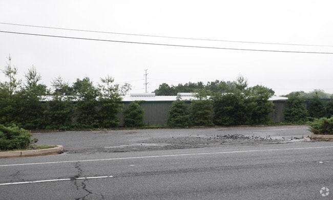
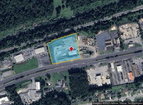
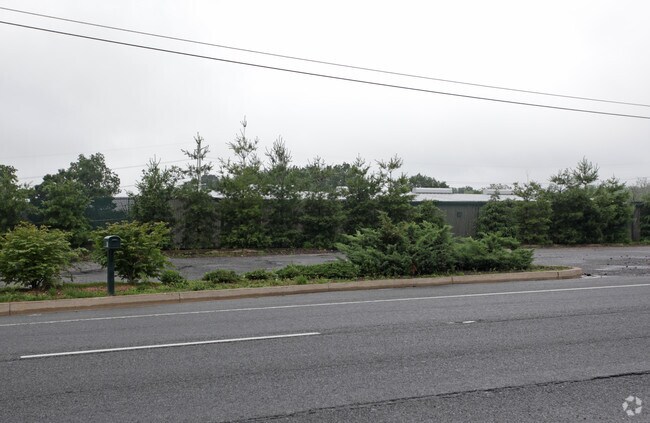
Property Record
422 Pulaski Hwy, Joppa, MD 21085

NEARBY LISTINGS FOR SALE OR LEASE
Property Detail
422 Pulaski Hwy
Baltimore-Columbia-Towson, MD
S Griffith Davis
01-001779
LOT 1 2.70 AC 422 PULASKI HIGHWAY PULASKI HWY PT 131/21
Commercialacreage
Harford
X
Maryland
2400100315H
1
2025
2.70 AC
2025
Outlying Harford County
301301
Baltimore
DEMOGRAPHICS near 422 Pulaski Hwy
1 Mile
3 Mile
5 Mile
2024 Total Population
6,286
32,167
93,732
2029 Population
6,471
33,005
95,438
Pop Growth 2024-2029
+ 2.94%
+ 2.61%
+ 1.82%
Average Age
40
39
40
2024 Total Households
2,268
12,051
35,008
HH Growth 2024-2029
+ 2.95%
+ 2.65%
+ 1.85%
Median Household Inc
$104,566
$77,863
$91,625
Avg Household Size
2.70
2.60
2.60
2024 Avg HH Vehicles
2.00
2.00
2.00
Median Home Value
$310,909
$265,141
$300,632
Median Year Built
1975
1978
1986
Nearby Places
Map Layers
Map Styles
 Street
 Aerial
- Restaurants
- Banks
- Shops
- Fitness
- Groceries
PUBLIC TRANSPORTATION
COMMUTER RAIL
Edgewood (Penn Line - Maryland Area Regional Commuter Trains (The MARC))
DRIVE
WALK
Distance
Edgewood (Penn Line - Maryland Area Regional Commuter Trains (The MARC))
10 min
5.3 mi
Martin State Airport (Penn Line - Maryland Area Regional Commuter Trains (The MARC))
DRIVE
WALK
Distance
Martin State Airport (Penn Line - Maryland Area Regional Commuter Trains (The MARC))
15 min
9.4 mi
AIRPORT
Baltimore/Washington International Thurgood Marshall
DRIVE
WALK
Distance
Baltimore/Washington International Thurgood Marshall
42 min
28.6 mi
Freight Ports
Port of Baltimore
DRIVE
WALK
Distance
Port of Baltimore
32 min
22.1 mi
Nearby Properties
Address
Land Use
TOTAL SIZE
Lot Size
Zoning
Address
Land Use
TOTAL SIZE
Lot Size
Zoning
253,842 SF
69.33 AC
R2
Address
Land Use
TOTAL SIZE
Lot Size
Zoning
44,475 SF
86.10 AC
R2
Address
Land Use
TOTAL SIZE
Lot Size
Zoning
822,410 SF
44.24 AC
GI
Address
Land Use
TOTAL SIZE
Lot Size
Zoning
996,030 SF
70.22 AC
GI
Address
Land Use
TOTAL SIZE
Lot Size
Zoning
212,760 SF
27.85 AC
GI
Address
Land Use
TOTAL SIZE
Lot Size
Zoning
246,560 SF
14.57 AC
LI
Address
Land Use
TOTAL SIZE
Lot Size
Zoning
1,690 SF
76.45 AC
R4
Address
Land Use
TOTAL SIZE
Lot Size
Zoning
109,398 SF
11.36 AC
CI
Address
Land Use
TOTAL SIZE
Lot Size
Zoning
200 AC
R4
Address
Land Use
TOTAL SIZE
Lot Size
Zoning
134,875 SF
40.88 AC
CI
Address
Land Use
TOTAL SIZE
Lot Size
Zoning
94,312 SF
14.40 AC
LI
Address
Land Use
TOTAL SIZE
Lot Size
Zoning
18.51 AC
R3
Address
Land Use
TOTAL SIZE
Lot Size
Zoning
255,464 SF
19.15 AC
GI
Address
Land Use
TOTAL SIZE
Lot Size
Zoning
16,129 SF
58.25 AC
AG
Address
Land Use
TOTAL SIZE
Lot Size
Zoning
150 AC
R4
Address
Land Use
TOTAL SIZE
Lot Size
Zoning
150 AC
R4
Address
Land Use
TOTAL SIZE
Lot Size
Zoning
97,454 SF
14.72 AC
L1
Address
Land Use
TOTAL SIZE
Lot Size
Zoning
67,184 SF
8.51 AC
GI
Address
Land Use
TOTAL SIZE
Lot Size
Zoning
130,200 SF
10.03 AC
LI
Address
Land Use
TOTAL SIZE
Lot Size
Zoning
28,452 SF
6 AC
R4
Address
Land Use
TOTAL SIZE
Lot Size
Zoning
100,950 SF
7.26 AC
R4
Address
Land Use
TOTAL SIZE
Lot Size
Zoning
77,438 SF
6.40 AC
GI
Address
Land Use
TOTAL SIZE
Lot Size
Zoning
105,760 SF
5.23 AC
GI
Address
Land Use
TOTAL SIZE
Lot Size
Zoning
53,593 SF
6.76 AC
B3
Address
Land Use
TOTAL SIZE
Lot Size
Zoning
127 AC
R4
Address
Land Use
TOTAL SIZE
Lot Size
Zoning
86,168 SF
8.89 AC
R4
Address
Land Use
TOTAL SIZE
Lot Size
Zoning
60,724 SF
327.15 AC
Address
Land Use
TOTAL SIZE
Lot Size
Zoning
146,783 SF
11.43 AC
LI
Address
Land Use
TOTAL SIZE
Lot Size
Zoning
158,200 SF
9.50 AC
GI
Address
Land Use
TOTAL SIZE
Lot Size
Zoning
104,000 SF
9.61 AC
ML
The World's #1 Commercial Real Estate Marketplace
Connect with us
© 2026 CoStar Group
The information above has been obtained from sources believed reliable. While we do not doubt its accuracy we have not verified it and make no guarantee, warranty or representation about it. It is your responsibility to independently confirm its accuracy and completeness. Any projections, opinions, assumptions, or estimates used are for example only and do not represent the current or future performance of the property. The value of this transaction to you depends on tax and other factors which should be evaluated by your tax, financial, and legal advisors. You and your advisors should conduct a careful, independent investigation of the property to determine to your satisfaction the suitability of the property for your needs.